ملف:AlpenHauptkamm mit Grenzen.jpg
حجم هذه المعاينة: 768 × 600 بكسل. البعد الآخر: 1٬200 × 937 بكسل.
الملف الأصلي (1٬200 × 937 بكسل حجم الملف: 885 كيلوبايت، نوع MIME: image/jpeg)
وصف قصير
| ⧼wm-license-information-description⧽ |
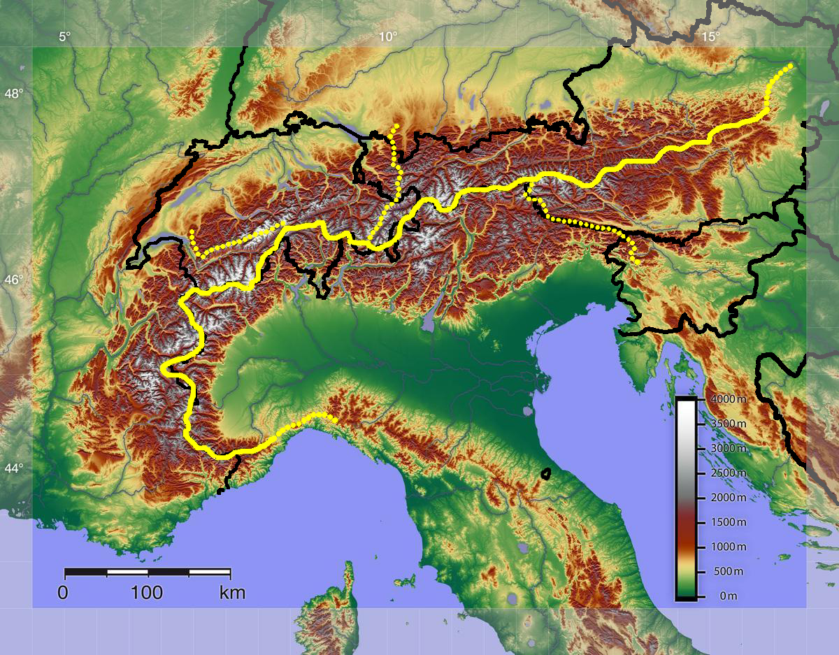
English: Main chain (YELLOW) of the Alps, and other important watersheds of the Alps plus borders (BLACK).
Deutsch: Alpenhauptkamm (GELB) und andere wichtige Wasserscheiden in den Alpen mit Staatsgrenzen (SCHWARZ).
|
| ⧼wm-license-information-date⧽ | 2015, {{time}} – invalid date format 21 (help) |
| ⧼wm-license-information-source⧽ | modified from File:Hauptkamm.jpg (map with watersheds) and File:Alpenrelief 02.jpg (borders) |
| ⧼wm-license-information-author⧽ | W like wiki |
ترخيص
|
تاريخ الملف
اضغط على زمن/تاريخ لرؤية الملف كما بدا في هذا الزمن.
| زمن/تاريخ | صورة مصغرة | الأبعاد | مستخدم | تعليق | |
|---|---|---|---|---|---|
| حالي | ★ مراجعة معتمدة 18:02، 1 ديسمبر 2023 | | 1٬200 × 937 (885 كيلوبايت) | Pastakhov (نقاش | مساهمات) | Upload https://upload.wikimedia.org/wikipedia/commons/0/00/AlpenHauptkamm_mit_Grenzen.jpg |
لا يمكنك استبدال هذا الملف.
وصلات
لا يوجد صفحات تصل لهذه الصورة.