ملف:All Saints Church, Wroxton - geograph.org.uk - 1771681.jpg
حجم هذه المعاينة: 800 × 600 بكسل. البعدان الآخران: 2٬560 × 1٬920 بكسل | 3٬072 × 2٬304 بكسل.
الملف الأصلي (3٬072 × 2٬304 بكسل حجم الملف: 2٫8 ميجابايت، نوع MIME: image/jpeg)
وصف قصير
| ⧼wm-license-information-description⧽ |
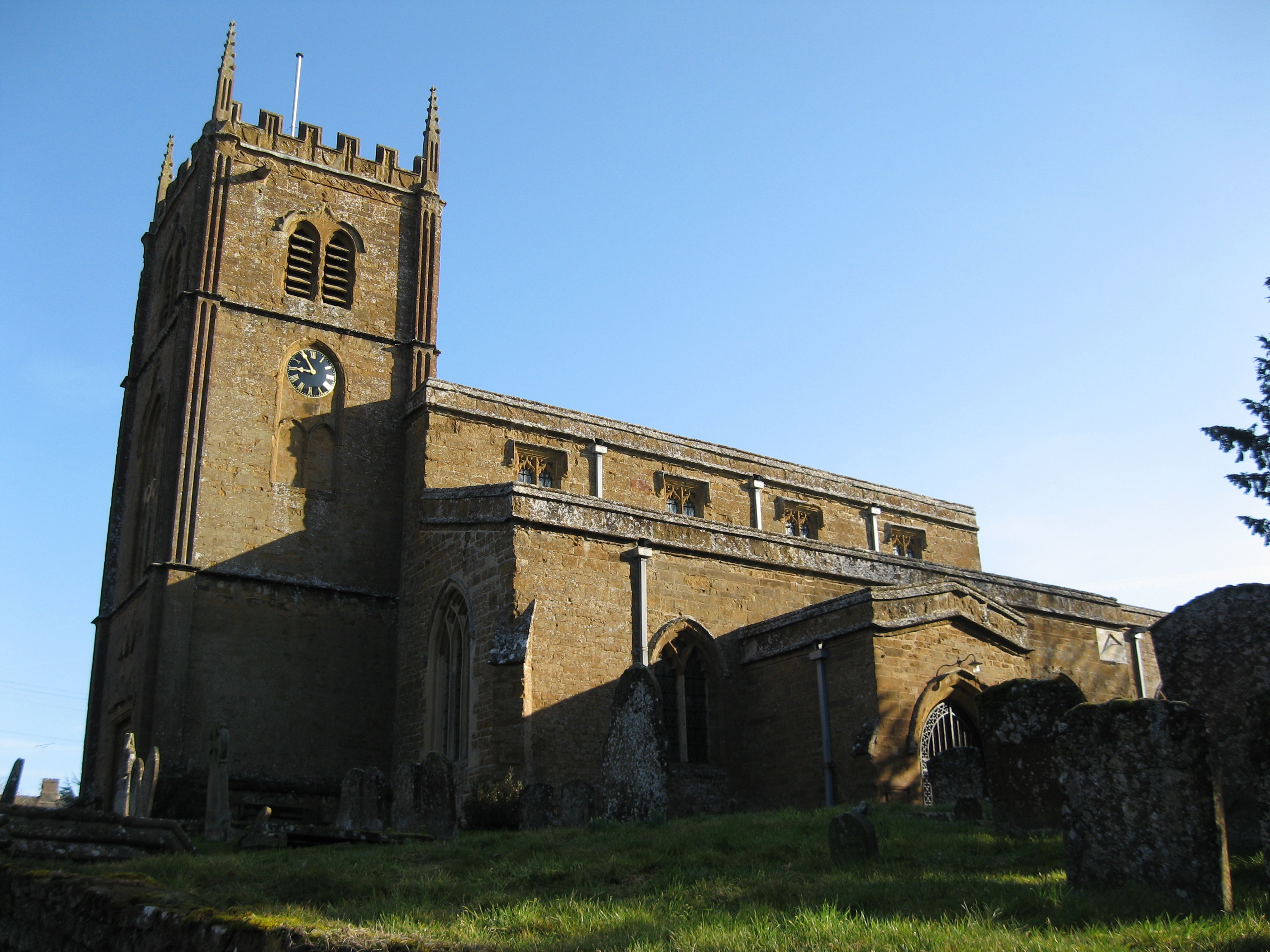
English: Church of England parish church of All Saints, Wroxton, Oxfordshire. The church is 14th and 15th century. The tower was designed by Sanderson Miller and begun in 1748.
|
| ⧼wm-license-information-date⧽ | 2010 |
| ⧼wm-license-information-source⧽ | From geograph.org.uk |
| ⧼wm-license-information-author⧽ | Richard Rogerson |
| ⧼wm-license-cc-attribution⧽ (قالب:I18n/Credit line) |
Richard Rogerson / All Saints Church, Wroxton / |
52°04′21″N 1°23′33″W / 52.07250°N 1.3924°W قالب:Object location
_heading:22)
ترخيص
تاريخ الملف
اضغط على زمن/تاريخ لرؤية الملف كما بدا في هذا الزمن.
| زمن/تاريخ | صورة مصغرة | الأبعاد | مستخدم | تعليق | |
|---|---|---|---|---|---|
| حالي | ★ مراجعة معتمدة 03:59، 5 ديسمبر 2023 | | 3٬072 × 2٬304 (2٫8 ميجابايت) | Pastakhov (نقاش | مساهمات) | Upload https://upload.wikimedia.org/wikipedia/commons/6/6e/All_Saints_Church%2C_Wroxton_-_geograph.org.uk_-_1771681.jpg |
لا يمكنك استبدال هذا الملف.
وصلات
لا يوجد صفحات تصل لهذه الصورة.