ملف:Alberta County Types.svg

حجم معاينة PNG لذلك الملف ذي الامتداد SVG: 369 × 599 بكسل. البعد الآخر: 1٬261 × 2٬048 بكسل.
الملف الأصلي (ملف SVG، أبعاده 945 × 1٬535 بكسل، حجم الملف: 889 كيلوبايت)
وصف قصير
| ⧼wm-license-information-description⧽ |
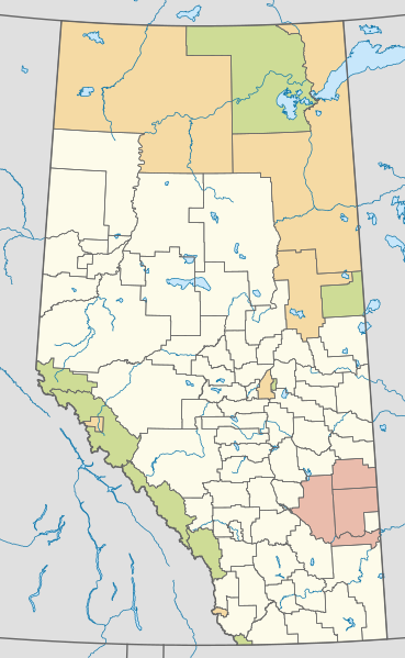
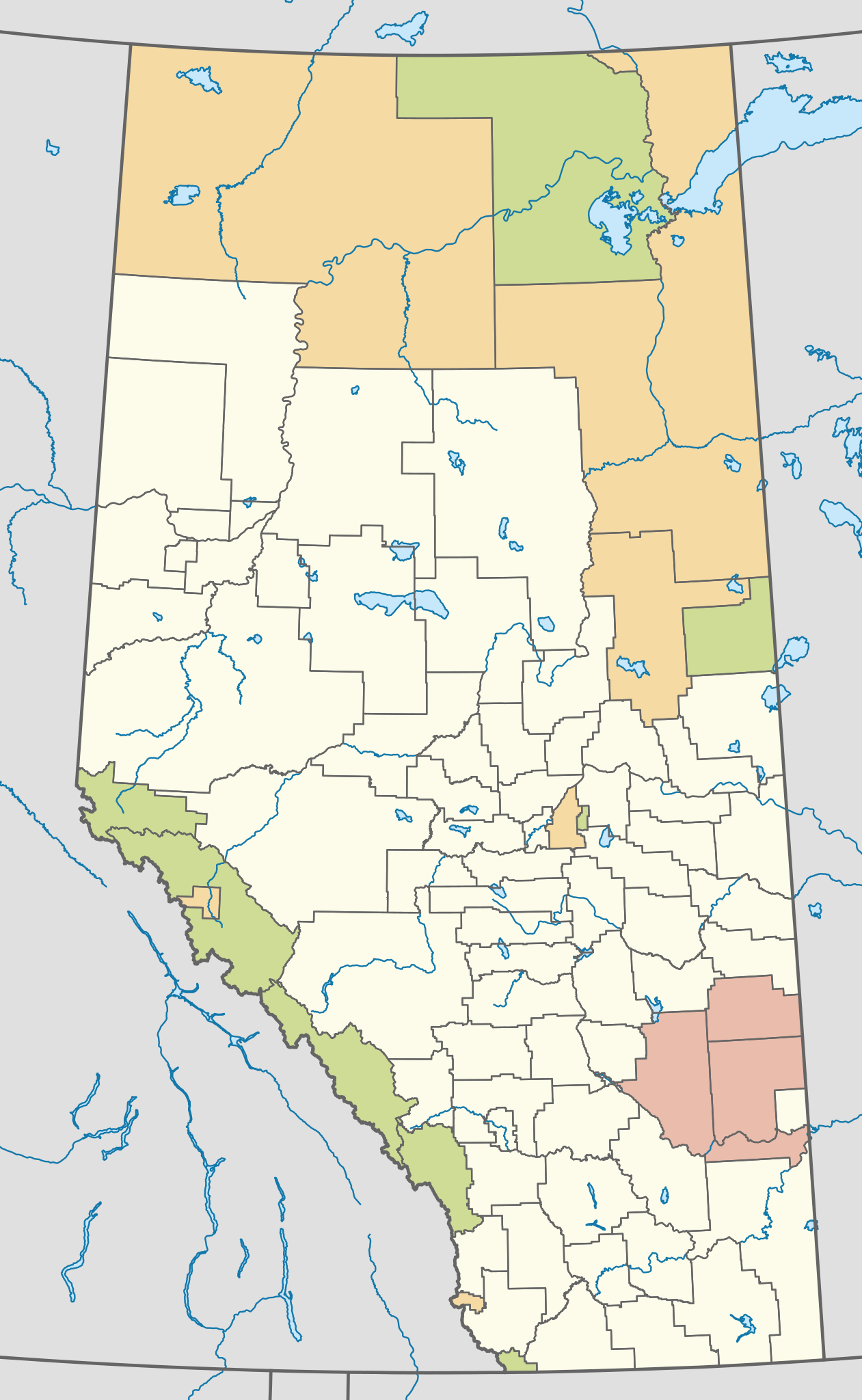
English: Map showing the classification of Alberta's rural municipalities.
Municipal boundary open data from AltaLIS, accessed on May 25 2019. Projection: EPSG:3401, transverse mercator, central meridian 115W Extents: -400000 W, 400000 E, 5400000 S, 6700000 N |
| ⧼wm-license-information-date⧽ | 2019 |
| ⧼wm-license-information-source⧽ | ⧼Wm-license-own-work⧽ |
| ⧼wm-license-information-author⧽ | awmcphee |
ترخيص
تاريخ الملف
اضغط على زمن/تاريخ لرؤية الملف كما بدا في هذا الزمن.
| زمن/تاريخ | صورة مصغرة | الأبعاد | مستخدم | تعليق | |
|---|---|---|---|---|---|
| حالي | ★ مراجعة معتمدة 09:20، 16 أكتوبر 2023 | | 945 × 1٬535 (889 كيلوبايت) | Pastakhov (نقاش | مساهمات) | Upload https://upload.wikimedia.org/wikipedia/commons/f/fd/Alberta_County_Types.svg |
لا يمكنك استبدال هذا الملف.
وصلات
لا يوجد صفحات تصل لهذه الصورة.