ملف:Aerial view of Balos beach.jpg

حجم هذه المعاينة: 800 × 600 بكسل. البعدان الآخران: 2٬560 × 1٬920 بكسل | 4٬000 × 3٬000 بكسل.
الملف الأصلي (4٬000 × 3٬000 بكسل حجم الملف: 12٫93 ميجابايت، نوع MIME: image/jpeg)
وصف قصير
| ⧼wm-license-information-description⧽ |
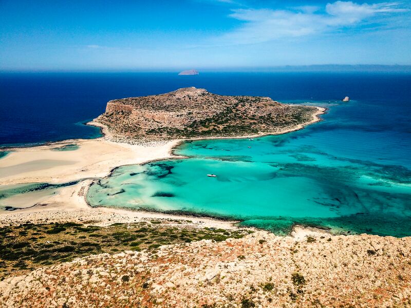
English: My first ever picture taken with a drone, the aerial view of the amazing paradise beach of Balos. Couldn't believe my eyes. I had seen pictures on the internet, but being there is something unique, the view, the water, truly paradise. قالب:Natura 2000
|
| ⧼wm-license-information-date⧽ | 2019, {{time}} – invalid date format 11 (help) |
| ⧼wm-license-information-source⧽ | ⧼Wm-license-own-work⧽ |
| ⧼wm-license-information-author⧽ | Simao Arinto |
35°35′08″N 23°35′47″E / 35.585683°N 23.596276°E
ترخيص
|
تاريخ الملف
اضغط على زمن/تاريخ لرؤية الملف كما بدا في هذا الزمن.
| زمن/تاريخ | صورة مصغرة | الأبعاد | مستخدم | تعليق | |
|---|---|---|---|---|---|
| حالي | ★ مراجعة معتمدة 14:01، 30 أكتوبر 2023 | | 4٬000 × 3٬000 (12٫93 ميجابايت) | Pastakhov (نقاش | مساهمات) | Upload https://upload.wikimedia.org/wikipedia/commons/c/ce/Aerial_view_of_Balos_beach.jpg |
لا يمكنك استبدال هذا الملف.
وصلات
لا يوجد صفحات تصل لهذه الصورة.