ملف:Aerial image of Burg Anholt (view from the west).jpg

حجم هذه المعاينة: 800 × 579 بكسل. البعدان الآخران: 2٬560 × 1٬852 بكسل | 4٬700 × 3٬400 بكسل.
الملف الأصلي (4٬700 × 3٬400 بكسل حجم الملف: 7٫61 ميجابايت، نوع MIME: image/jpeg)
وصف قصير
| ⧼wm-license-information-description⧽ |
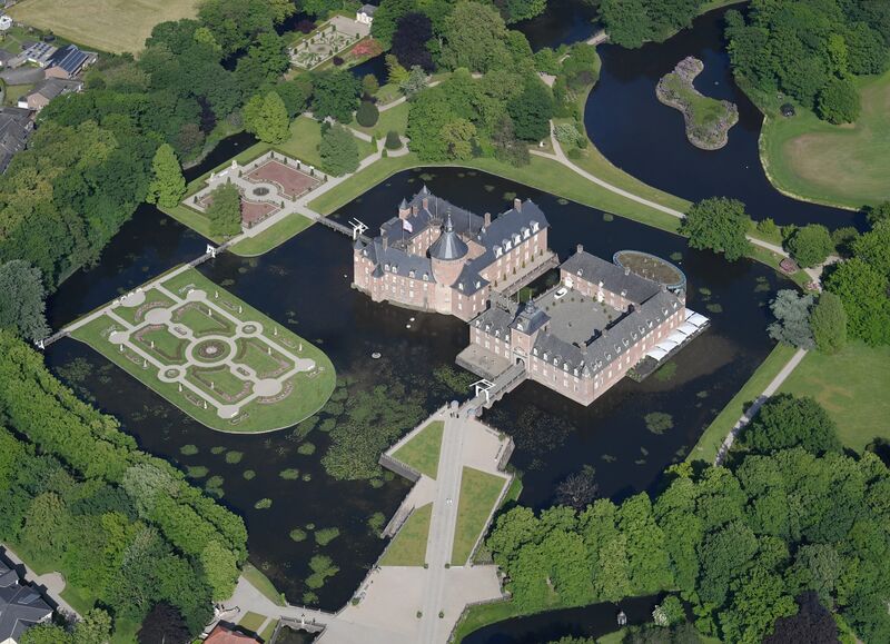
English: Aerial image of Burg Anholt (view from the west)
Deutsch: Luftbild der Burg Anholt (Ansicht von Westen) قالب:Kulturdenkmal
|
| ⧼wm-license-information-date⧽ | 2023, {{time}} – invalid date format 04 (help) |
| ⧼wm-license-information-source⧽ | ⧼Wm-license-own-work⧽ |
| ⧼wm-license-information-author⧽ | Carsten Steger |
51°50′35″N 6°25′06″E / 51.843056°N 6.418333°E قالب:Object location
.jpg¶ms=51.843056_N_6.418333_E_heading:75)
ترخيص
|
تاريخ الملف
اضغط على زمن/تاريخ لرؤية الملف كما بدا في هذا الزمن.
| زمن/تاريخ | صورة مصغرة | الأبعاد | مستخدم | تعليق | |
|---|---|---|---|---|---|
| حالي | ★ مراجعة معتمدة 21:12، 8 ديسمبر 2023 | | 4٬700 × 3٬400 (7٫61 ميجابايت) | Pastakhov (نقاش | مساهمات) | Upload https://upload.wikimedia.org/wikipedia/commons/7/7a/Aerial_image_of_Burg_Anholt_%28view_from_the_west%29.jpg |
لا يمكنك استبدال هذا الملف.
وصلات
لا يوجد صفحات تصل لهذه الصورة.
.jpg&oldid=3732574)