ملف:Aerial image of Altenberger Dom (view from the south).jpg

حجم هذه المعاينة: 800 × 576 بكسل. البعدان الآخران: 2٬560 × 1٬843 بكسل | 5٬000 × 3٬600 بكسل.
الملف الأصلي (5٬000 × 3٬600 بكسل حجم الملف: 7٫84 ميجابايت، نوع MIME: image/jpeg)
وصف قصير
| ⧼wm-license-information-description⧽ |
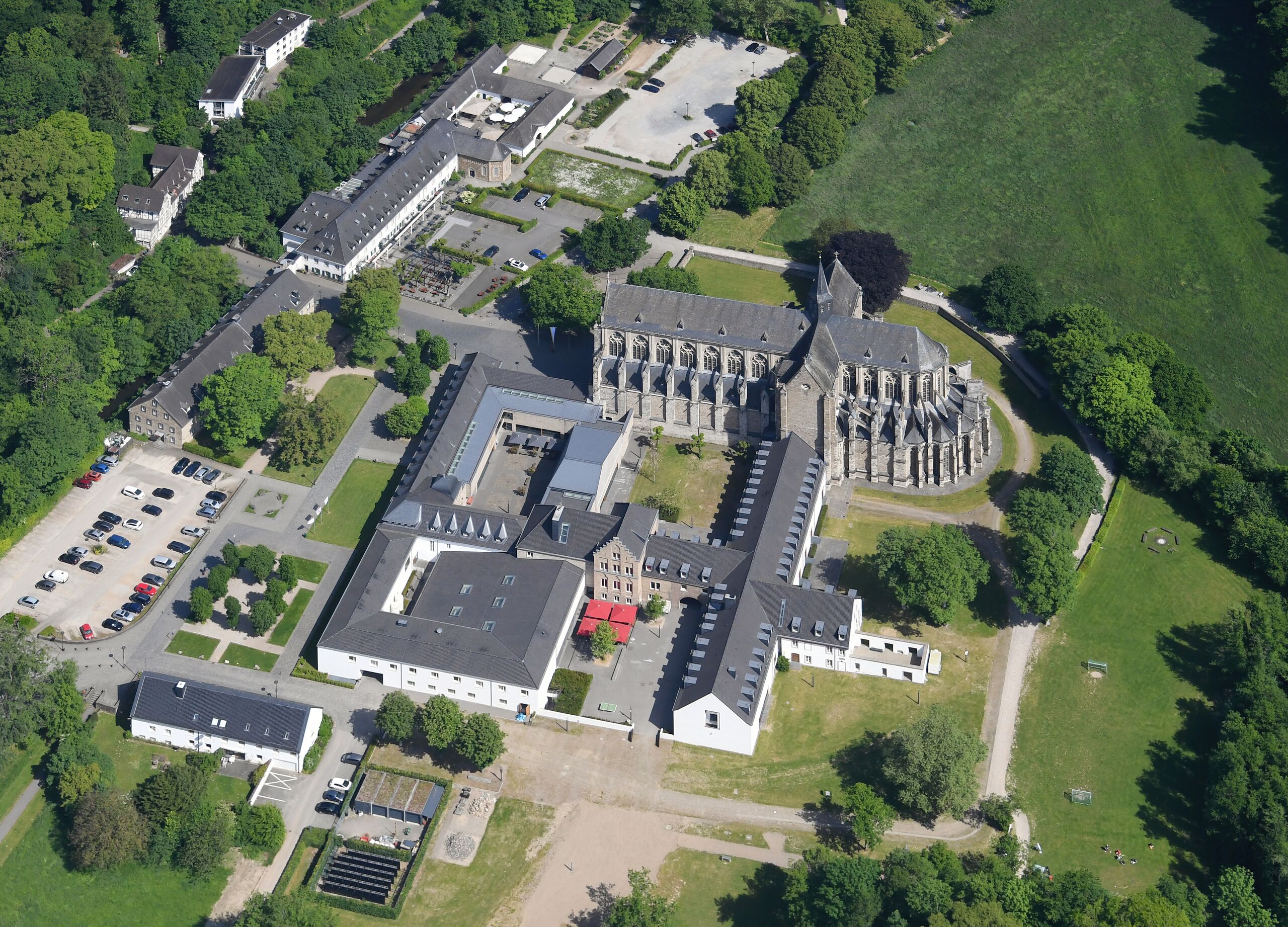
English: Aerial image of Altenberger Dom (view from the south)
Deutsch: Luftbild des Altenberger Doms (Ansicht von Süden)
قالب:Kulturdenkmal قالب:Kulturdenkmal قالب:Kulturdenkmal قالب:Kulturdenkmal قالب:Kulturdenkmal |
| ⧼wm-license-information-date⧽ | 2023, 05:33 UTC+11:00 [refresh] |
| ⧼wm-license-information-source⧽ | ⧼Wm-license-own-work⧽ |
| ⧼wm-license-information-author⧽ | Carsten Steger |
.jpg&action=purge)
51°02′59″N 7°08′03″E / 51.049691°N 7.134048°E قالب:Object location
.jpg¶ms=51.049691_N_7.134048_E_heading:350)
ترخيص
|
تاريخ الملف
اضغط على زمن/تاريخ لرؤية الملف كما بدا في هذا الزمن.
| زمن/تاريخ | صورة مصغرة | الأبعاد | مستخدم | تعليق | |
|---|---|---|---|---|---|
| حالي | ★ مراجعة معتمدة 14:54، 10 أكتوبر 2023 | | 5٬000 × 3٬600 (7٫84 ميجابايت) | Pastakhov (نقاش | مساهمات) | Upload https://upload.wikimedia.org/wikipedia/commons/8/81/Aerial_image_of_Altenberger_Dom_%28view_from_the_south%29.jpg |
لا يمكنك استبدال هذا الملف.
وصلات
لا يوجد صفحات تصل لهذه الصورة.
.jpg&oldid=3049291)