ملف:Acadianpmap.png
حجم هذه المعاينة: 442 × 600 بكسل. البعد الآخر: 1٬768 × 2٬399 بكسل.
الملف الأصلي (1٬768 × 2٬399 بكسل حجم الملف: 2٫37 ميجابايت، نوع MIME: image/png)
وصف قصير
| ⧼wm-license-information-description⧽ |
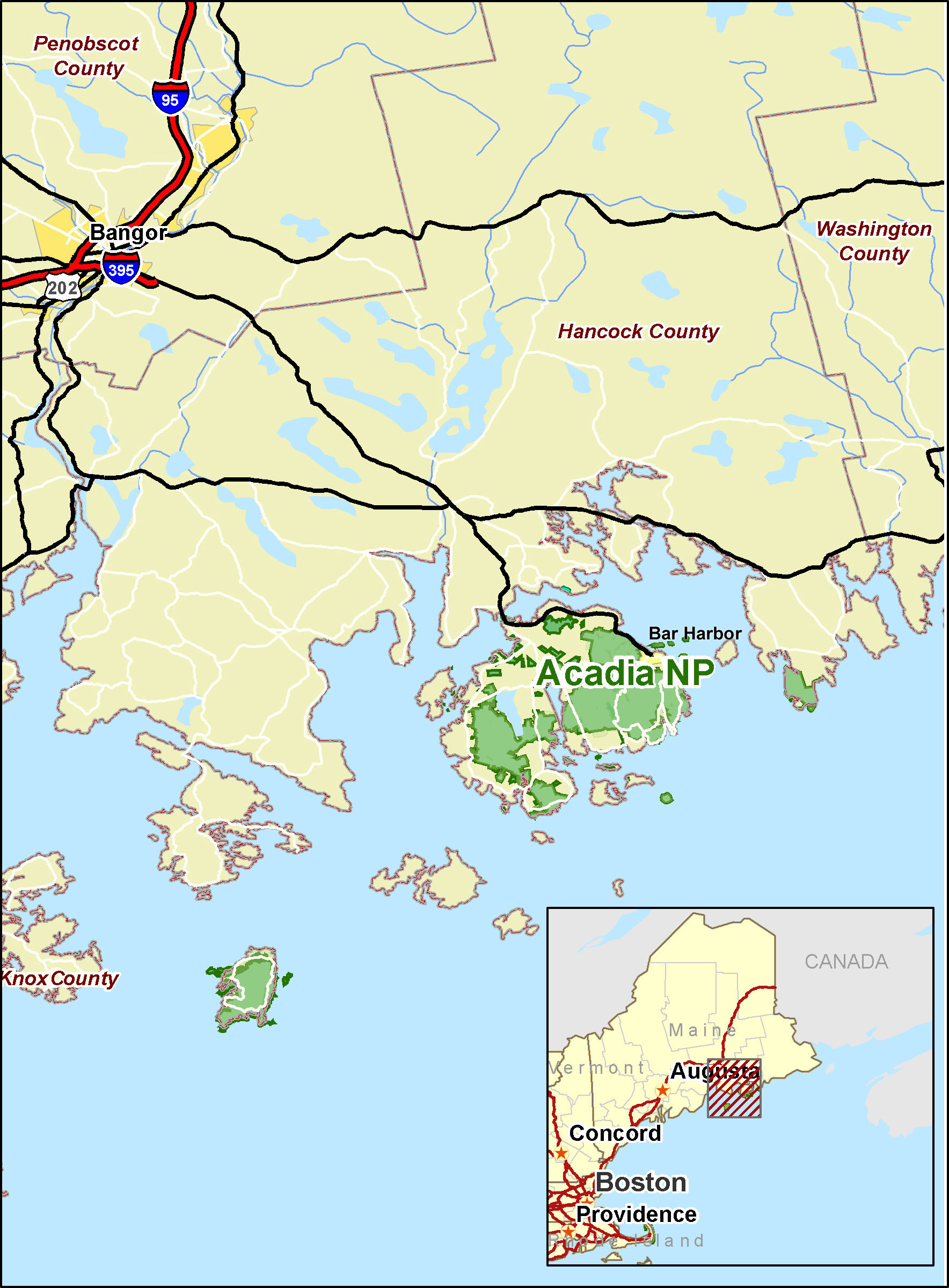
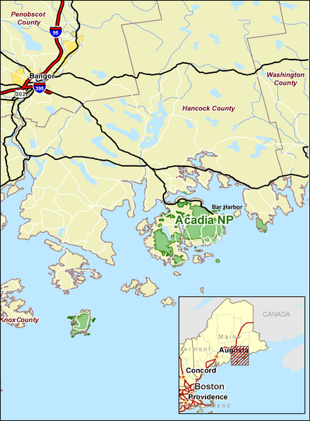
Acadian National Park (Maine) regional-scale map. Created by Kmf164. |
| ⧼wm-license-information-date⧽ | |
| ⧼wm-license-information-source⧽ | Self-published work by Aude |
| ⧼wm-license-information-author⧽ | Aude |
ترخيص
تاريخ الملف
اضغط على زمن/تاريخ لرؤية الملف كما بدا في هذا الزمن.
| زمن/تاريخ | صورة مصغرة | الأبعاد | مستخدم | تعليق | |
|---|---|---|---|---|---|
| حالي | ★ مراجعة معتمدة 06:55، 17 أكتوبر 2023 | | 1٬768 × 2٬399 (2٫37 ميجابايت) | Pastakhov (نقاش | مساهمات) | Upload https://upload.wikimedia.org/wikipedia/commons/6/66/Acadianpmap.png |
لا يمكنك استبدال هذا الملف.
وصلات
لا يوجد صفحات تصل لهذه الصورة.