ملف:A map of Mosquitia and the territory of Poyais with the Adjacent Countries,.jpg

حجم هذه المعاينة: 440 × 599 بكسل. البعدان الآخران: 1٬505 × 2٬048 بكسل | 5٬645 × 7٬682 بكسل.
الملف الأصلي (5٬645 × 7٬682 بكسل حجم الملف: 13٫29 ميجابايت، نوع MIME: image/jpeg)
وصف قصير
| ⧼wm-license-information-description⧽ |
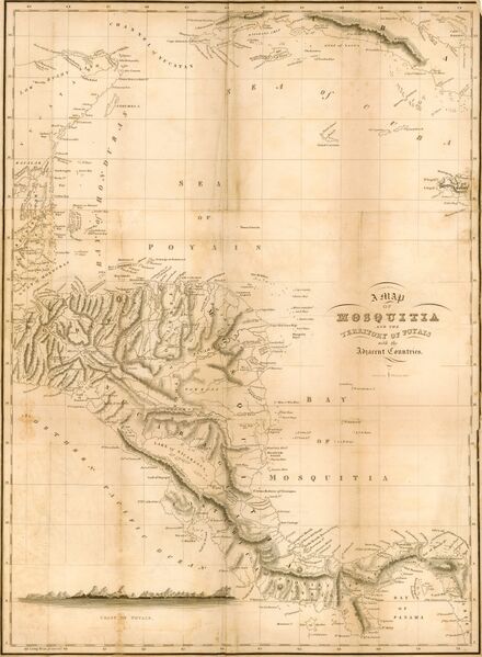
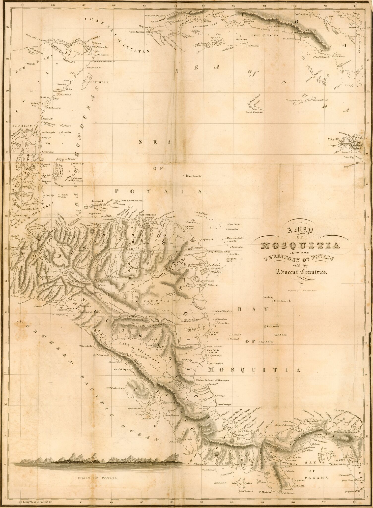
English: Sketch of the Mosquito shore, including the territory of Poyais, descriptive of the country; with some information as to its productions, the best mode of culture, &c. chiefly intended for the use of settlers
|
| ⧼wm-license-information-date⧽ | 1822 |
| ⧼wm-license-information-source⧽ | https://jcb.lunaimaging.com/luna/servlet/detail/JCBMAPS~1~1~4862~102963?qvq=q%3AMap%20of%20Mosquitia%3Blc%3AJCBMAPS~1~1%2CJCBMAPS~2~2%2CJCB~3~3%2CJCBBOOKS~1~1%2CJCBMAPS~3~3%2CJCB~1~1&mi=1&trs=2 |
| ⧼wm-license-information-author⧽ | Thomas Strangeways |
ترخيص
|
|
هذا العمل مرخّص تحت رخصة المشاع الإبداعي الملزمة بنسبة العمل لمؤلفه وبترخيص الأعمال المشتقة بالمثل 4.0. |
تاريخ الملف
اضغط على زمن/تاريخ لرؤية الملف كما بدا في هذا الزمن.
| زمن/تاريخ | صورة مصغرة | الأبعاد | مستخدم | تعليق | |
|---|---|---|---|---|---|
| حالي | ★ مراجعة معتمدة 01:36، 17 أكتوبر 2023 | | 5٬645 × 7٬682 (13٫29 ميجابايت) | Pastakhov (نقاش | مساهمات) | Upload https://upload.wikimedia.org/wikipedia/commons/c/ce/A_map_of_Mosquitia_and_the_territory_of_Poyais_with_the_Adjacent_Countries%2C.jpg |
لا يمكنك استبدال هذا الملف.
وصلات
لا يوجد صفحات تصل لهذه الصورة.