ملف:2015 Baucau beschriftet.png
حجم هذه المعاينة: 800 × 377 بكسل. البعدان الآخران: 2٬560 × 1٬206 بكسل | 4٬492 × 2٬117 بكسل.
الملف الأصلي (4٬492 × 2٬117 بكسل حجم الملف: 1٫11 ميجابايت، نوع MIME: image/png)
وصف قصير
| ⧼wm-license-information-description⧽ |
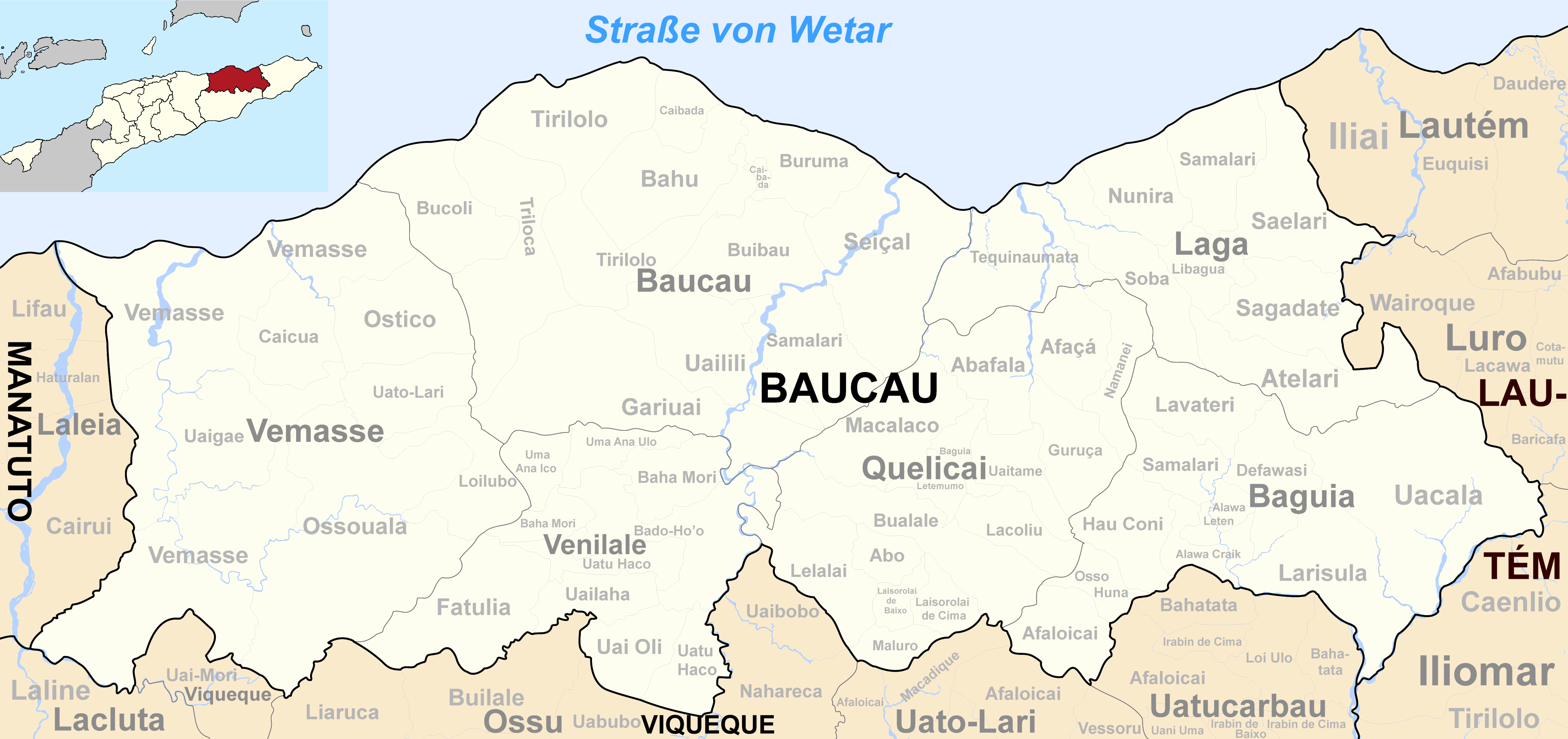
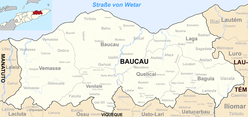
Deutsch: Verwaltungseinheiten der Gemeinde Baucau, Osttimor.
|
| ⧼wm-license-information-date⧽ | 2017 |
| ⧼wm-license-information-source⧽ | Informationen von Ministerium für Staatsadministration, Osttimor |
| ⧼wm-license-information-author⧽ | Von mir (J. Patrick Fischer) überarbeitetes Werk: File:Map of Timor-Leste - administrative (since 2015) - Município of Baucau.png von Maximilian Dörrbecker (Chumwa) und File:2015 East Timor Baucau locator map.png von mir |
| ⧼wm-license-information-other-versions⧽ |
Vor 2015: File:Sucos Baucau.png |
_-_Munic%C3%ADpio_of_Baucau.png&action=edit&redlink=1)
ترخيص
تاريخ الملف
اضغط على زمن/تاريخ لرؤية الملف كما بدا في هذا الزمن.
| زمن/تاريخ | صورة مصغرة | الأبعاد | مستخدم | تعليق | |
|---|---|---|---|---|---|
| حالي | ★ مراجعة معتمدة 05:10، 19 ديسمبر 2023 | | 4٬492 × 2٬117 (1٫11 ميجابايت) | Pastakhov (نقاش | مساهمات) | Upload https://upload.wikimedia.org/wikipedia/commons/1/14/2015_Baucau_beschriftet.png |
لا يمكنك استبدال هذا الملف.
وصلات
لا يوجد صفحات تصل لهذه الصورة.