ملف:2013 map 17th Worcester district Massachusetts House of Representatives DC10SLDL25219 001.png
حجم هذه المعاينة: 675 × 599 بكسل. البعدان الآخران: 2٬306 × 2٬048 بكسل | 5٬405 × 4٬800 بكسل.
الملف الأصلي (5٬405 × 4٬800 بكسل حجم الملف: 6٫3 ميجابايت، نوع MIME: image/png)
وصف قصير
| ⧼wm-license-information-description⧽ |
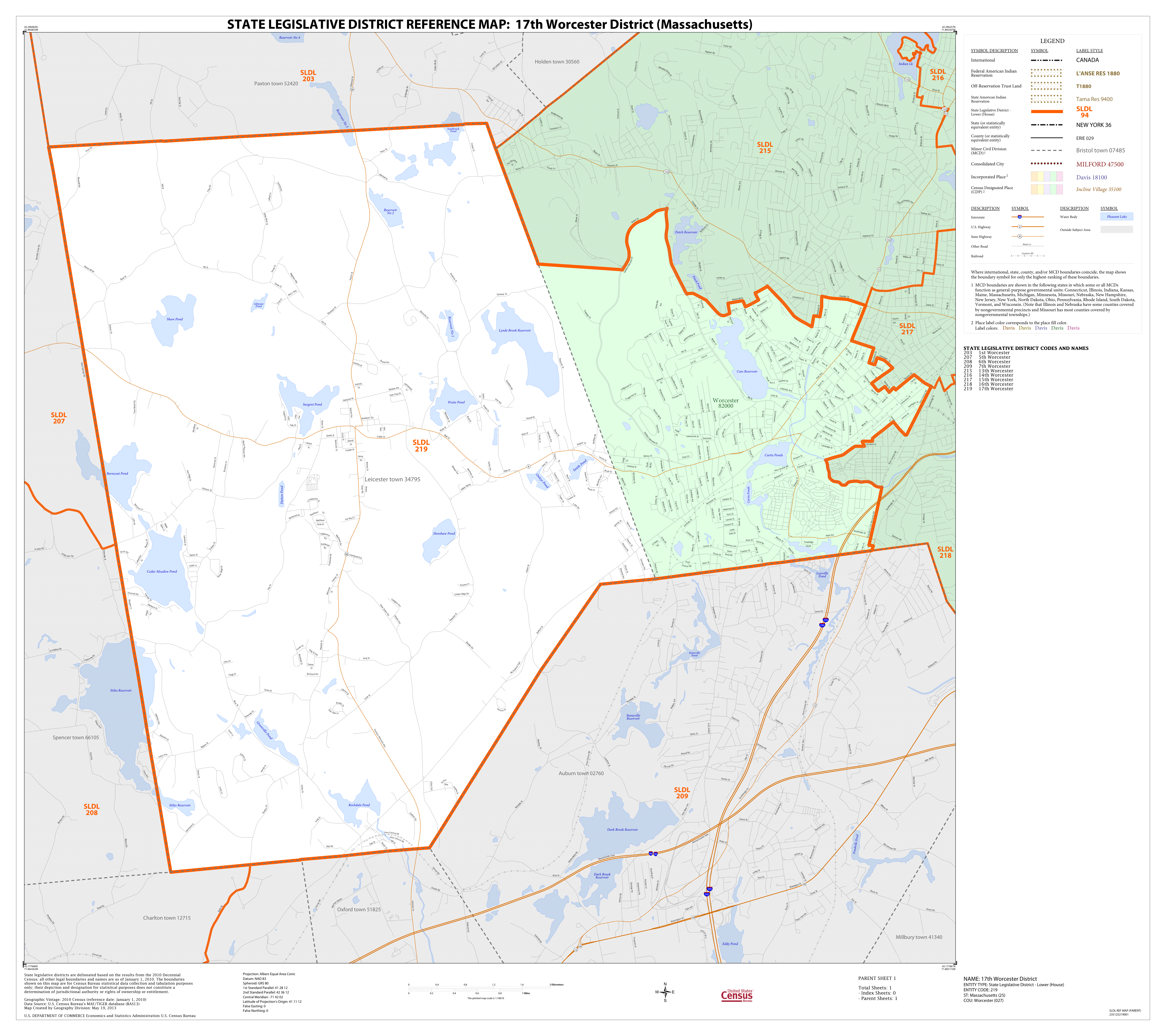
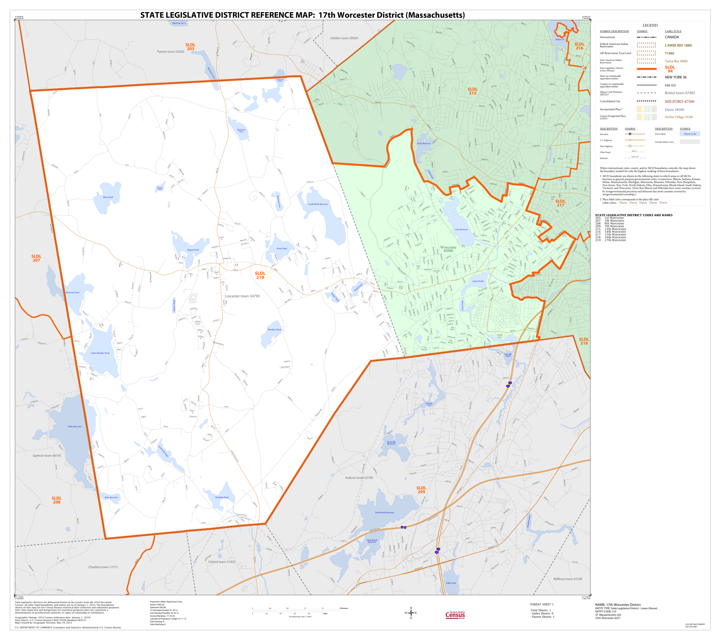
English: Massachusetts House of Representatives district map. Based on 2010 census.
|
| ⧼wm-license-information-date⧽ | 2013 |
| ⧼wm-license-information-source⧽ | US Census Bureau, 2018 State Legislative District Reference Maps / https://www.census.gov/geographies/reference-maps/2018/geo/2018-state-leg-districts1.html Lower Chamber Maps: Massachusetts / https://www2.census.gov/geo/maps/dc10map/SLD_RefMap/lower/st25_ma/ |
| ⧼wm-license-information-author⧽ | United States Census Bureau |
ترخيص
تاريخ الملف
اضغط على زمن/تاريخ لرؤية الملف كما بدا في هذا الزمن.
| زمن/تاريخ | صورة مصغرة | الأبعاد | مستخدم | تعليق | |
|---|---|---|---|---|---|
| حالي | ★ مراجعة معتمدة 15:05، 3 نوفمبر 2023 | | 5٬405 × 4٬800 (6٫3 ميجابايت) | Pastakhov (نقاش | مساهمات) | Upload https://upload.wikimedia.org/wikipedia/commons/c/c2/2013_map_17th_Worcester_district_Massachusetts_House_of_Representatives_DC10SLDL25219_001.png |
لا يمكنك استبدال هذا الملف.
وصلات
لا يوجد صفحات تصل لهذه الصورة.