ملف:1876 1st Essex senate district map Massachusetts.jpg
حجم هذه المعاينة: 800 × 487 بكسل. البعد الآخر: 3٬200 × 1٬949 بكسل.
الملف الأصلي (3٬200 × 1٬949 بكسل حجم الملف: 1٫09 ميجابايت، نوع MIME: image/jpeg)
وصف قصير
| ⧼wm-license-information-description⧽ |
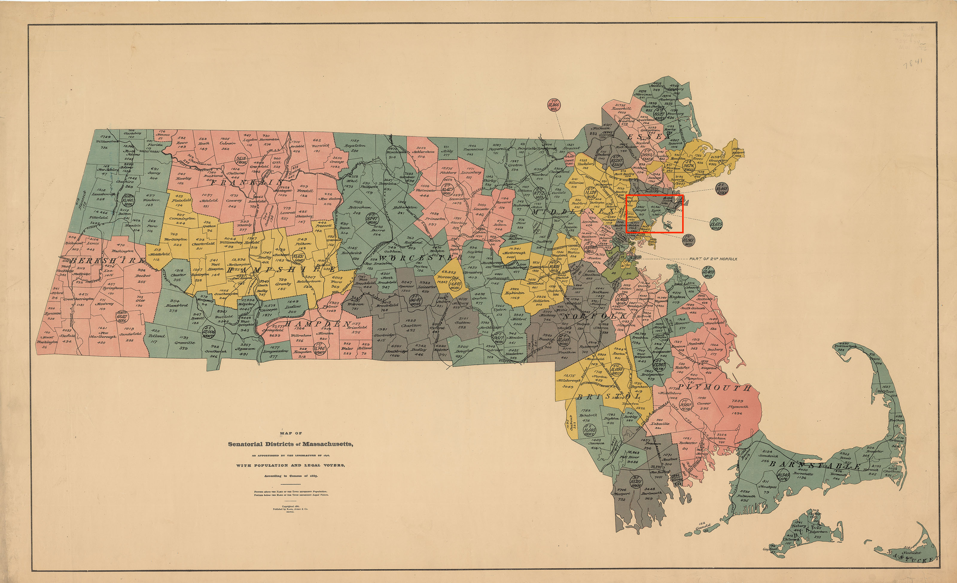
Map of districts of the Massachusetts state senate apportioned in 1876. The map includes 1885 population information. The location of the 1st Essex senate district is highlighted in red. Acts and Resolves of the Massachusetts General Court, 1876 Chap. 0190. An Act To Divide The Commonwealth Into Forty Districts For The Choice Of Senators: "...The city of Lynn and the towns of Nahant, Saugus and Swampscott, shall constitute a district, to be known as the First Essex District...." |
| ⧼wm-license-information-date⧽ | 1886 |
| ⧼wm-license-information-source⧽ | https://malegislature.gov/Redistricting/HistoricDistricts/Senate |
| ⧼wm-license-information-author⧽ | Rand, Avery & Co. |
تاريخ الملف
اضغط على زمن/تاريخ لرؤية الملف كما بدا في هذا الزمن.
| زمن/تاريخ | صورة مصغرة | الأبعاد | مستخدم | تعليق | |
|---|---|---|---|---|---|
| حالي | ★ مراجعة معتمدة 09:01، 11 أكتوبر 2023 | | 3٬200 × 1٬949 (1٫09 ميجابايت) | Pastakhov (نقاش | مساهمات) | Upload https://upload.wikimedia.org/wikipedia/commons/d/de/1876_1st_Essex_senate_district_map_Massachusetts.jpg |
لا يمكنك استبدال هذا الملف.
وصلات
لا يوجد صفحات تصل لهذه الصورة.