ملف:14-Intercos2019-241400415.png

حجم هذه المعاينة: 800 × 564 بكسل. البعدان الآخران: 2٬560 × 1٬804 بكسل | 3٬519 × 2٬480 بكسل.
الملف الأصلي (3٬519 × 2٬480 بكسل حجم الملف: 1٫96 ميجابايت، نوع MIME: image/png)
وصف قصير
| ⧼wm-license-information-description⧽ |
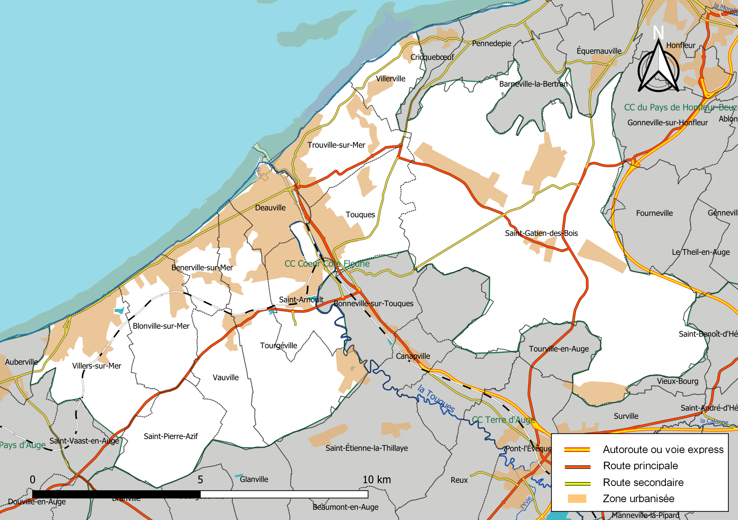
Français : Carte géographique de la Communauté de communes Cœur Côte Fleurie, département du Calvados, France. Composition au 1er janvier 2019.
|
| ⧼wm-license-information-date⧽ | 2019 |
| ⧼wm-license-information-source⧽ | ⧼Wm-license-own-work⧽ à partir des jeux de données :
|
| ⧼wm-license-information-author⧽ | Roland45 et contributeurs d'OpenStreetMap |
ترخيص
|
تاريخ الملف
اضغط على زمن/تاريخ لرؤية الملف كما بدا في هذا الزمن.
| زمن/تاريخ | صورة مصغرة | الأبعاد | مستخدم | تعليق | |
|---|---|---|---|---|---|
| حالي | ★ مراجعة معتمدة 02:26، 2 نوفمبر 2023 | | 3٬519 × 2٬480 (1٫96 ميجابايت) | Pastakhov (نقاش | مساهمات) | Upload https://upload.wikimedia.org/wikipedia/commons/5/52/14-Intercos2019-241400415.png |
لا يمكنك استبدال هذا الملف.
وصلات
لا يوجد صفحات تصل لهذه الصورة.