ملف:13055-Marseille-Sols.png

حجم هذه المعاينة: 755 × 600 بكسل. البعدان الآخران: 2٬560 × 2٬034 بكسل | 3٬270 × 2٬598 بكسل.
الملف الأصلي (3٬270 × 2٬598 بكسل حجم الملف: 5٫47 ميجابايت، نوع MIME: image/png)
وصف قصير
| ⧼wm-license-information-description⧽ |
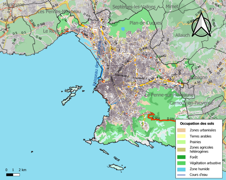
Français : Carte des infrastructures et de l’occupation des sols en 2018 de la commune de fr:Marseille (France).
|
| ⧼wm-license-information-date⧽ | 2021 |
| ⧼wm-license-information-source⧽ | ⧼Wm-license-own-work⧽ avec les données : * Découpage administratif communal et départemental : Export simple de janvier 2021 - vérifié et simplifié à 5 m sur le site du portail de données libres du gouvernement français, élaboré avec le concours des contributeurs à OpenStreetMap * Cours d'eau : Cours d'eau - Métropole 2017 - BD Carthage * Occupation des sols : Corine land cover 2018 * Infrastructures (routes, fer) : : Export openstreetmap de Geofabrik- version du 9 avril 2021 Assemblé et enrichi dans fr:QGis. |
| ⧼wm-license-information-author⧽ | Roland45 |
ترخيص
|
تاريخ الملف
اضغط على زمن/تاريخ لرؤية الملف كما بدا في هذا الزمن.
| زمن/تاريخ | صورة مصغرة | الأبعاد | مستخدم | تعليق | |
|---|---|---|---|---|---|
| حالي | ★ مراجعة معتمدة 10:27، 23 نوفمبر 2023 | | 3٬270 × 2٬598 (5٫47 ميجابايت) | Pastakhov (نقاش | مساهمات) | Upload https://upload.wikimedia.org/wikipedia/commons/d/d6/13055-Marseille-Sols.png |
لا يمكنك استبدال هذا الملف.
وصلات
لا يوجد صفحات تصل لهذه الصورة.