ملف:فتوح مصر والنوبة.jpg
حجم هذه المعاينة: 418 × 599 بكسل. البعد الآخر: 1٬345 × 1٬929 بكسل.
الملف الأصلي (1٬345 × 1٬929 بكسل حجم الملف: 695 كيلوبايت، نوع MIME: image/jpeg)
وصف قصير
| ⧼wm-license-information-description⧽ |
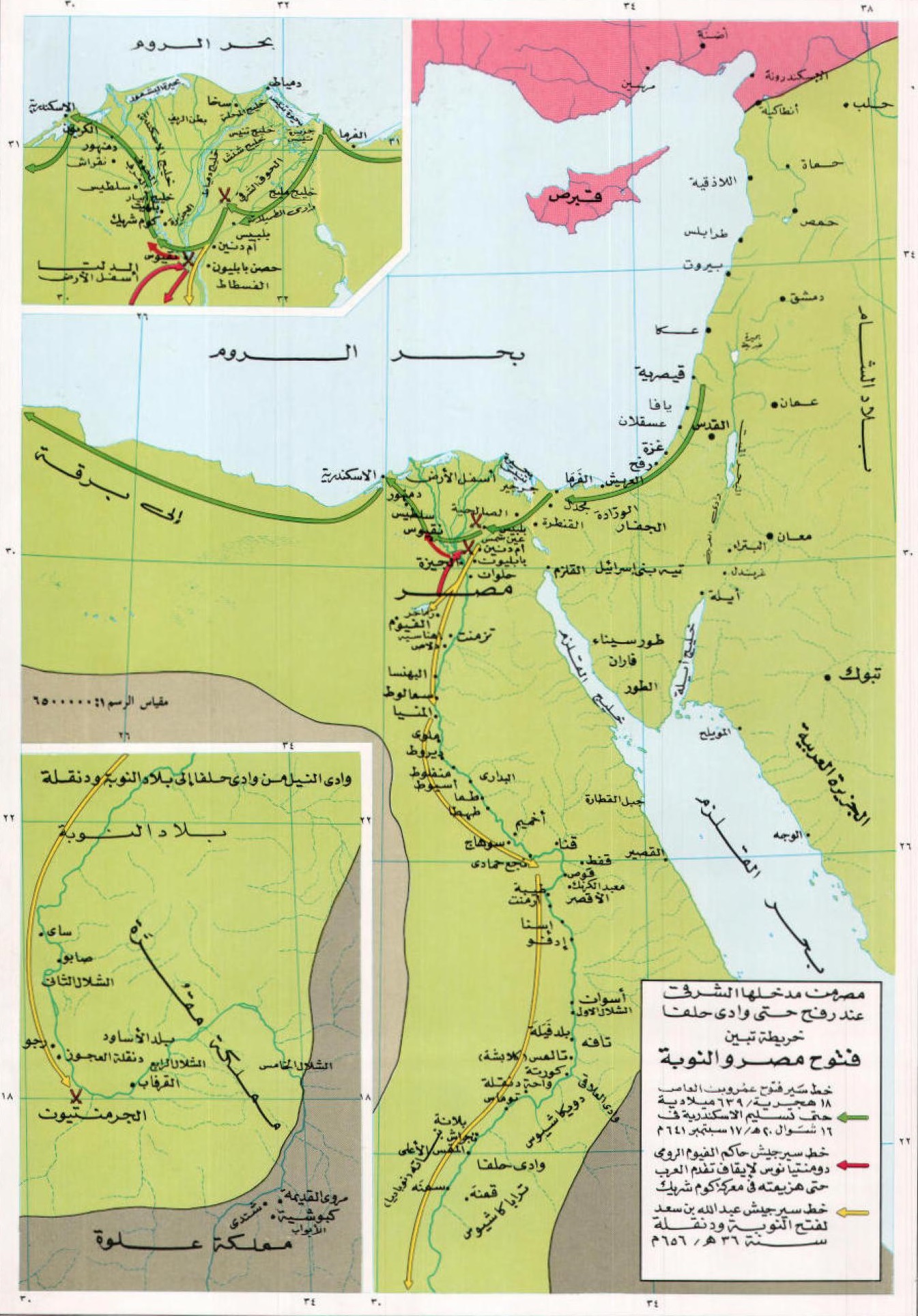
العربية: خارطة تُظهر مسير الجُيوش الإسلاميَّة وفتحها بلاد مصر والنوبة.
English: Map showing the course of the Islamic armies and their conquest of Egypt and Nubia.
|
| ⧼wm-license-information-date⧽ | 1986 |
| ⧼wm-license-information-source⧽ | أطلس تاريخ الإسلام، ص 119 |
| ⧼wm-license-information-author⧽ | Dr. Husein Mu'nis et al. |
| ⧼wm-license-information-permission⧽ (⧼wm-license-information-permission-reusing-text⧽) |
According to Egyptian law, any Non-creative audiovisual works is considered free if it was published prior to 1987 |
ترخيص
تاريخ الملف
اضغط على زمن/تاريخ لرؤية الملف كما بدا في هذا الزمن.
| زمن/تاريخ | صورة مصغرة | الأبعاد | مستخدم | تعليق | |
|---|---|---|---|---|---|
| حالي | ★ مراجعة معتمدة 04:47، 14 يناير 2024 | | 1٬345 × 1٬929 (695 كيلوبايت) | Pastakhov (نقاش | مساهمات) | Upload https://upload.wikimedia.org/wikipedia/commons/4/48/%D9%81%D8%AA%D9%88%D8%AD_%D9%85%D8%B5%D8%B1_%D9%88%D8%A7%D9%84%D9%86%D9%88%D8%A8%D8%A9.jpg |
لا يمكنك استبدال هذا الملف.
وصلات
لا يوجد صفحات تصل لهذه الصورة.