ملف:Ås Äspered.svg

حجم معاينة PNG لذلك الملف ذي الامتداد SVG: 560 × 599 بكسل. البعد الآخر: 1٬914 × 2٬048 بكسل.
الملف الأصلي (ملف SVG، أبعاده 4٬348 × 4٬653 بكسل، حجم الملف: 1٫59 ميجابايت)
| ⧼wm-license-information-description⧽ |
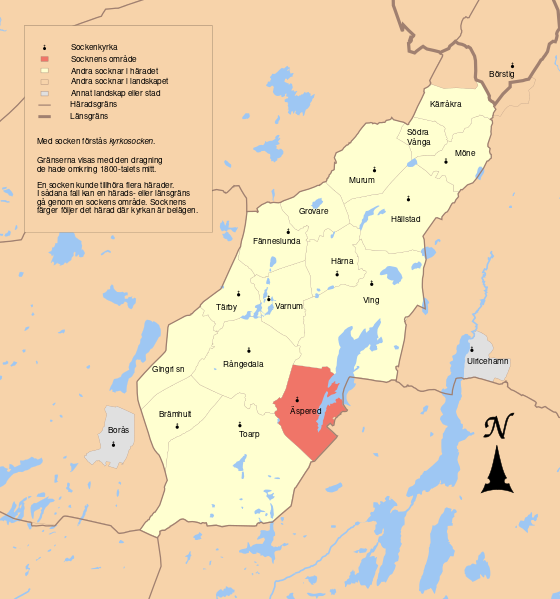
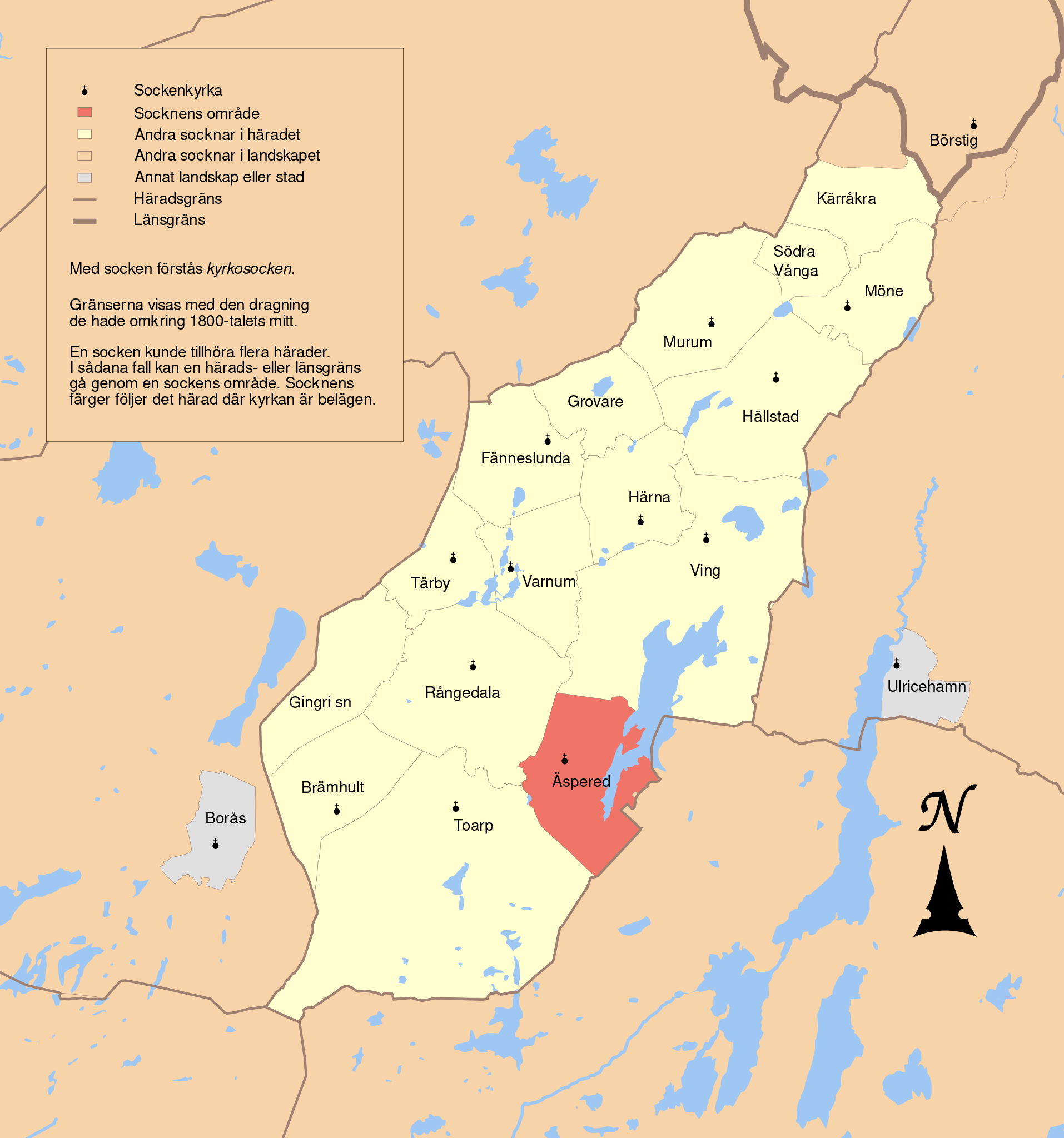
English: Map showing the borders of the civil parish of Äspered in the hundred of Ås, Älvsborg County, Västergötland Region of Sweden. Circa 1850-1900.
|
| ⧼wm-license-information-date⧽ | 2010-10-06 15:58 (UTC) |
| ⧼wm-license-information-source⧽ | |
| ⧼wm-license-information-author⧽ |
|
| [This is a retouched picture, which means that it has been digitally altered from its original version. Modifications: Combined maps to show Ås härad. The original can be viewed here: GS_Nissafors.svg. Modifications made by Edaen.] Error: {{Lang}}: text has italic markup (help)
|
|
|
هذا الملفُّ مُرخَّص بموجب رخصة المشاع الإبداعي نسبة المُصنَّف إِلى مؤلفه - المشاركة بالمثل 3.0 العامة. |
قالب:Original upload log
This image is a derivative work of the following images:
- File:GS_Borås.svg licensed with Cc-by-3.0
- 2010-09-05T19:06:41Z Edaen 5946x4441 (475776 Bytes) fewer colours
- 2010-09-05T07:06:34Z Edaen 5946x4441 (487531 Bytes) fewer colours
- 2010-09-04T18:48:20Z Edaen 5946x4441 (488977 Bytes) {{Information |Description={{en|1=Map showing borders of parishes and hundreds in the vicinity of Gothenburg, based on information from map by Topografiska Corpsen. '''33. Borås''' Topografiska Corpsens karta öfver Sverig
- File:GS_Ulricehamn.svg licensed with Cc-by-3.0
- 2010-09-08T17:56:30Z Edaen 5933x4385 (392081 Bytes) {{Information |Description={{en|1=Map showing borders of parishes and hundreds in the vicinity of Ulricehamn, based on information from map by Generalstaben. '''34. Ulricehamn''' Generalstabens karta öfver Sverige 1885. Up
- File:GS_Kungsbacka.svg licensed with Cc-by-3.0
- 2010-09-08T11:27:50Z Edaen 5952x4436 (673725 Bytes) Colours
- 2010-09-04T18:53:25Z Edaen 5950x4438 (719413 Bytes) {{Information |Description={{en|1=Map showing borders of parishes and hundreds in the vicinity of Kungsbacka, based on information from map by Topografiska Corpsen. '''Kongsbacka''' Geogr. längden är räknad från Stockhol
- File:GS_Nissafors.svg licensed with Cc-by-3.0
- 2010-09-23T13:42:36Z Edaen 5927x4418 (733623 Bytes) {{Information |Description={{en|1=Map showing borders of parishes and hundreds in the vicinity of Gislaved, based on information from map by Topografiska Corpsen. '''Nissafors''' (Gislaved) Grav. af Steffens, Wennersten och
تاريخ الملف
اضغط على زمن/تاريخ لرؤية الملف كما بدا في هذا الزمن.
| زمن/تاريخ | صورة مصغرة | الأبعاد | مستخدم | تعليق | |
|---|---|---|---|---|---|
| حالي | ★ مراجعة معتمدة 02:58، 2 نوفمبر 2023 | | 4٬348 × 4٬653 (1٫59 ميجابايت) | Pastakhov (نقاش | مساهمات) | Upload https://upload.wikimedia.org/wikipedia/commons/4/4b/%C3%85s_%C3%84spered.svg |
لا يمكنك استبدال هذا الملف.
وصلات
لا يوجد صفحات تصل لهذه الصورة.