خيلوكاسترو-إڤروستينا
(تم التحويل من Xylokastro-Evrostina)
خيلوكاسترو-إڤروستينا
Ξυλόκαστρο-Ευρωστίνα | |
|---|---|
 Xylokastro - Evrostina municipality | |
أظهر الموقع في المنطقة | |
| الإحداثيات: 38°4′N 22°38′E / 38.067°N 22.633°E | |
| البلد | |
| المنطقة الادارية | پلوپونيز |
| الوحدة المحلية | كورنثيا |
| المساحة | |
| • البلدية | 411٫7 كم² (159�0 ميل²) |
| التعداد (2011)[1] | |
| • البلدية | 17٬365 |
| • كثافة البلدية | 42/km2 (110/sq mi) |
| منطقة التوقيت | UTC+2 (EET) |
| • الصيف (التوقيت الصيفي) | UTC+3 (EEST) |
| الموقع الإلكتروني | http://www.xylokastro-evrostini.gov.gr/ |
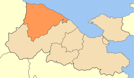
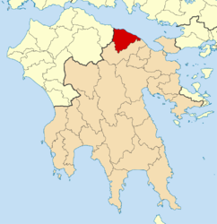
خيلوكاسترو-إڤروستينا (باليونانية: Ξυλόκαστρο-Ευρωστίνα ؛ إنگليزية: Xylokastro–Evrostina) هي بلدية في الوحدة المحلية كورنثيا، پلوپونيز، اليونان. مقر البلدية هو بلدة خيلوكاسترو.[2] The municipality has an area of 411.667 km2.[3]
البلدية
تشكلت بلدية خيلوكاسترو-إڤروستينا في إصلاح الحكم المحلي في 2011 بدمج البلديتين السابقتين، لتصبحا وحدتين بلديتين:[2]
المراجع
- ^ أ ب "Απογραφή Πληθυσμού - Κατοικιών 2011. ΜΟΝΙΜΟΣ Πληθυσμός" (in اليونانية). Hellenic Statistical Authority.
- ^ أ ب Kallikratis law Greece Ministry of Interior (in Greek)
- ^ "Population & housing census 2001 (incl. area and average elevation)" (PDF) (in اليونانية). National Statistical Service of Greece.
تصنيفات:
- Pages using gadget WikiMiniAtlas
- CS1 اليونانية-language sources (el)
- Articles with Greek-language sources (el)
- Short description is different from Wikidata
- Coordinates on Wikidata
- Articles containing Greek-language text
- Articles containing إنگليزية-language text
- Pages using Lang-xx templates
- بلديات پلوپونيز (منطقة)
- أماكن مأهولة في كورنثيا


