محافظة كوماموتو
محافظة كوماموتو
熊本県 Kumamoto Prefecture | |||||||||||||
|---|---|---|---|---|---|---|---|---|---|---|---|---|---|
| الترجمة اللفظية بالـ Japanese | |||||||||||||
| • اليابانية | 熊本県 | ||||||||||||
| • روماجي | Kumamoto-ken | ||||||||||||
 | |||||||||||||
| الإحداثيات: 32°43′N 130°40′E / 32.717°N 130.667°E | |||||||||||||
| البلد | |||||||||||||
| Region | كيوشو | ||||||||||||
| الجزيرة | كيوشو | ||||||||||||
| العاصمة | كوماموتو | ||||||||||||
| Subdivisions | Districts: 9، Municipalities: 45 | ||||||||||||
| الحكومة | |||||||||||||
| • Governor | Ikuo Kabashima | ||||||||||||
| المساحة | |||||||||||||
| • الإجمالي | 7٬409٫48 كم² (2٬860٫82 ميل²) | ||||||||||||
| ترتيب المساحة | 15th | ||||||||||||
| التعداد (June 1, 2019) | |||||||||||||
| • الإجمالي | 1٬748٬134 | ||||||||||||
| • الترتيب | 23rd | ||||||||||||
| • الكثافة | 240/km2 (610/sq mi) | ||||||||||||
| ISO 3166 code | JP-43 | ||||||||||||
| الموقع الإلكتروني | www | ||||||||||||
| |||||||||||||
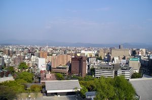
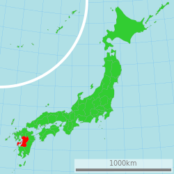
محافظة كوماموتو (熊本県, Kumamoto-ken) هي محافظة يابانية تقع في جزيرة كيوشو.[1] Kumamoto Prefecture has a population of 1,748,134 (1 June 2019) and has a geographic area of 7,409 km² (2,860 sq mi). Kumamoto Prefecture borders Fukuoka Prefecture to the north, Ōita Prefecture to the northeast, Miyazaki Prefecture to the southeast, and محافظة كاگوشيما إلى الجنوب.
كوماموتو هي عاصمة وأكبر مدن محافظة كوماموتو، with other major cities including Yatsushiro, Amakusa, and Tamana.[2] Kumamoto Prefecture is located in the center of Kyūshū on the coast of the Ariake Sea, across from Nagasaki Prefecture, with the mainland separated from the East China Sea by the Amakusa Archipelago. Kumamoto Prefecture is home to جبل آسو، the largest active volcano in Japan and among the largest in the world, with its peak 1,592 متر فوق سطح البحر.
التاريخ
Historically, the area was called Higo Province; and the province was renamed Kumamoto during the Meiji Restoration.[3] The creation of prefectures was part of the abolition of the feudal system. The current Japanese orthography for Kumamoto literally means "bear root/origin," or "origin of the bear." However, Man'yōgana-like phonetic transcriptions based on the kanji for "a ball, a sphere" (球 /ku/ ~ /kjū/) and "to polish, to grind, to brush (one's teeth)" (磨 /ma/) are used for the names of the Kuma River (球磨川) and Kuma District (球磨郡). The Kuma element also appears in the ancient Kumaso.
الجغرافيا
Kumamoto Prefecture is in the center of Kyushu, the southernmost of the four major Japanese islands. It is bordered by the Ariake inland sea and the Amakusa archipelago to the west, Fukuoka Prefecture and Ōita Prefecture to the north, Miyazaki Prefecture to the east, and Kagoshima Prefecture to the south.
Mount Aso (1,592 m (5,223 ft)), an extensive active volcano, is in the east of Kumamoto Prefecture. This volcano is located at the centre of the Aso caldera.
المدن
أربعة عشر مدينة توجد في محافظة كوماموتو:
| Name | Area (km2) | Population | Map | |
|---|---|---|---|---|
| Rōmaji | Kanji | |||
| 天草市 | 683.17 | 83,082 | ||
| 荒尾市 | 57.15 | 53,675 | ||
| 阿蘇市 | 376.25 | 27,039 | ||
| 人吉市 | 210.55 | 33,461 | ||
| 上天草市 | 126.94 | 27,603 | ||
| 菊池市 | 276.66 | 49,455 | ||
| 合志市 | 53.19 | 61,022 | ||
| 熊本市 | 390.32 | 738,907 | ||
| 水俣市 | 162.88 | 25,310 | ||
| 玉名市 | 152.55 | 70,530 | ||
| 宇城市 | 188.56 | 59,928 | ||
| 宇土市 | 74.17 | 37,442 | ||
| 山鹿市 | 299.67 | 53,404 | ||
| 八代市 | 680.59 | 129,358 | ||
البلدات والقرى
These are the towns and villages in each district:
| Name | Area (km2) | Population | District | Type | Map | |
|---|---|---|---|---|---|---|
| Rōmaji | Kanji | |||||
| あさぎり町 | 159.56 | 15,796 | Kuma District | Town | ||
| 芦北町 | 233.48 | 16,306 | Ashikita District | Town | ||
| 玉東町 | 24.4 | 5,363 | Tamana District | Town | ||
| 氷川町 | 33.29 | 12,250 | Yatsushiro District | Town | ||
| 五木村 | 252.94 | 1,136 | Kuma District | Village | ||
| 嘉島町 | 16.66 | 9,119 | Kamimashiki District | Town | ||
| 菊陽町 | 37.57 | 41,411 | Kikuchi District | Town | ||
| 甲佐町 | 57.87 | 10,924 | Kamimashiki District | Town | ||
| 球磨村 | 207.73 | 3,863 | Kuma District | Village | ||
| 益城町 | 65.67 | 33,001 | Kamimashiki District | Town | ||
| 御船町 | 99 | 16,901 | Kamimashiki District | Town | ||
| 南阿蘇村 | 137.3 | 11,086 | Aso District | Village | ||
| 南小国町 | 115.86 | 3,977 | Aso District | Town | ||
| 美里町 | 144.03 | 10,532 | Shimomashiki District | Town | ||
| 水上村 | 192.11 | 2,276 | Kuma District | Village | ||
| 長洲町 | 19.43 | 16,125 | Tamana District | Town | ||
| 和水町 | 98.75 | 10,030 | Tamana District | Town | ||
| 南関町 | 68.92 | 9,572 | Tamana District | Town | ||
| 西原村 | 77.23 | 6,752 | Aso District | Village | ||
| 錦町 | 84.87 | 10,899 | Kuma District | Town | ||
| 小国町 | 137 | 8,735 | Aso District | Town | ||
| 大津町 | 99.09 | 33,793 | Kikuchi District | Town | ||
| 苓北町 | 67.06 | 7,462 | Amakusa District | Town | ||
| 相良村 | 94.54 | 4,598 | Kuma District | Village | ||
| 高森町 | 174.9 | 6,189 | Aso District | Town | ||
| 多良木町 | 165.87 | 9,604 | Kuma District | Town | ||
| 津奈木町 | 33.97 | 4,574 | Ashikita District | Town | ||
| 産山村 | 60.72 | 1,542 | Aso District | Village | ||
| 山江村 | 121.2 | 3,553 | Kuma District | Village | ||
| 山都町 | 544.83 | 15,771 | Kamimashiki District | Town | ||
| 湯前町 | 48.41 | 4,046 | Kuma District | Town | ||
الاندماجات
الديمغرافيا
The population was on 1 June 2019 at 1,748,134 inhabitants with a population density of 236 per km ². The prefecture ranks 23rd in Japan.
الاقتصاد
يوجد مصنع دراجات نارية لشركة هوندا.
السياحة
- جبل آسو هو أحد أكبر البراكين النشطة في العالم.
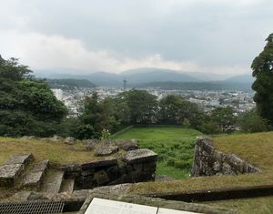
- قلعة كوماموتو
- منتزه سويزنجي
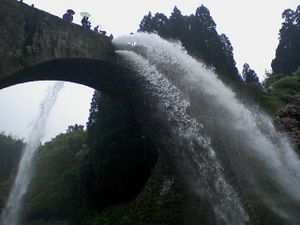
- جسر تسوجون، the largest stone aqueduct in Japan is في ياماتو
The prefecture has a mascot named "Kumamon", a black bear with red cheeks, who was created to attract tourists to the region after the Kyushu Shinkansen line opened.[4][5]
ملاحظات
- ^ Nussbaum, Louis-Frédéric. (2005). "Kumamoto prefecture" in Japan Encyclopedia, p. 572, p. 572, في كتب گوگل.
- ^ Nussbaum, "Kumamoto" in p. 572, p. 572, في كتب گوگل.
- ^ Nussbaum, "Provinces and prefectures" in p. 780, p. 780, في كتب گوگل.
- ^ The Life and Times of Japan's Mascots
- ^ "Top Ten Japanese Character Mascots". Finding Fukuoka. 2012-01-13. Retrieved 2013-02-16.
الهامش
- Nussbaum, Louis-Frédéric and Käthe Roth. (2005). Japan encyclopedia. Cambridge: Harvard University Press. ISBN 978-0-674-01753-5; OCLC 58053128
وصلات خارجية
- Official website
- National Archives of Japan ... Kumamoto map (1891)
 Geographic data related to محافظة كوماموتو at OpenStreetMap


