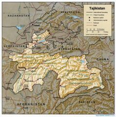
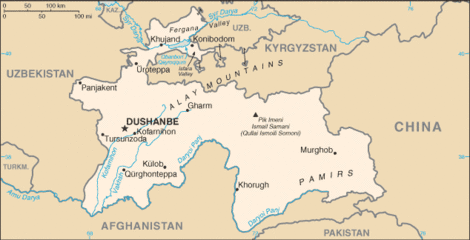
حدود الصين-طاجيكستان
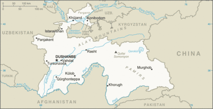
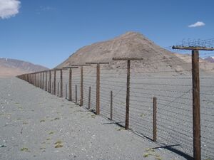
يبلغ طول حدود الصين-طاجيكستان 477 km (296 mi) 477 km (296 mi)[1] وتمتد من النقطة الثلاثية مع قيرغيزستان التي تتبع تقريبًا خطًا بين الشمال والجنوب عبر تلال وقمم جبلية مختلفة من سلاسل جبال بامير وصولاً إلى النقطة الثلاثية مع أفغانستان.[2] تقسم الحدود مقاطعة مورگوب ، منطقة گورنو-بدخشان ذاتية الحكم في طاجيكستان من مقاطعة أكتو ، محافظة كيزيلسو قيرغيزستان ذاتية الحكم (إلى الشمال) و طاشقورغان، الناحية الذاتية الطاجكية ، قشغر (إلى الجنوب) في منطقة شينجيانگ ذاتية الحكم ، الصين.
History
تعود أصول الحدود إلى منتصف القرن التاسع عشر ، عندما توسعت الإمبراطورية الروسية في آسيا الوسطى وفرضت سيطرتها على منطقة بحيرة زايسان. تم الاتفاق على إنشاء الحدود بين الامبراطورية الروسية و مملكة تشينگ، والتي لا تختلف كثيرًا عن الحدود الصينية الكازاخستانية / القرغيزية / الطاجيكية الحالية في معاهدة پكين لعام 1860 ؛[3][4] تم رسم خط الحدود الفعلي طبقًا للاتفاقية بواسطة معاهدة تاربگاتاي (1864) ومعاهدة أولياسوهاي (1870) ، تاركًا بحيرة زايسان على الجانب الروسي.[5][6][4] انهار الوجود العسكري لإمبراطورية تشينگ في حوض إرتيش خلال ثورة الدونگان (1862-1877). بعد فشل التمرد واستعادة شينجيانگ من قبل زيو زونگتانگ ، تم تعديل الحدود بين الإمبراطوريتين الروسية وتشينگ في حوض نهر إيلي بشكل طفيف ، لصالح روسيا، من خلال معاهدة سانت پطرسبورگ (1881) وسلسلة من البروتوكولات اللاحقة.[4] في عام 1915 تم التوقيع على اتفاقية لترسيم الحدود بدقة أكبر بين وادي إيلي ومنطقة دزونگاريان ألاتاو.[4] بقي الجزء الجنوبي من الحدود (أي النصف الجنوبي تقريبًا من الحدود الصينية - الطاجيكية الحديثة) بدون ترسيم ، ويرجع ذلك جزئيًا إلى التنافس المستمر بين بريطانيا وروسيا على الهيمنة في آسيا الوسطى المعروف باسم اللعبة الكبرى ؛ في النهاية اتفق الاثنان على أن أفغانستان ستبقى دولة عازلة مستقلة بينهما ، مع إنشاء رواق واخان في أفغانستان في عام 1895.[4] لم تكن الصين طرفًا في هذه الاتفاقيات ، وبالتالي ظل الجزء الجنوبي من الحدود الصينية الروسية غير محدد.[4][7] عندما نالت طاجيكستان استقلالها في عام 1991 ، ورثت جزءًا من حدود الصين والاتحاد السوفيتي. اتبعت تلك الحدود فاصل حوض النهر بين جيحون و نهر ياركاند حتى الوصول إلى ماركانسو.[4]
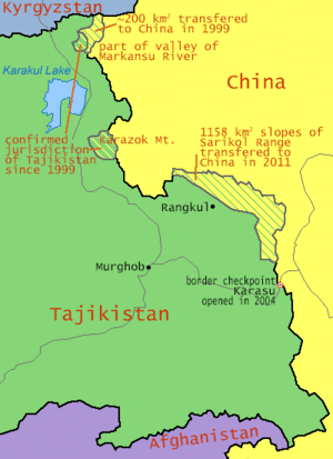
في عام 2011 ، صدقت طاجيكستان على صفقة 1999 (واتفاقية تكميلية لعام 2002) للتنازل عن 200 km2 (77 sq mi) و 1,122 km2 (433 sq mi) على التوالي[8] من الأراضي في جبال بامير إلى جمهورية الصين الشعبية ، منهية نزاعًا دام 130 عامًا. في المعاهدة ، تخلت الصين أيضًا عن مطالباتها بأكثر من 28,000 km2 (11,000 sq mi) من أراضي طاجيكستان.[9][10][8] تاريخيا ، قدمت جمهورية الصين ادعاءات مماثلة في المنطقة.[11][مطلوب مصدر أفضل] واختلفت المواقف الطاجيكية تجاه معاهدة الحدود بشكل كبير بين مجموعات المصالح المختلفة ، بدءًا من المعارضة العلنية إلى الدعم العلني.[12]
في يوليو 2020 ، قوبل النشر المتكرر لمقال بقلم تشو ياو لو في وسائل الإعلام المحلية الصينية والذي اقترح أن تمنح طاجيكستان الصين المزيد من الأراضي برفض حاد في طاجيكستان وروسيا.[13][14][15][16][17]
الجغرافية
نقطة شمال نهر ماركانسو (瑪爾坎蘇 河) على الحدود بين الصين وطاجيكستان هي أقصى نقطة في غرب الصين. تم العثور على المحطة الجنوبية للحدود في نقطة ثلاثية بين أفغانستان والصين وطاجيكستان على قمة بوفالو-شفيكوفسكوغو[18][19] (Chinese: 波万洛什维科夫斯基峰[20]; pinyin: Bōwànluò Shíwéikēfūsījī Fēng) / Kokrash Kol Peak (Kekelaqukaole Peak; Chinese: 克克拉去考勒峰[21]; pinyin: Kèkèlāqùkǎolè Fēng)[22] وهي أيضًا الطرف الشرقي من حدود أفغانستان وطاجيكستان والنهاية الشمالية للحدود الأفغانية الصينية بالإضافة إلى أقصى نقطة في شرق أفغانستان.
المعابر الحدودية
يعتبر منفذ كاراسو للدخول عند ممر كولما (4,362.7 m (14,313 ft)) هو المعبر الحدودي الوحيد في العصر الحديث بين الصين وطاجيكستان.[23] تاريخيًا ، تم تجربة ممرين إلى الجنوب على طول الحدود ، ممر نزاتاش و ممر بايك. ويوجد شمال غرب ممر كولما Uzbel / Kyzyl-Dzhiik Pass (المعروف أيضًا باسم أوزبل شانكو,[24] بيريفال كيزيل دزيك,[25][26] ممر وزيبيلي[22] (乌孜别里山口[27]), كيزيل جيك داون, ممر كيزول جيك, كو-تسي-لو-تشي-كو شان-كو, كيزيل جيك ديوان, ممر أوتزوبييلي وو-تزو- بيه-لي Shan-k’ou[26]).[22]
Historical maps
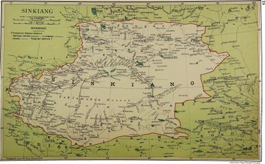
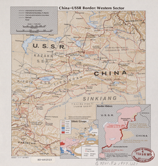
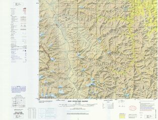
خرائط تاريخية باللغة الإنجليزية لمنطقة الحدود بين الصين والاتحاد السوڤيتي و( جمهورية طاجيكستان الاشتراكية) ، من منتصف إلى أواخر القرن العشرين ، والخرائط التاريخية بما في ذلك الحدود بين الصين وطاجيكستان قبل عام 2011:
From the International Map of the World (AMS, 1966)[أ]
Map of Afghanistan-China Boundary (with the Afghanistan-China-USSR (Tajik SSR) tripoint labeled as PEAK POVALO SHVEIKOVSKI 5698 (18694)) (1969)[ب]
Portion of the China-USSR (Tajik SSR) border (DMA, 1989)
See also
- Chalachigu Valley
- List of extreme points of China
- Extreme points of Tajikistan
- Karakoram Highway
- Beyik Pass
- Tegermansu Pass
- Wakhjir Pass
- Kilik Pass
- Mintaka Pass
- Afghanistan–China border
- China–Pakistan border
Notes
- ^ From map: "DELINEATION OF INTERNATIONAL BOUNDARIES MUST NOT BE CONSIDERED AUTHORITATIVE"
- ^ From map: "NAMES AND BOUNDARY REPRESENTATION ARE NOT NECESSARILY AUTHORITATIVE"
- ^ From map: "The representation of international boundaries is not necessarily authoritative."
- ^ From map: "The representation of international boundaries is not necessarily authoritative"
- ^ From map: "The representation of international boundaries is not necessarily authoritative"
- ^ From map: "THE REPRESENTATION OF INTERNATIONAL BOUNDARIES IS NOT NECESSARILY AUTHORITATIVE."
- ^ From map: "BOUNDARY REPRESENTATION IS NOT NECESSARILY AUTHORITATIVE."
References
- ^ "FIELD LISTING :: LAND BOUNDARIES". The World Factbook. Retrieved 30 January 2020.
China total: 22,457 km border countries (15):{...}Tajikistan 477 km, {...}Tajikistan total: 4,130 km border countries (4): {...}China 477 km, {...
} - ^ CIA World Factbook - Tajikistan, 23 September 2018, https://www.cia.gov/library/publications/the-world-factbook/geos/ki.html[dead link]
- ^ Articles 2 and 3 in the Russian text of the treaty
- ^ أ ب ت ث ج ح خ International Boundary Study No. 64 – China-USSR Boundary, 13 February 1978, http://www.law.fsu.edu/library/collection/LimitsinSeas/IBS064.pdf, retrieved on 23 September 2018
- ^ (See the map)
- ^ The Lost Frontier: the treaty maps that changed Qing's northwestern boundaries
- ^ CIA (1977). "China Oil Production Prospects". p. 2 – via Internet Archive. (Note: In the map, the southern part of the border is drawn with a dotted line, whereas the northern part of the border is drawn with a solid line.)
- ^ أ ب Alex Sodiqov (24 January 2011). "Tajikistan cedes disputed land to China". Eurasia Daily Monitor. Jamestown Foundation. 8 (16). Retrieved 23 September 2018.
On January 12, the lower house of the Tajik parliament voted to ratify the 2002 border demarcation agreement, handing over 1,122 square kilometers (433 square miles) of mountainous land in the remote Pamir Mountains (www.asiaplus.tj, January 12). The ceded land represents about 0.8 percent of the country's total area of 143,100 square kilometers (55,250 square miles).{...}At the time of independence, Tajikistan inherited three disputed border segments, constituting about 28,500 square kilometers (11,000 square miles), which China and the Soviet Union had been unable to resolve. In 1999, Tajikistan and China signed a border demarcation agreement, defining the border in two of the three segments. Under the 1999 deal, Dushanbe ceded about 200 square kilometers (77 square miles) of land to Beijing (http://www.ca-oasis.info/oasis/?jrn=109&id=817).
{{cite journal}}: External link in|quote= - ^ "Tajikistan cedes land to China". BBC News. 13 January 2011. Retrieved 3 May 2016.
- ^ "China's area increases by 1000 sq km". Times of India. 12 January 2011. Archived from the original on 2011-01-16. Retrieved 3 May 2016.
- ^ 臺灣歷史地圖 增訂版 [Taiwan Historical Maps, Expanded and Revised Edition] (in Chinese (Taiwan)). Taipei: National Museum of Taiwan History. February 2018. p. 165. ISBN 978-986-05-5274-4. (In the map 外省來源地分布圖1966年, the border of Sinkiang (Xinjiang; 新疆省) includes an area approximately similar to the Pamir area in the map China-USSR: Border Western Sector.)
- ^ Assel Bitabarova (January 2015). "Contested Views of Contested Territories: How Tajik Society Views the Tajik-Chinese Border Settlement" (PDF). Eurasia Border Review. Retrieved 21 January 2020.
- ^ Paul Goble (30 July 2020). "Beijing Implies Tajikistan's Pamir Region Should Be Returned to China". Eurasia Daily Monitor. 17 (112). Retrieved 7 August 2020 – via Jamestown Foundation.
- ^ "Now, China eyes Pamir region in Tajikistan". WION. 4 August 2020. Retrieved 7 August 2020.
'Pamir was outside China [for] 128 years due to the pressure of world powers', these are the words of Cho Yau Lu.
- ^ Yau Tsz Yan (3 August 2020). "China business briefing: Unclear borders, uneasy neighbors". Eurasianet. Retrieved 7 August 2020.
Days later, an article appeared in Chinese news outlets claiming that Tajikistan's Pamir mountains historically belonged to China and should be returned. Though the article was penned by a nationalist historian and does not appear to be a veiled hint from the Party, the message hit Dushanbe in a sensitive spot. Tajik officials are perennially concerned about the Pamirs, a region where they have tenuous authority over the local population.
- ^ "Expansionist China eyes Tajik territory".
- ^ Пекин претендует на Памир? Что пишут китайские СМИ о таджиках и о Таджикистане?.
- ^ Kamoludin Abdullaev (2018). Historical Dictionary of Tajikistan (3 ed.). Rowman & Littlefield. p. 92. ISBN 9781538102527 – via Google Books.
CHINA-TAJIK BORDER.{...}This mountainous boundary runs along the Sarikol mountain range in eastern Tajikistan, reaching in Pamir the Afghan border at the Povalo-Shveikovskogo peak (5,543 meters above sea level).
- ^ "NJ 43 Su-fu [U.S.S.R., China, Afghanistan, Pakistan, State of Jammu and Kashmir] Series 1301, Edition 5-AMS" (in الإنجليزية). Washington, D. C.: Army Map Service. March 1967 – via Perry–Castañeda Library Map Collection.
Pik Povalo-Shveikovskogo
- ^ 中华人民共和国和阿富汗王国边界条约 (in الصينية). 22 November 1963 – via Wikisource.
到高程为5698米的克克拉去考勒峰(阿方图称波万洛什维科夫斯基峰)。
- ^ 阿富汗 (in الصينية المبسطة). State Ethnic Affairs Commission. 6 July 2004. Archived from the original on 4 December 2008.
中阿边界{...}南起中、巴、阿3国交界处的5587山峰,沿穆斯塔格山脉分水岭北行至克克拉去考勒峰。
- ^ أ ب ت "China Report Political, Sociological and Military Affaris No. 363" (PDF). United States Joint Publications Research Service. 18 November 1982. p. 1. Retrieved 11 January 2020 – via Defense Technical Information Center.
If we open up the Atlas of the People's Republic of China we will find that the region of the Pamir, the western extremity of Xinjiang, from the Wuzibieli [Uzbel] Pass1 to the south down to the Kekelaqukaole Peak (which the Soviet Russians call "Pavel Shveikovsky Peak") is designated as a not limited area.
- ^ Caravanistan - Tajikistan border crossings, http://caravanistan.com:80/border-crossings/tajikistan, retrieved on 23 September 2018
- ^ Uzbel Shankou (Approved - N) at GEOnet Names Server, United States National Geospatial-Intelligence Agency
- ^ Pereval Kyzyl-Dzhiik (Approved - N) at GEOnet Names Server, United States National Geospatial-Intelligence Agency
- ^ أ ب "China-USSR border, western sector" – via Library of Congress.
Wu-tzu-pieh-li Shan-k'ou (Pereval Kyzyl-Dzhiik)
- ^ 夏征农; 陈至立, eds. (September 2009). 辞海:第六版彩图本 [Cihai (Sixth Edition in Color)] (in الصينية). 上海. Shanghai: 上海辞书出版社. Shanghai Lexicographical Publishing House. p. 2187. ISBN 9787532628599.
乌孜别里山口
- Articles with dead external links from January 2021
- CS1 uses الصينية-language script (zh)
- CS1 Chinese (Taiwan)-language sources (zh-tw)
- Articles containing صينية-language text
- CS1 uses الروسية-language script (ru)
- CS1 الصينية-language sources (zh)
- CS1 الصينية المبسطة-language sources (zh-hans)
- Short description is different from Wikidata
- كل المقالات بدون مراجع موثوقة
- كل المقالات بدون مراجع موثوقة from January 2020
- Articles containing simplified Chinese-language text
- Articles containing Chinese-language text
- China–Tajikistan border
- China–Tajikistan relations
- Borders of China
- Borders of Tajikistan
- International borders
![From the International Map of the World (AMS, 1966)[أ]](/w/images/thumb/a/ae/Txu-oclc-6654394-nj-43-5th-ed.jpg/215px-Txu-oclc-6654394-nj-43-5th-ed.jpg)
![Map of Afghanistan-China Boundary (with the Afghanistan-China-USSR (Tajik SSR) tripoint labeled as PEAK POVALO SHVEIKOVSKI 5698 (18694)) (1969)[ب]](/w/images/thumb/4/4c/Afghanistan-China_Boundary._4-69._LOC_gm70003373_cropped.jpg/313px-Afghanistan-China_Boundary._4-69._LOC_gm70003373_cropped.jpg)
![Border region (DMA, 1980)[ت]](/w/images/thumb/f/fb/Operational_Navigation_Chart_G-7%2C_6th_edition.jpg/331px-Operational_Navigation_Chart_G-7%2C_6th_edition.jpg)
![Northern/western section of the border (DMA, 1981)[ث]](/w/images/thumb/b/bb/Txu-pclmaps-oclc-22834566_g-6b.jpg/321px-Txu-pclmaps-oclc-22834566_g-6b.jpg)
![Southern/eastern section of the border (DMA, 1984)[ج]](/w/images/thumb/a/a1/Txu-pclmaps-oclc-22834566_g-7a.jpg/335px-Txu-pclmaps-oclc-22834566_g-7a.jpg)
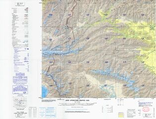
![Portion of the China-USSR (Tajik SSR) border (DMA, 1988)[ح]](/w/images/thumb/1/1d/Txu-oclc-224033229-nj43-06.jpg/321px-Txu-oclc-224033229-nj43-06.jpg)
![Portion of the China–Tajikistan border (labeled "BOUNDARY IN DISPUTE") including the tripoint with Afghanistan (DMA, 1992)[خ]](/w/images/thumb/9/92/Txu-oclc-224033229-nj43-10.jpg/318px-Txu-oclc-224033229-nj43-10.jpg)
