شامپين-أردن
شامپين-أردَن
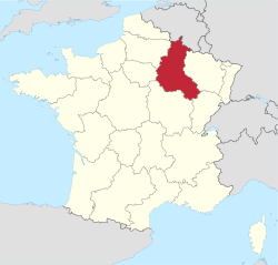
Région Champagne-Ardenne | |
|---|---|
 | |
| البلد | |
| عاصمة الإقليم | شالون-ان-شامپين |
| الأقاليم | أوب أردَن مارن العليا مارن |
| المساحة | |
| • الإجمالي | 25٬606 كم² (9٬887 ميل²) |
| منطقة التوقيت | UTC+1 (CET) |
| • الصيف (التوقيت الصيفي) | UTC+2 (CEST) |
شامپين-أردَن Champagne-Ardenneis هي واحدة من 26 منطقة في فرنسا.
. . . . . . . . . . . . . . . . . . . . . . . . . . . . . . . . . . . . . . . . . . . . . . . . . . . . . . . . . . . . . . . . . . . . . . . . . . . . . . . . . . . . . . . . . . . . . . . . . . . . . . . . . . . . . . . . . . . . . . . . . . . . . . . . . . . . . . . . . . . . . . . . . . . . . . . . . . . . . . . . . . . . . . . .
History
The administrative region was formed in 1956, consisting of the four departments Aube, Ardennes, Haute-Marne, and Marne. On 1 January 2016, it merged with the neighboring regions of Alsace and Lorraine to form the new region Grand Est, thereby ceasing to exist as an independent entity.[1]
Geography
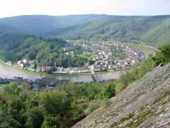
Its rivers, most of which flow west, include the Seine, the Marne, and the Aisne. The Meuse flows north.
Transportation
Highways
- A4 connecting Paris and Strasbourg and serving the Reims metropolitan area
- A5 connecting Paris and Dijon and serving Troyes and Chaumont
- A26 connecting Calais and Troyes and serving Reims and Châlons-en-Champagne
- A34 connecting Reims and the Belgian border and serving Charleville-Mézières
Rail
The rail network includes the Paris–Strasbourg line, which follows the Marne Valley and serves Épernay, Châlons-en-Champagne, and Vitry-le-François. The LGV Est TGV line also connecting Paris and Strasbourg opened in 2007 and serves Reims with a train station in the commune of Bezannes.
المياه
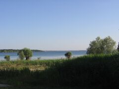
The region's canals include the Canal latéral à la Marne and Marne-Rhine Canal, the latter connecting to the Marne at Vitry-le-François. These are petit gabarit canals.
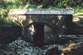
منبع المارن.
Air
The Vatry International Airport, primarily dedicated to air freight, has a runway 3,650 m (11,980 ft) long. The airport is in a sparsely populated area just 150 km (93 mi) from Paris.
انظر ايضا: أردَن
اقتصاد
- 61.4% of its land is dedicated to agriculture
- 1st in France for the production of barley and alfalfa
- 2nd in France for the production of beets, onions, and peas
- 3rd in France for the production of tender wheat and rapeseed.
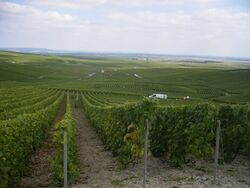
- 282.37 km2 of vineyards
- Champagne sales in 2001: 263 million bottles (4% increase from 2000) of which 37.6% were exported.
- 25% of French hosiery production
- 3rd metallurgic region in France
الأعمال
الصناعات الغذائية
الديمغرافيا
The population of Champagne-Ardenne has been in steady decrease since 1982 due to a rural exodus. With 1.3 million people and a density of 52/km2, it is one of France's least populated regions. After a brief period of stabilization in the 1990s, the region's population is now among the fastest "dying" in Europe, with several municipalities losing people at a faster rate than a lot of Eastern European areas, especially in the Haute-Marne department. The region is among the oldest in France, has a weak fertility rate, and its immigrant population, while growing,[بحاجة لمصدر] is still minimal compared to the national average.
السياحة
أهم المجتمعات
انظر ايضا
المصادر الخارجيةs
- (بالفرنسية) Government of Champagne-Ardenne region
- (إنگليزية) Champagne-Ardenne at the Open Directory Project
- Pages using gadget WikiMiniAtlas
- Short description is different from Wikidata
- Pages using infobox settlement with no coordinates
- Articles with hatnote templates targeting a nonexistent page
- Articles with unsourced statements from October 2012
- Coordinates on Wikidata
- شامبين-أردان
- مناطق فرنسا
- أقاليم التصنيف الثاني في الاتحاد الأوروپي

