برنلي
| Burnley | |
|---|---|
| Town | |
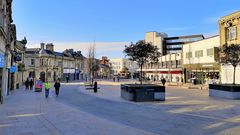 St James's Street | |
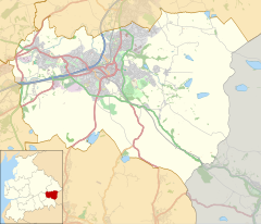
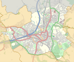
Location within Lancashire | |
| Area | 15.82 km2 (6.11 sq mi) [1] |
| Population | 73٬021 (2001 Census) |
| • Density | 11,171/sq mi (4,313/km2) |
| OS grid reference | SD836326 |
| • London | 181 mi (291 km) SSE |
| District | |
| Shire county | |
| Region | |
| Country | England |
| Sovereign state | United Kingdom |
| Post town | BURNLEY |
| Postcode district | BB10-BB12 |
| Dialling code | 01282 |
| Police | Lancashire |
| Fire | Lancashire |
| Ambulance | North West |
| EU Parliament | North West England |
| UK Parliament | |
| Website | www |
Burnley ( /ˈbɜrnli/) is a town in Lancashire, England, with a 2001 population of 73,021.[1] It is 21 miles (34 km) north of Manchester and 20 miles (32 km) east of Preston, at the confluence of the River Calder and River Brun.
The town is located near countryside to the south and east, with the smaller towns of Padiham and Nelson to the west and north respectively. It has a reputation as a regional centre of excellence for the manufacturing and aerospace industries.
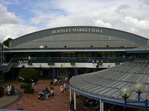
The town began to develop in the early medieval period as a number of farming hamlets surrounded by manor houses and royal forests, and has held a market for more than 700 years. During the Industrial Revolution it became one of Lancashire's most prominent mill towns; at its peak it was one of the world's largest producers of cotton cloth, and a major centre of engineering.
Burnley has retained a strong manufacturing sector, and has strong economic links with the cities of Manchester and Leeds, as well as neighbouring towns along the M65 corridor. In 2013, in recognition of its success, Burnley received an Enterprising Britain award from the UK Government, for being the "Most Enterprising Area in the UK".[2] For the first time in more than fifty years, a direct train service now operates between the town's Manchester Road railway station and Manchester's Victoria station, via the newly restored Todmorden Curve, which opened in May 2015.
| Year | 1911 | 1921 | 1931 | 1939 | 1951 | 1961 | 1971 | 2001 | |||||||||||||
|---|---|---|---|---|---|---|---|---|---|---|---|---|---|---|---|---|---|---|---|---|---|
| Population | 106,322 | 103,157 | 89,258 | 85,400 | 84,987 | 80,559 | 76,489 | 73,021 | |||||||||||||
| [3] | |||||||||||||||||||||
Economy
Religion
Transport
See also
- Pendelfin, a Burnley-based stoneware company named after Pendle Hill
- Collieries in the Burnley area of Lancashire
- List of mining disasters in Lancashire
References
Footnotes
- ^ أ ب خطأ استشهاد: وسم
<ref>غير صحيح؛ لا نص تم توفيره للمراجع المسماة2001urban - ^ "Burnley named most enterprising place in Britain".
- ^ "www.visionofbritain.org.uk".
خطأ استشهاد: الوسم <ref> ذو الاسم "Tommies" المُعرّف في <references> غير مستخدم في النص السابق.
خطأ استشهاد: الوسم <ref> ذو الاسم "Bene1" المُعرّف في <references> غير مستخدم في النص السابق.
خطأ استشهاد: الوسم <ref> ذو الاسم "Bene2" المُعرّف في <references> غير مستخدم في النص السابق.
<ref> ذو الاسم "Bene3" المُعرّف في <references> غير مستخدم في النص السابق.Bibliography
- Brian Hall, Burnley: A Short History, Burnley Historical Society, 2002
- Brian Hall & Ken Spencer, Burnley: A Pictorial History, Phillimore, 1993, ISBN 0-85033-866-2
- Guy Rickards, "Icarus Soaring: The Music of John Pickard" in Tempo, n.s., 201 (July 1997), pp. 2–5
- Kev Roberts, Northern Soul Top 500, Goldmine Publications, 2000, ISBN 0-9539291-0-8
Further reading
- Walter Bennett, The History of Burnley, 4 vols., Burnley Corporation, 1946–1951
- Ken Bolton & Roger Frost, Burnley, Francis Frith, 2006 ISBN 1-84589-131-7
- Mike Townend, Burnley, Tempus Publishing, 2004 ISBN 0-7524-1566-2
- Mike Townend, Burnley Revisited, Tempus Publishing, 2006 ISBN 0-7524-3996-0
External links
General information
- Burnley Borough Council Official council site
- Visit Burnley Official tourism site
Maps and photographs
- Ordnance Survey Map of Eastern Burnley in 1890
- Ordnance Survey Map of Western Burnley in 1890
- Ordnance Survey Map of Burnley in 1910
- Ordnance Survey Map of Burnley in 1953–55
- Photographs of Burnley at Geograph (UK)
- Burnley in 2007 | Photographs of the Leeds and Liverpool Canal in Burnley
- Image Burnley
