المسح الجيولوجي الأمريكي
 الختم | |
 الشعار الرسمي | |
| استعراض الوكالة | |
|---|---|
| تشكلت | 3 مارس 1879 |
| المقر الرئيسي | رستون، ڤيرجينيا |
| الموظفون | 8,670 (2009) |
| الميزانية السنوية | 1.1 بليون دولار (س.م. 2010)[1] |
| تنفيذي الوكالة |
|
| الوكالة الأم | وزارة الداخلية |
| الموقع الإلكتروني | www.usgs.gov |
المسح الجيولوجي الأمريكي United States Geological Survey (واختصاره USGS) هو وكالة علمية في حكومة الولايات المتحدة. يدرس علماء المسح الجيولوجي الأمريكي تضاريس الولايات المتحدة، مواردها الطبيعية، والكوارث الطبيعية التي تهددها. يضم المركز أربع تخصصات علمية، تهتم بعلم الأحياء، الجغرافيا، الجيولوجيا، والهيدرولوجيا. المسج الجيولوجي الأمريكي هو منظمة أبحاث - لجنة تقصي حقائق ليس لها مسئولية تنظيمية.
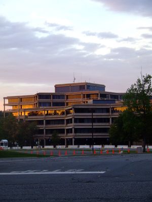
المسح الجيولوجي الأمريكي هو الوكالة العلمية التابعة لوزارة الداخلية الأمريكية. يبلغ عدد الموظفين به حوالي 8.670 شخص[2] ومقره الرئيسي في رستون، ڤيرجينيا. للمسح الجيولجي الأمريكي مكاتب رئيسية بالقرب من ليكوود، كلورادو، في مركز دنـِڤر الاتحادي، ومنلو پارك، كاليفورنيا.
شعار المسح الجيولوجي الأمريكي هو "العلم من أجل تغيير العالم".[3]
التاريخ
في 3 مارس 1879، خول الكونگرس الأمريكي (20 Stat. L. 394) مكتب مدير المسح الجيولوجي الأمريكي، وذلك بقيامه بتخصيصات في الميزانية "لمصاريف مدنية متفرقة للحكومة." كلارنس كنگ، أول مدير، كان قد رُشـِّح في 21 مارس 1879 وبدأ العمل في 24 مايو 1879. وكان المسح على مستوى الدولة لتصنيف الأراضي العامة وبنيتها الجيولوجية والمصادر المعدنية والمنتجات. وكان أول مسح جيولوجي بتمويل من الكونگرس قد أُمِر به في 28 يونيو 1834 (4 Stat. L. 394) والذي خصص $5,000 دولار لمسح قام به جورج وليام فيذرستونهو للأرض بين نهري ميزوري والأحمر. أول مسح على نفقة ولاية أجري في 1830-33 في مساتشوستس.« *
قائمة مديري المسح الجيولوجي

|
البرامج
انظر أيضاً
الهامش
- ^ "Secretary Salazar Applauds Senate's Confirmation of Dr. Marcia McNutt as Director of the U.S. Geological Survey" (Press release). U.S. Department of the Interior. October 22, 2009. Retrieved 2009-11-07.
- ^ The Associated Press (October 23, 2009). "Monterey Aquarium's McNutt new USGS director". Google News. Retrieved 2009-10-25.
- ^ "USGS Visual Identity System". U.S. Geological Survey. July 27, 2006. Retrieved 2008-12-29.
المراجع
- Eilperin, Juliet (December 14, 2006). "USGS Scientists Object To Stricter Review Rules". The Washington Post. Retrieved 2007-12-27.
- Erickson, Jim (December 14, 2006). "USGS to review scientists' studies prior to publication". Rocky Mountain News. Archived from the original on 2008-01-08. Retrieved 2007-12-27.
- Heilprin, John (December 13, 2006). "USGS scientists worry about being muzzled". Associated Press. Retrieved 2007-12-27.
- Lubick, Naomi (February 7, 2007). "Heavier peer review policy for USGS". Environmental Science & Technology. Retrieved 2007-12-27.[dead link]
- "500.5 - News Release and Media Relations Policy". U.S. Geological Survey. August 19, 2002. Retrieved 2007-12-27.
- "502.4 - Fundamental Science Practices: Review, Approval, and Release of Information Products". U.S. Geological Survey. September 20, 2006. Retrieved 2007-12-27.
وصلات خارجية
مواقع تابعة للمسح الجيولوجي
- USGS official site
- Major USGS Mission Area sites: Water, Energy, Minerals, and Environmental Health, Climate and Land Use Change, Ecosystems, Natural Hazards, Core Science Systems
- Science Quality and Integrity
- USGS Fundamental Science Practices
- USGS Library
- Science Topics (thematic directory)
- Science in Your Backyard (State index)
- USGS Circular 1050 (History of the USGS)
- USGS Geomagnetism Program
- Earthquake Hazards Program (current and historical earthquake information)
- Subscribe to automated earthquake messages
- Volcano Information
- Invasive Species
- Land Remote Sensing
- USGS Realtime Streamflow Information
- USGS Water Data for the Nation
مطبوعات
- USGS Publications Warehouse
- Open-File reports online, accessed 11/25/08
- Mineral Resources Program Online Publications and Data
- Central Mineral Resources Team, selected maps and publications online
- National Strong-Motion Project—Reports and software online.
مواقع ذات صلة خارج المسح الجيولوجي
- The Libre Map Project offers free, high-quality USGS DRG maps in TIFF format along with world files for use with your GIS software
- Microsoft Research Maps (formerly TerraServer-USA) and Acme host USGS topographic maps (and aerial photos on Microsoft Research Maps);
- Mytopo historical maps hosts historical USGS topos in the northeast U.S.
- Mapfinder Utility download USGS Topographic maps for free in Tiff format using Google Earth.
- The US Minerals Databrowser provides interactive access to data visualizations based on data from USGS DS140: "Historical Statistics for Mineral Commodities"
- Historic technical reports from USGS (and other Federal agencies) are available in the Technical Reports Archive and Image Library (TRAIL)
