ملف:Yugra-Surgutsky District.png

حجم هذه المعاينة: 800 × 505 بكسل. البعد الآخر: 2٬000 × 1٬262 بكسل.
الملف الأصلي (2٬000 × 1٬262 بكسل حجم الملف: 329 كيلوبايت، نوع MIME: image/png)
وصف قصير
| ⧼wm-license-information-description⧽ |
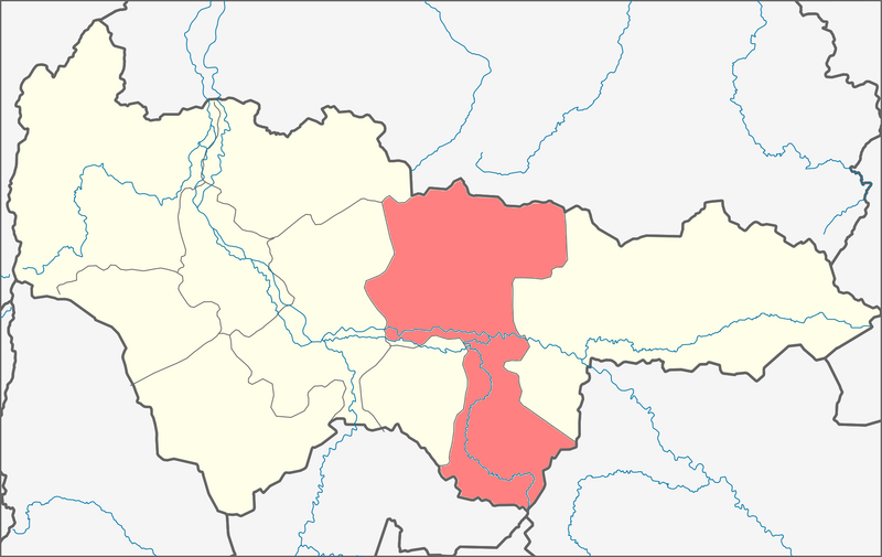
English: Location of Surgutsky District in the Khanty–Mansi Autonomous Okrug, Russia. This is a derivative work, based on http://commons.wikimedia.org/wiki/File:Blank_map_of_xmao-geoloc.svg.
|
| ⧼wm-license-information-date⧽ | 2013, {{time}} – invalid date format 03 (help) |
| ⧼wm-license-information-source⧽ | ⧼Wm-license-own-work⧽ |
| ⧼wm-license-information-author⧽ | Paju |
There is also "svg" version available, but it was based on the the "svg" file which was only saved as svg even though the content was not true vectorized map but png; thus the derivative svg-files are dot fully satisfactory for all uses. Thus these png files.
ترخيص
|
تاريخ الملف
اضغط على زمن/تاريخ لرؤية الملف كما بدا في هذا الزمن.
| زمن/تاريخ | صورة مصغرة | الأبعاد | مستخدم | تعليق | |
|---|---|---|---|---|---|
| حالي | ★ مراجعة معتمدة 20:25، 8 أكتوبر 2023 | | 2٬000 × 1٬262 (329 كيلوبايت) | Pastakhov (نقاش | مساهمات) | Upload https://upload.wikimedia.org/wikipedia/commons/9/93/Yugra-Surgutsky_District.png |
لا يمكنك استبدال هذا الملف.
وصلات
لا يوجد صفحات تصل لهذه الصورة.