ملف:Ww2 europe map italy june until december 1944.jpg
حجم هذه المعاينة: 785 × 599 بكسل. البعد الآخر: 1٬265 × 966 بكسل.
الملف الأصلي (1٬265 × 966 بكسل حجم الملف: 1٫89 ميجابايت، نوع MIME: image/jpeg)
وصف قصير
| ⧼wm-license-information-description⧽ |
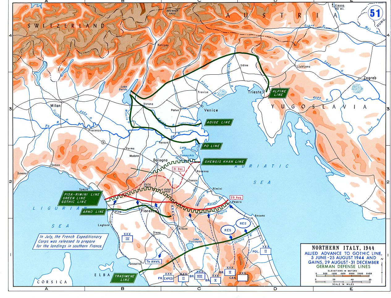
English: Allied Corp formations are depicted in blue. The German defensive lines are shown in green. The solid red line denotes the extent of the Allied advance by 29 August 1944, and the dotted red line is the extent of the Allied advance by 31 December 1944.
|
| ⧼wm-license-information-date⧽ | 1985 |
| ⧼wm-license-information-source⧽ | Archive link to original website used for the map and the archive link to the map source page. |
| ⧼wm-license-information-author⧽ | The History Department of the United States Military Academy |
| ⧼wm-license-information-permission⧽ (⧼wm-license-information-permission-reusing-text⧽) |
US Government document |
| ⧼wm-license-information-other-versions⧽ |
The current version of the map by the The History Department of the United States Military Academy: قالب:F |
ترخيص
تاريخ الملف
اضغط على زمن/تاريخ لرؤية الملف كما بدا في هذا الزمن.
| زمن/تاريخ | صورة مصغرة | الأبعاد | مستخدم | تعليق | |
|---|---|---|---|---|---|
| حالي | ★ مراجعة معتمدة 17:49، 29 أكتوبر 2023 | | 1٬265 × 966 (1٫89 ميجابايت) | Pastakhov (نقاش | مساهمات) | Upload https://upload.wikimedia.org/wikipedia/commons/3/32/Ww2_europe_map_italy_june_until_december_1944.jpg |
لا يمكنك استبدال هذا الملف.
وصلات
لا يوجد صفحات تصل لهذه الصورة.