ملف:Witcher Creek WV map.png
حجم هذه المعاينة: 789 × 600 بكسل. البعدان الآخران: 2٬560 × 1٬946 بكسل | 3٬169 × 2٬409 بكسل.
الملف الأصلي (3٬169 × 2٬409 بكسل حجم الملف: 6٫5 ميجابايت، نوع MIME: image/png)
وصف قصير
| ⧼wm-license-information-description⧽ |
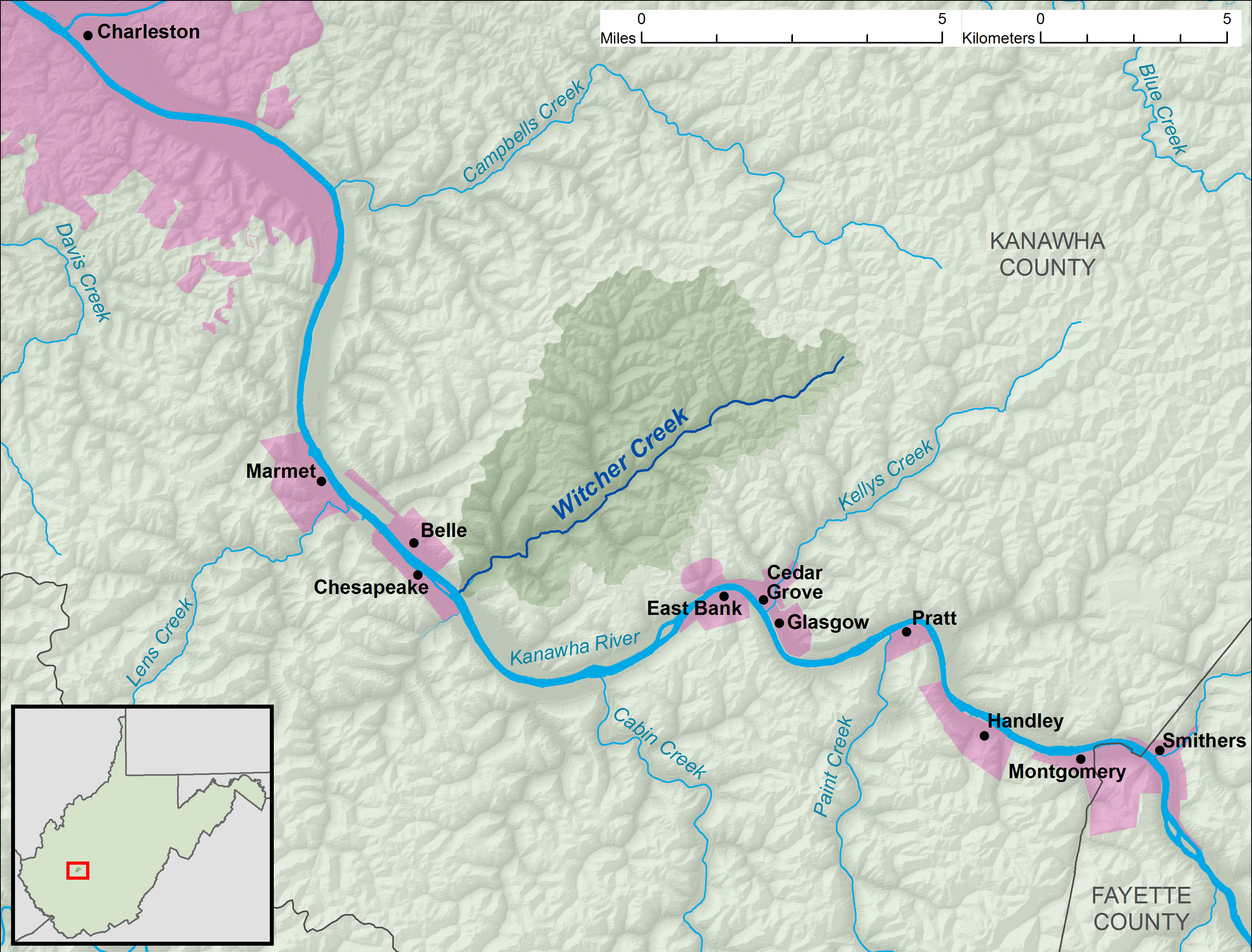
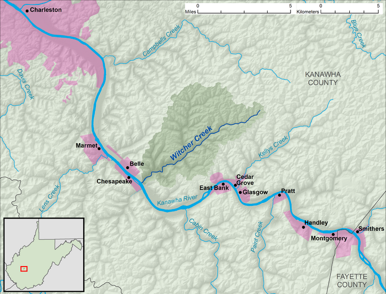
English: A map of Witcher Creek and its watershed (USGS HUC-12 code 050500060401), in Kanawha County, West Virginia.
|
| ⧼wm-license-information-date⧽ | 2013 |
| ⧼wm-license-information-source⧽ | Own work, data from w:The National Map |
| ⧼wm-license-information-author⧽ | Tim Kiser (User:Malepheasant) |
ترخيص
|

تاريخ الملف
اضغط على زمن/تاريخ لرؤية الملف كما بدا في هذا الزمن.
| زمن/تاريخ | صورة مصغرة | الأبعاد | مستخدم | تعليق | |
|---|---|---|---|---|---|
| حالي | ★ مراجعة معتمدة 21:38، 6 أكتوبر 2023 | | 3٬169 × 2٬409 (6٫5 ميجابايت) | Pastakhov (نقاش | مساهمات) | Upload https://upload.wikimedia.org/wikipedia/commons/6/60/Witcher_Creek_WV_map.png |
لا يمكنك استبدال هذا الملف.
وصلات
لا يوجد صفحات تصل لهذه الصورة.