ملف:Whale pier elements over Meuse.jpg
حجم هذه المعاينة: 800 × 600 بكسل. البعد الآخر: 2٬272 × 1٬704 بكسل.
الملف الأصلي (2٬272 × 1٬704 بكسل حجم الملف: 1٫32 ميجابايت، نوع MIME: image/jpeg)
وصف قصير
| ⧼wm-license-information-description⧽ |
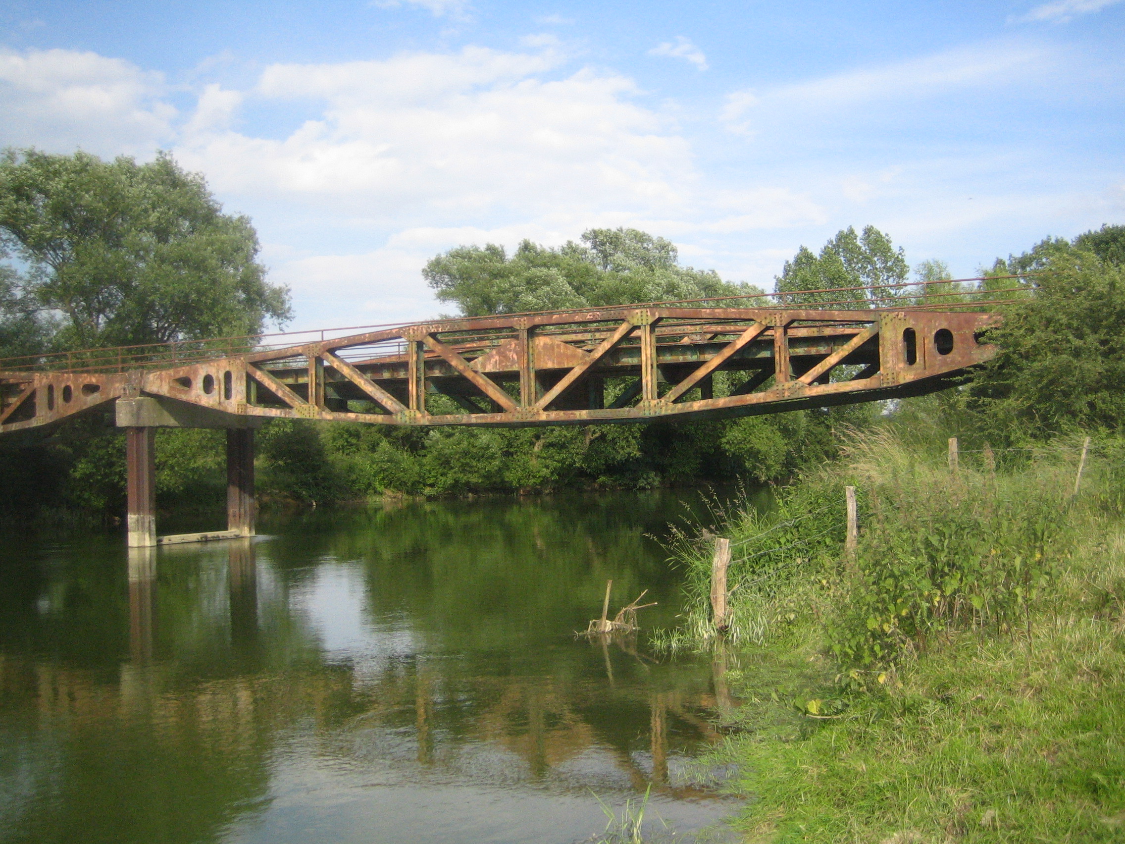
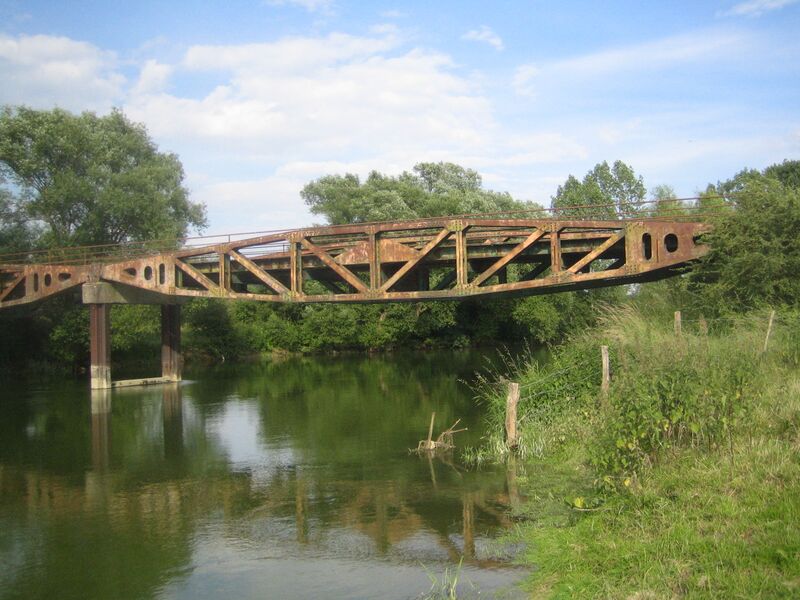
English: Bridge over river Meuse formed with assembled 'Whale' pier elements. This bridge is located in Vacherauville (Meuse). These piers were the floating roadways that connected the Spud pier heads to the land in a Mulberry harbour, a type of temporary harbour developed in World War II to offload cargo on the beaches during the Allied invasion of Normandy.
Français : Pont sur la Meuse formé de pontons 'Whale'. Ce pont est localisé à Vacherauville (Meuse). Ces pontons reliaient les têtes Spud dans un port Mulberry. Un port Mulberry était un port artificiel construit sur la côte normande pendant la Seconde Guerre mondiale pour permettre l'approvisionnement des armées alliées dans les jours qui suivirent le débarquement de Normandie.
|
| ⧼wm-license-information-date⧽ | 2008 |
| ⧼wm-license-information-source⧽ | ⧼Wm-license-own-work⧽ |
| ⧼wm-license-information-author⧽ | Foxandpotatoes |
ترخيص
|

تاريخ الملف
اضغط على زمن/تاريخ لرؤية الملف كما بدا في هذا الزمن.
| زمن/تاريخ | صورة مصغرة | الأبعاد | مستخدم | تعليق | |
|---|---|---|---|---|---|
| حالي | ★ مراجعة معتمدة 14:44، 11 أكتوبر 2023 | | 2٬272 × 1٬704 (1٫32 ميجابايت) | Pastakhov (نقاش | مساهمات) | Upload https://upload.wikimedia.org/wikipedia/commons/6/6f/Whale_pier_elements_over_Meuse.jpg |
لا يمكنك استبدال هذا الملف.
وصلات
لا يوجد صفحات تصل لهذه الصورة.