ملف:Western-ganga-empire-map.svg

حجم معاينة PNG لذلك الملف ذي الامتداد SVG: 565 × 600 بكسل. البعد الآخر: 1٬929 × 2٬048 بكسل.
الملف الأصلي (ملف SVG، أبعاده 1٬651 × 1٬753 بكسل، حجم الملف: 430 كيلوبايت)
وصف قصير
I used Image:India-locator-map-blank.svg as base and edited myself using inkspace and created it by looking at the following sources.
- Malini Adiga (2006), The Making of Southern Karnataka: Society, Polity and Culture in the early medieval period, AD 400-1030, Orient Longman, Chennai, , ISBN 81 250 2912 5 , p121
- Dr. Suryanath U. Kamath, A Concise history of Karnataka from pre-historic times to the present, Jupiter books, MCC, 2001 (Reprinted 2002) (page no - 329)
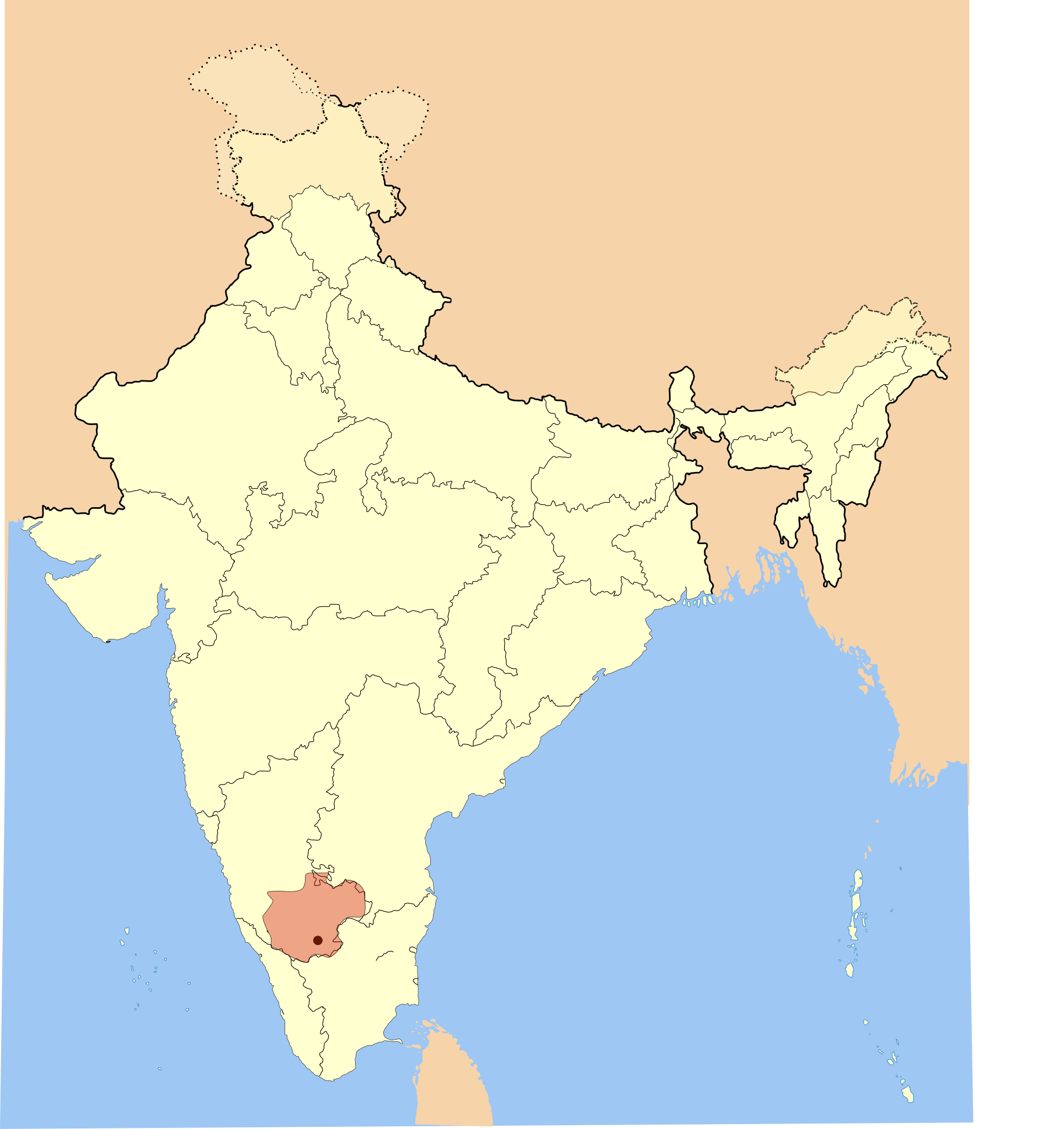
The Gangadomains map pertains to the "Western Ganga Dynasty" (Western Gangas). The double shaded region was under the control of their feudatories in 1st version. I deleted the double shade to avoid confusion and internalisation overhead in 2nd picture.
| ⧼wm-license-information-description⧽ |
Western Ganga Empire Map |
| ⧼wm-license-information-date⧽ | 2007 |
| ⧼wm-license-information-source⧽ | ⧼Wm-license-own-work⧽ |
| ⧼wm-license-information-author⧽ | Mlpkr |
ترخيص
|

تاريخ الملف
اضغط على زمن/تاريخ لرؤية الملف كما بدا في هذا الزمن.
| زمن/تاريخ | صورة مصغرة | الأبعاد | مستخدم | تعليق | |
|---|---|---|---|---|---|
| حالي | ★ مراجعة معتمدة 03:59، 13 نوفمبر 2023 | | 1٬651 × 1٬753 (430 كيلوبايت) | Pastakhov (نقاش | مساهمات) | Upload https://upload.wikimedia.org/wikipedia/commons/9/98/Western-ganga-empire-map.svg |
لا يمكنك استبدال هذا الملف.
وصلات
لا يوجد صفحات تصل لهذه الصورة.