ملف:Wayne County Michigan Incorporated and Unincorporated areas Grosse Pointe Park highlighted.svg

حجم معاينة PNG لذلك الملف ذي الامتداد SVG: 800 × 533 بكسل. البعد الآخر: 2٬560 × 1٬707 بكسل.
الملف الأصلي (ملف SVG، أبعاده 1٬200 × 800 بكسل، حجم الملف: 136 كيلوبايت)
| ⧼wm-license-information-description⧽ |
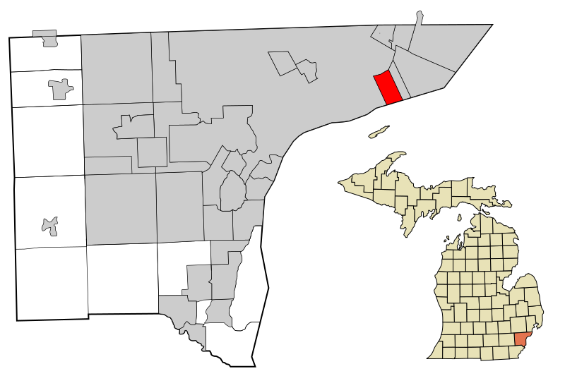
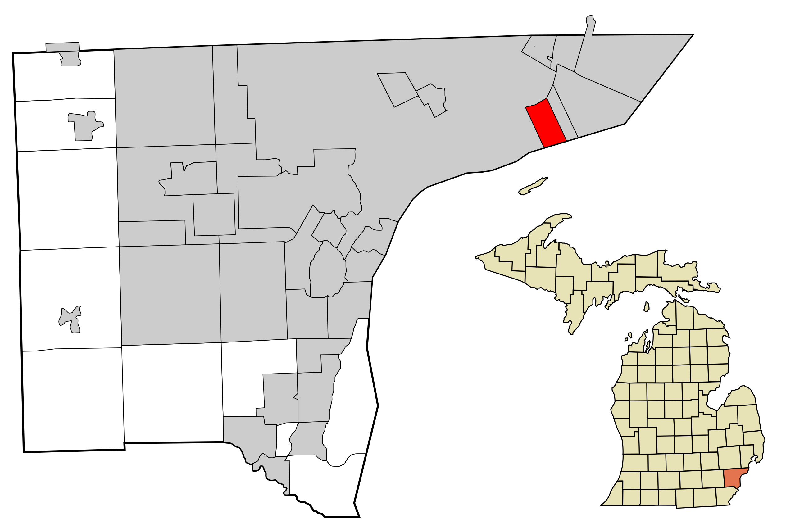
This map shows the incorporated and unincorporated areas in Wayne County, Michigan, highlighting Grosse Pointe Park in red. I created it in Inkscape using data from the US Census Bureau. |
| ⧼wm-license-information-date⧽ | 2007 |
| ⧼wm-license-information-source⧽ | My own work, based on public domain information. Based on similar map concepts by Ixnayonthetimmay |
| ⧼wm-license-information-author⧽ | Arkyan |
| ⧼wm-license-information-permission⧽ (⧼wm-license-information-permission-reusing-text⧽) |
Own work, copyleft: Multi-license with GFDL and Creative Commons CC-BY-SA-2.5 and older versions (2.0 and 1.0) |
|

تاريخ الملف
اضغط على زمن/تاريخ لرؤية الملف كما بدا في هذا الزمن.
| زمن/تاريخ | صورة مصغرة | الأبعاد | مستخدم | تعليق | |
|---|---|---|---|---|---|
| حالي | ★ مراجعة معتمدة 14:44، 9 نوفمبر 2023 | | 1٬200 × 800 (136 كيلوبايت) | Pastakhov (نقاش | مساهمات) | Upload https://upload.wikimedia.org/wikipedia/commons/b/b3/Wayne_County_Michigan_Incorporated_and_Unincorporated_areas_Grosse_Pointe_Park_highlighted.svg |
لا يمكنك استبدال هذا الملف.
وصلات
لا يوجد صفحات تصل لهذه الصورة.