ملف:Walton House, Shoreditch - geograph.org.uk - 687852.jpg
لا توجد دقة أعلى متوفرة.
Walton_House,_Shoreditch_-_geograph.org.uk_-_687852.jpg (640 × 427 بكسل حجم الملف: 80 كيلوبايت، نوع MIME: image/jpeg)
وصف قصير
| ⧼wm-license-information-description⧽ |
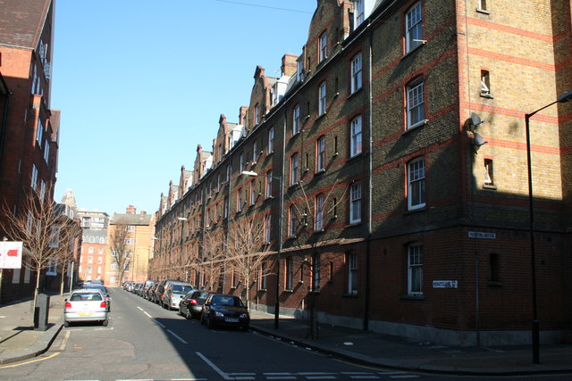
English: Walton House, Shoreditch Walton House, formerly known as Walton Buildings, is an example of the well-constructed tenement or apartment blocks that were built in late Victorian years to replace the slums of the Old Nichol. This photograph taken from the junction of Old Nichol Street with Turville Street.
|
| ⧼wm-license-information-date⧽ | 2008 |
| ⧼wm-license-information-source⧽ | From geograph.org.uk |
| ⧼wm-license-information-author⧽ | Dr Neil Clifton |
| ⧼wm-license-cc-attribution⧽ (قالب:I18n/Credit line) |
Dr Neil Clifton / Walton House, Shoreditch / |
51°31′29″N 0°04′25″W / 51.52473°N 0.0735°W قالب:Object location
_heading:22)
ترخيص
تاريخ الملف
اضغط على زمن/تاريخ لرؤية الملف كما بدا في هذا الزمن.
| زمن/تاريخ | صورة مصغرة | الأبعاد | مستخدم | تعليق | |
|---|---|---|---|---|---|
| حالي | ★ مراجعة معتمدة 08:42، 16 أكتوبر 2023 | | 640 × 427 (80 كيلوبايت) | Pastakhov (نقاش | مساهمات) | Upload https://upload.wikimedia.org/wikipedia/commons/6/6a/Walton_House%2C_Shoreditch_-_geograph.org.uk_-_687852.jpg |
لا يمكنك استبدال هذا الملف.
وصلات
لا يوجد صفحات تصل لهذه الصورة.