ملف:Vorderstoder Zellerhütte Spitzmauer Brotfall.jpg
حجم هذه المعاينة: 800 × 533 بكسل. البعدان الآخران: 2٬560 × 1٬707 بكسل | 5٬898 × 3٬932 بكسل.
الملف الأصلي (5٬898 × 3٬932 بكسل حجم الملف: 6٫17 ميجابايت، نوع MIME: image/jpeg)
وصف قصير
| ⧼wm-license-information-description⧽ |
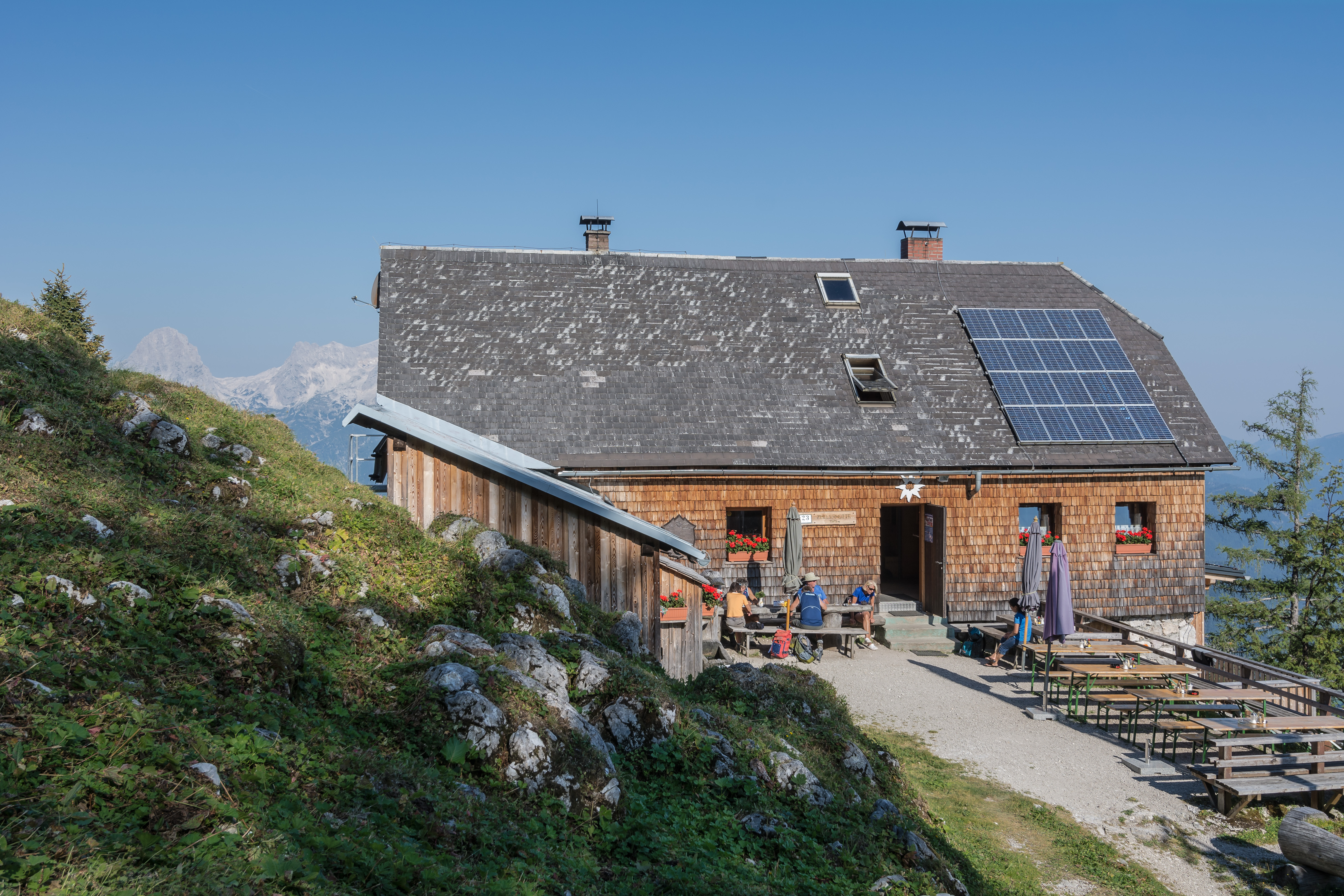
Deutsch: Die Zellerhütte befindet sich in der Gemeinde Vorderstoder in Oberösterreich, Österreich. Sie ist eine Schutzhütte der Kategorie I des ÖAV, Sektion TK Windischgarsten. Sie steht auf 1575 m Seehöhe am Weg zum Warscheneck im Toten Gebirge. Dieser Weg ist unter anderem ein Teilstück des Europäischen Fernwanderwegs E4 und des Österreichischen Weitwanderwegs 01 (Nordalpenweg). English: The refuge Zellerhütte is located in the community of Vorderstoder in Upper Austria. It is a category I refuge Of the Austrian Alpine Club ÖAV. It is on the way to the mountain Warschenek in the mountain Area of Totes Gebirge.
|
| ⧼wm-license-information-date⧽ | 2015 |
| ⧼wm-license-information-source⧽ | ⧼Wm-license-own-work⧽ |
| ⧼wm-license-information-author⧽ | Isiwal |
ترخيص
|
تاريخ الملف
اضغط على زمن/تاريخ لرؤية الملف كما بدا في هذا الزمن.
| زمن/تاريخ | صورة مصغرة | الأبعاد | مستخدم | تعليق | |
|---|---|---|---|---|---|
| حالي | ★ مراجعة معتمدة 21:05، 13 أكتوبر 2023 | | 5٬898 × 3٬932 (6٫17 ميجابايت) | Pastakhov (نقاش | مساهمات) | Upload https://upload.wikimedia.org/wikipedia/commons/f/f8/Vorderstoder_Zellerh%C3%BCtte_Spitzmauer_Brotfall.jpg |
لا يمكنك استبدال هذا الملف.
وصلات
لا يوجد صفحات تصل لهذه الصورة.