ملف:Village green, Chailey - geograph.org.uk - 70504.jpg
لا توجد دقة أعلى متوفرة.
Village_green,_Chailey_-_geograph.org.uk_-_70504.jpg (640 × 479 بكسل حجم الملف: 147 كيلوبايت، نوع MIME: image/jpeg)
وصف قصير
| ⧼wm-license-information-description⧽ |
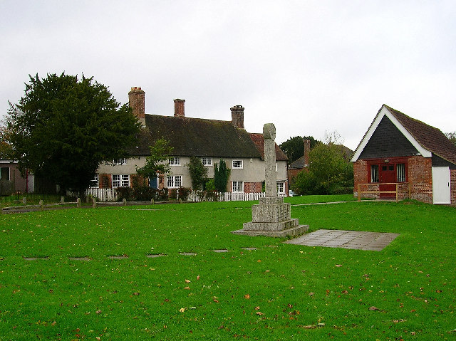
English: Village green, Chailey. Chailey is made up of three parts; Chailey, North Chailey and South Chailey. Like Barcombe, Wivelsfield and Plumpton the parochial centre is not the major population centre. This view of the pleasant village green looks north past the war memorial and village hall. The view south takes in the church.
|
| ⧼wm-license-information-date⧽ | 2005 |
| ⧼wm-license-information-source⧽ | From geograph.org.uk |
| ⧼wm-license-information-author⧽ | Simon Carey |
| ⧼wm-license-cc-attribution⧽ (قالب:I18n/Credit line) |
Simon Carey / Village green, Chailey / |
50°57′24″N 0°01′08″W / 50.9568°N 0.019°W قالب:Object location
)
ترخيص
تاريخ الملف
اضغط على زمن/تاريخ لرؤية الملف كما بدا في هذا الزمن.
| زمن/تاريخ | صورة مصغرة | الأبعاد | مستخدم | تعليق | |
|---|---|---|---|---|---|
| حالي | ★ مراجعة معتمدة 07:43، 11 أكتوبر 2023 | | 640 × 479 (147 كيلوبايت) | Pastakhov (نقاش | مساهمات) | Upload https://upload.wikimedia.org/wikipedia/commons/b/bf/Village_green%2C_Chailey_-_geograph.org.uk_-_70504.jpg |
لا يمكنك استبدال هذا الملف.
وصلات
لا يوجد صفحات تصل لهذه الصورة.