ملف:Village Square, Ripe - geograph.org.uk - 62623.jpg
لا توجد دقة أعلى متوفرة.
Village_Square,_Ripe_-_geograph.org.uk_-_62623.jpg (640 × 479 بكسل حجم الملف: 139 كيلوبايت، نوع MIME: image/jpeg)
وصف قصير
| ⧼wm-license-information-description⧽ |
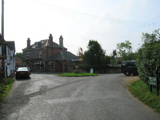
English: Village Square, Ripe. Looking south from Ripe Lane. The village store is to the left, the pub straight ahead. The road to the east goes to Chalvington, the road to the west eventually makes its way to the A27.
|
| ⧼wm-license-information-date⧽ | 2005 |
| ⧼wm-license-information-source⧽ | From geograph.org.uk |
| ⧼wm-license-information-author⧽ | Simon Carey |
| ⧼wm-license-cc-attribution⧽ (قالب:I18n/Credit line) |
Simon Carey / Village Square, Ripe / |
50°52′16″N 0°08′42″E / 50.8711°N 0.145°E قالب:Object location
)
ترخيص
تاريخ الملف
اضغط على زمن/تاريخ لرؤية الملف كما بدا في هذا الزمن.
| زمن/تاريخ | صورة مصغرة | الأبعاد | مستخدم | تعليق | |
|---|---|---|---|---|---|
| حالي | ★ مراجعة معتمدة 01:29، 4 ديسمبر 2023 | | 640 × 479 (139 كيلوبايت) | Pastakhov (نقاش | مساهمات) | Upload https://upload.wikimedia.org/wikipedia/commons/f/f2/Village_Square%2C_Ripe_-_geograph.org.uk_-_62623.jpg |
لا يمكنك استبدال هذا الملف.
وصلات
لا يوجد صفحات تصل لهذه الصورة.