ملف:Victoria Embankment, London - geograph.org.uk - 1598692.jpg
لا توجد دقة أعلى متوفرة.
Victoria_Embankment,_London_-_geograph.org.uk_-_1598692.jpg (640 × 428 بكسل حجم الملف: 73 كيلوبايت، نوع MIME: image/jpeg)
وصف قصير
| ⧼wm-license-information-description⧽ |
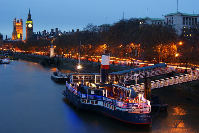
English: Victoria Embankment, London Photographed from the Golden Jubilee Bridge. In the foreground is the Tattershall Castle, a paddle steamer dating from 1934. Looking along the Victoria Embankment, the RAF Memorial (WWI) overlooks the River Thames, and is illuminated. The portion of the Victoria Embankment, beyond the memorial, is in the next grid square. In the distance, Big Ben and part of the Houses of Parliament can be seen.
http://www.thetattershallcastle.co.uk/
|
| ⧼wm-license-information-date⧽ | 2009 |
| ⧼wm-license-information-source⧽ | From geograph.org.uk |
| ⧼wm-license-information-author⧽ | Peter Trimming |
| ⧼wm-license-cc-attribution⧽ (قالب:I18n/Credit line) |
Peter Trimming / Victoria Embankment, London / |
51°30′23″N 0°07′15″W / 51.50643°N 0.1208°W قالب:Object location
_heading:202)
ترخيص
تاريخ الملف
اضغط على زمن/تاريخ لرؤية الملف كما بدا في هذا الزمن.
| زمن/تاريخ | صورة مصغرة | الأبعاد | مستخدم | تعليق | |
|---|---|---|---|---|---|
| حالي | ★ مراجعة معتمدة 04:24، 29 نوفمبر 2023 | | 640 × 428 (73 كيلوبايت) | Pastakhov (نقاش | مساهمات) | Upload https://upload.wikimedia.org/wikipedia/commons/7/79/Victoria_Embankment%2C_London_-_geograph.org.uk_-_1598692.jpg |
لا يمكنك استبدال هذا الملف.
وصلات
لا يوجد صفحات تصل لهذه الصورة.