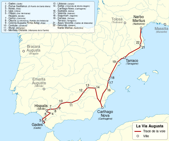
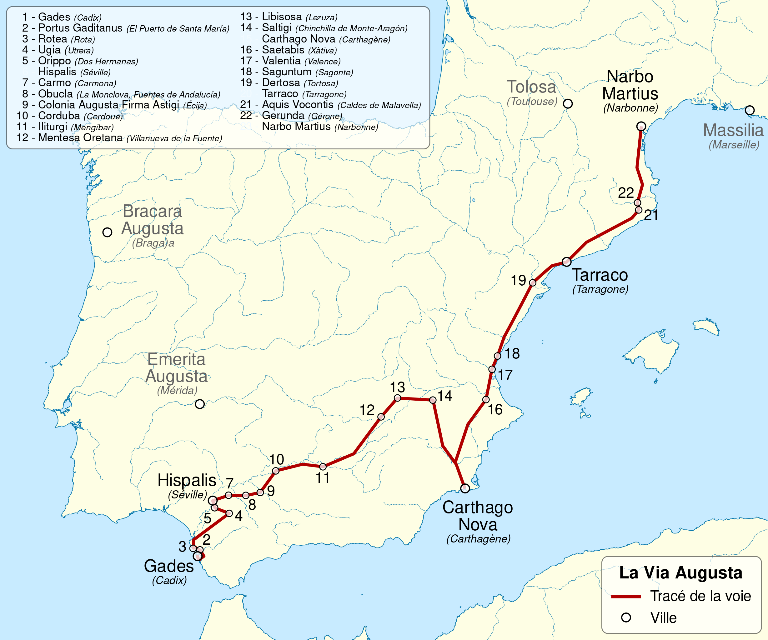
ملف:Via Augusta map-fr.svg

حجم معاينة PNG لذلك الملف ذي الامتداد SVG: 719 × 599 بكسل. البعد الآخر: 2٬457 × 2٬048 بكسل.
الملف الأصلي (ملف SVG، أبعاده 1٬261 × 1٬051 بكسل، حجم الملف: 554 كيلوبايت)
وصف قصير
| ⧼wm-license-information-description⧽ |
Deutsch: Karte der Via Augusta im römischen Spanien zwischen Cádiz und Narbonne. English: Map of Via Augusta in Roman Hispania, between Cadiz and Narbonne. español: Mapa de la Via Augusta en la Hispania romana, entre Cádiz y Narbona. français: Carte de la Via Augusta en Hispanie romaine, entre Cadix et Narbonne. |
| ⧼wm-license-information-date⧽ | 2011 |
| ⧼wm-license-information-source⧽ |
|
| ⧼wm-license-information-author⧽ | Sémhur |
| ⧼wm-license-information-other-versions⧽ |
|
| ⧼wm-license-cc-attribution⧽ (قالب:I18n/Credit line) |
© Sémhur / Wikimedia Commons / |
|
|
This image was created with Inkscape. |
قالب:Translation possible قالب:Atelier graphique carte
ترخيص
تاريخ الملف
اضغط على زمن/تاريخ لرؤية الملف كما بدا في هذا الزمن.
| زمن/تاريخ | صورة مصغرة | الأبعاد | مستخدم | تعليق | |
|---|---|---|---|---|---|
| حالي | ★ مراجعة معتمدة 03:13، 14 نوفمبر 2023 | | 1٬261 × 1٬051 (554 كيلوبايت) | Pastakhov (نقاش | مساهمات) | Upload https://upload.wikimedia.org/wikipedia/commons/4/49/Via_Augusta_map-fr.svg |
لا يمكنك استبدال هذا الملف.
وصلات
لا يوجد صفحات تصل لهذه الصورة.