ملف:Vantaa districts-Asola.png

حجم هذه المعاينة: 800 × 588 بكسل. البعد الآخر: 1٬174 × 863 بكسل.
الملف الأصلي (1٬174 × 863 بكسل حجم الملف: 24 كيلوبايت، نوع MIME: image/png)
| ⧼wm-license-information-description⧽ |
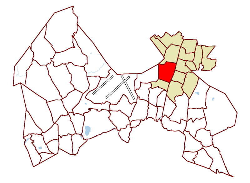
District of Asola (marked red), within Korso-Koivukylä service area (marked light brown) in Vantaa, Finland |
|
| ⧼wm-license-information-date⧽ | 2006 | |
| ⧼wm-license-information-source⧽ | modified version of Vantaa_Districts2.png, District location map of Vantaa, Finland by Author: User:Paju | |
| ⧼wm-license-information-author⧽ | Paju | |
| ⧼wm-license-information-permission⧽ (⧼wm-license-information-permission-reusing-text⧽) |
|
تاريخ الملف
اضغط على زمن/تاريخ لرؤية الملف كما بدا في هذا الزمن.
| زمن/تاريخ | صورة مصغرة | الأبعاد | مستخدم | تعليق | |
|---|---|---|---|---|---|
| حالي | ★ مراجعة معتمدة 22:48، 1 نوفمبر 2023 | | 1٬174 × 863 (24 كيلوبايت) | Pastakhov (نقاش | مساهمات) | Upload https://upload.wikimedia.org/wikipedia/commons/b/bf/Vantaa_districts-Asola.png |
لا يمكنك استبدال هذا الملف.
وصلات
لا يوجد صفحات تصل لهذه الصورة.