ملف:Val-de-Marne - Créteil arrondissement.svg

حجم معاينة PNG لذلك الملف ذي الامتداد SVG: 697 × 600 بكسل. البعد الآخر: 2٬381 × 2٬048 بكسل.
الملف الأصلي (ملف SVG، أبعاده 808 × 695 بكسل، حجم الملف: 79 كيلوبايت)
وصف قصير
| ⧼wm-license-information-description⧽ |
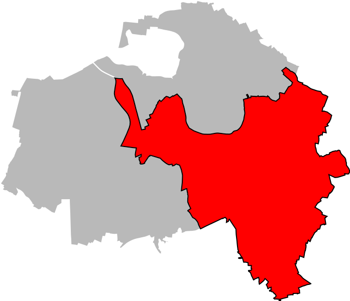
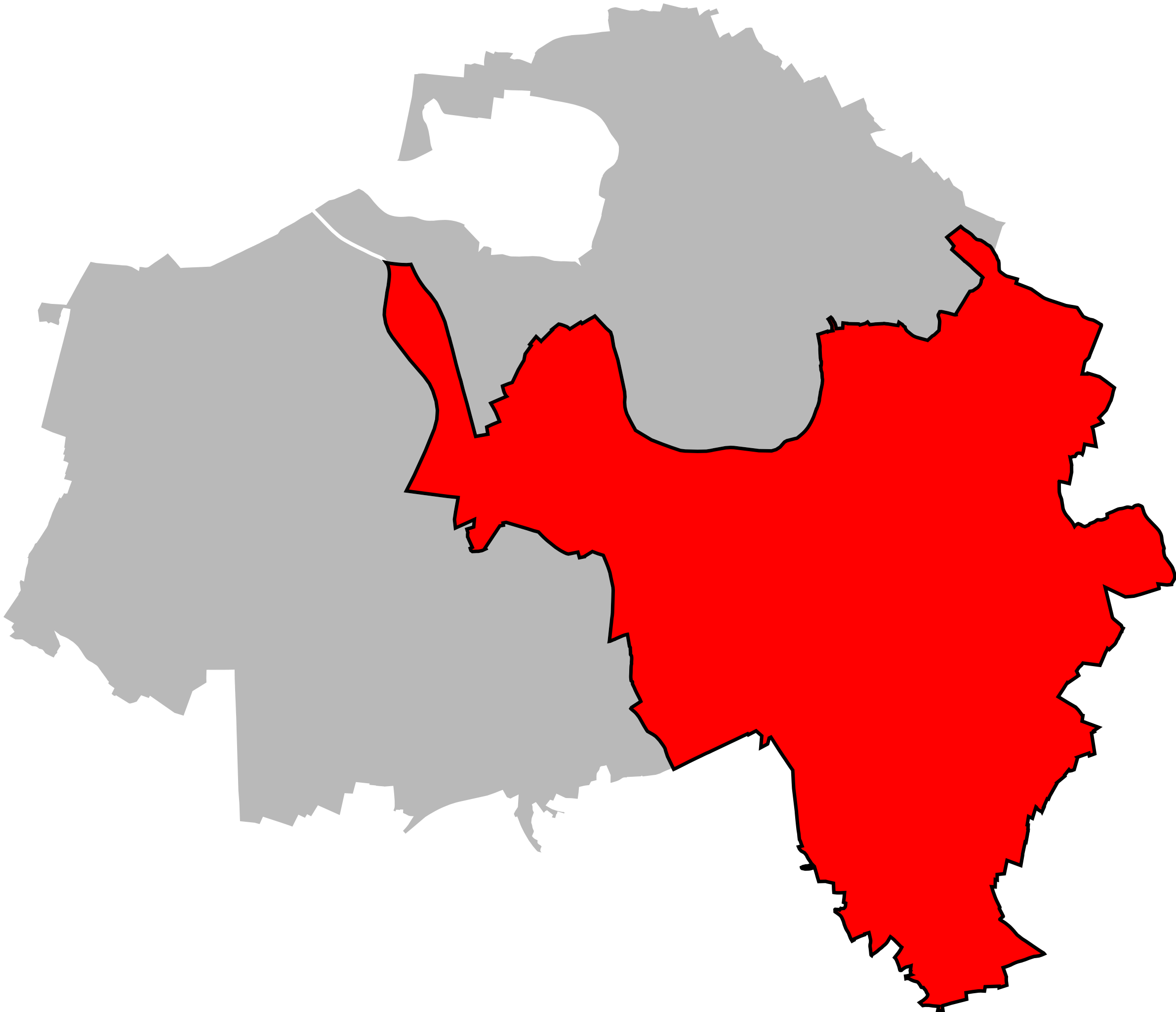
English: Locator map of Arrondissement of Créteil in Val-de-Marne on 2022/1/1. Français : Carte de localisation de l'arrondissement de Créteil dans le Val-de-Marne au 1قالب:Er janvier 2022.
|
| ⧼wm-license-information-date⧽ | 2012 |
| ⧼wm-license-information-source⧽ | ⧼Wm-license-own-work⧽ |
| ⧼wm-license-information-author⧽ | Poulpy |
| ⧼wm-license-information-permission⧽ (⧼wm-license-information-permission-reusing-text⧽) |
Coordinates are taken from GEOFLA® Communes, a work of Institut géographique national, licensed under the Licence Ouverte. |
ترخيص
|
تاريخ الملف
اضغط على زمن/تاريخ لرؤية الملف كما بدا في هذا الزمن.
| زمن/تاريخ | صورة مصغرة | الأبعاد | مستخدم | تعليق | |
|---|---|---|---|---|---|
| حالي | ★ مراجعة معتمدة 03:22، 4 نوفمبر 2023 | | 808 × 695 (79 كيلوبايت) | Pastakhov (نقاش | مساهمات) | Upload https://upload.wikimedia.org/wikipedia/commons/7/7e/Val-de-Marne_-_Cr%C3%A9teil_arrondissement.svg |
لا يمكنك استبدال هذا الملف.
وصلات
لا يوجد صفحات تصل لهذه الصورة.