ملف:United States 1812-06-1816.png
حجم هذه المعاينة: 800 × 542 بكسل. البعد الآخر: 1٬000 × 677 بكسل.
الملف الأصلي (1٬000 × 677 بكسل حجم الملف: 113 كيلوبايت، نوع MIME: image/png)
| ⧼wm-license-information-description⧽ |
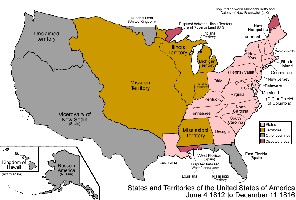
Map of the states and territories of the United States as it was from June 1812 to 1816. On June 4 1812, to minimize confusion, Louisiana Territory was renamed Missouri Territory. On December 11 1816, the southern portion of Indiana Territory was admitted as the state of Indiana; the rest became unorganized. |
| ⧼wm-license-information-date⧽ | 2007 |
| ⧼wm-license-information-source⧽ | ⧼Wm-license-own-work⧽ |
| ⧼wm-license-information-author⧽ | Made by User:Golbez. |
| ⧼wm-license-information-permission⧽ (⧼wm-license-information-permission-reusing-text⧽) |
Own work, attribution required (Multi-license with GFDL and Creative Commons CC-BY 2.5) |
قالب:Cc-by-sa-3.0-migrated |

تاريخ الملف
اضغط على زمن/تاريخ لرؤية الملف كما بدا في هذا الزمن.
| زمن/تاريخ | صورة مصغرة | الأبعاد | مستخدم | تعليق | |
|---|---|---|---|---|---|
| حالي | ★ مراجعة معتمدة 22:03، 3 ديسمبر 2023 | | 1٬000 × 677 (113 كيلوبايت) | Pastakhov (نقاش | مساهمات) | Upload https://upload.wikimedia.org/wikipedia/commons/c/c8/United_States_1812-06-1816.png |
لا يمكنك استبدال هذا الملف.
وصلات
لا يوجد صفحات تصل لهذه الصورة.