ملف:Uebersicht gemeinde freising.png

حجم هذه المعاينة: 522 × 600 بكسل. البعدان الآخران: 1٬782 × 2٬048 بكسل | 2٬989 × 3٬435 بكسل.
الملف الأصلي (2٬989 × 3٬435 بكسل حجم الملف: 3٫21 ميجابايت، نوع MIME: image/png)
| ⧼wm-license-information-description⧽ |
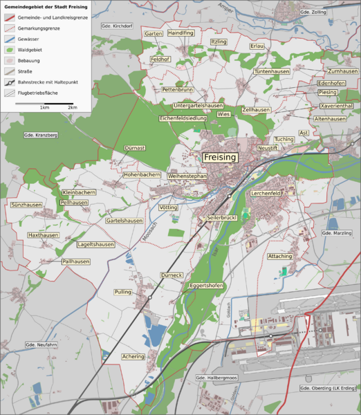
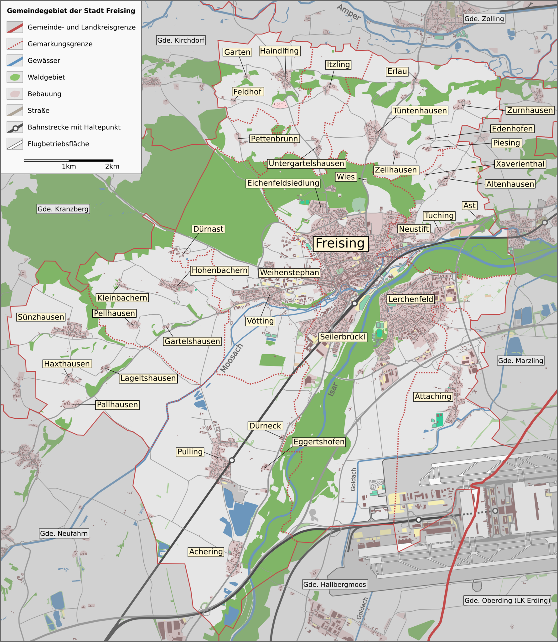
English: This map of Freising was created from OpenStreetMap project data, collected by the community.
This map may be incomplete, and may contain errors. Don't rely solely on it for navigation. |
||
| ⧼wm-license-information-date⧽ | see file history | ||
| ⧼wm-license-information-source⧽ | OpenStreetMap data exported and adapted by myself | ||
| ⧼wm-license-information-author⧽ | OpenStreetMap contributors | ||
| ⧼wm-license-information-permission⧽ (⧼wm-license-information-permission-reusing-text⧽) |
All OpenStreetMap data and maps are Creative Commons "CC-BY-SA 2.0" licensed |
تاريخ الملف
اضغط على زمن/تاريخ لرؤية الملف كما بدا في هذا الزمن.
| زمن/تاريخ | صورة مصغرة | الأبعاد | مستخدم | تعليق | |
|---|---|---|---|---|---|
| حالي | ★ مراجعة معتمدة 03:13، 28 أكتوبر 2023 | | 2٬989 × 3٬435 (3٫21 ميجابايت) | Pastakhov (نقاش | مساهمات) | Upload https://upload.wikimedia.org/wikipedia/commons/7/75/Uebersicht_gemeinde_freising.png |
لا يمكنك استبدال هذا الملف.
وصلات
لا يوجد صفحات تصل لهذه الصورة.