ملف:US Mid-Atlantic states.png

حجم هذه المعاينة: 800 × 520 بكسل. البعد الآخر: 1٬513 × 983 بكسل.
الملف الأصلي (1٬513 × 983 بكسل حجم الملف: 49 كيلوبايت، نوع MIME: image/png)
وصف قصير
| ⧼wm-license-information-description⧽ |
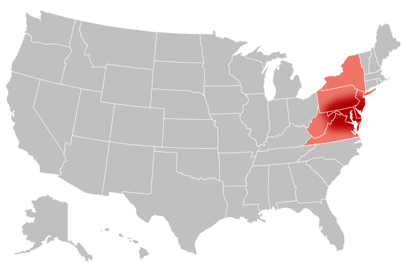
English: General definition of the Mid-Atlantic region of the United States. The pink areas are the states that are often accepted to be part of the Mid-Atlantic. The dark red signifies the regions that are almost always considered to be the Mid-Atlantic. There is no specific boundary for what constitutes the "common Mid-Atlantic" so I have gradually faded it out to pink.
Map taken from File:BlankMap-USA-states.PNG
|
| ⧼wm-license-information-date⧽ | 2010 |
| ⧼wm-license-information-source⧽ | ⧼Wm-license-own-work⧽, also File:BlankMap-USA-states.PNG |
| ⧼wm-license-information-author⧽ | Grayshi, Roke |
ترخيص
|

تاريخ الملف
اضغط على زمن/تاريخ لرؤية الملف كما بدا في هذا الزمن.
| زمن/تاريخ | صورة مصغرة | الأبعاد | مستخدم | تعليق | |
|---|---|---|---|---|---|
| حالي | ★ مراجعة معتمدة 16:33، 22 يناير 2024 | | 1٬513 × 983 (49 كيلوبايت) | Pastakhov (نقاش | مساهمات) | Upload https://upload.wikimedia.org/wikipedia/commons/5/59/US_Mid-Atlantic_states.png |
لا يمكنك استبدال هذا الملف.
وصلات
لا يوجد صفحات تصل لهذه الصورة.