ملف:USACE Laurel River Dam and Lake.jpg
حجم هذه المعاينة: 800 × 534 بكسل. البعد الآخر: 1٬500 × 1٬001 بكسل.
الملف الأصلي (1٬500 × 1٬001 بكسل حجم الملف: 488 كيلوبايت، نوع MIME: image/jpeg)
| ⧼wm-license-information-description⧽ |
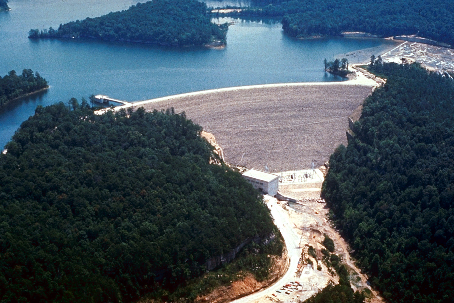
English: Aerial view of Laurel River Dam and Lake on the Laurel River above the confluence with the Cumberland River near Corbin, Kentucky, USA. The U.S. Army Corps of Engineers completed the dam and the lake impounded in 1974. The dam is 282 feet (86 m) high and 1,420 feet (433 m) long. The hydroelectric plant in the dam produces 74 MW of electric power.
|
| ⧼wm-license-information-date⧽ | not specified or unknown |
| ⧼wm-license-information-source⧽ | U.S. Army Corps of Engineers Digital Visual Library Image page Image description page Digital Visual Library home page |
| ⧼wm-license-information-author⧽ | George Green, U.S. Army Corps of Engineers |
| ⧼wm-license-information-permission⧽ (⧼wm-license-information-permission-reusing-text⧽) |
تاريخ الملف
اضغط على زمن/تاريخ لرؤية الملف كما بدا في هذا الزمن.
| زمن/تاريخ | صورة مصغرة | الأبعاد | مستخدم | تعليق | |
|---|---|---|---|---|---|
| حالي | ★ مراجعة معتمدة 09:17، 10 نوفمبر 2023 | | 1٬500 × 1٬001 (488 كيلوبايت) | Pastakhov (نقاش | مساهمات) | Upload https://upload.wikimedia.org/wikipedia/commons/a/a3/USACE_Laurel_River_Dam_and_Lake.jpg |
لا يمكنك استبدال هذا الملف.
وصلات
لا يوجد صفحات تصل لهذه الصورة.