ملف:Tyrestaåns sjösystem.png
حجم هذه المعاينة: 800 × 431 بكسل. البعد الآخر: 1٬300 × 700 بكسل.
الملف الأصلي (1٬300 × 700 بكسل حجم الملف: 184 كيلوبايت، نوع MIME: image/png)
وصف قصير
| ⧼wm-license-information-description⧽ |
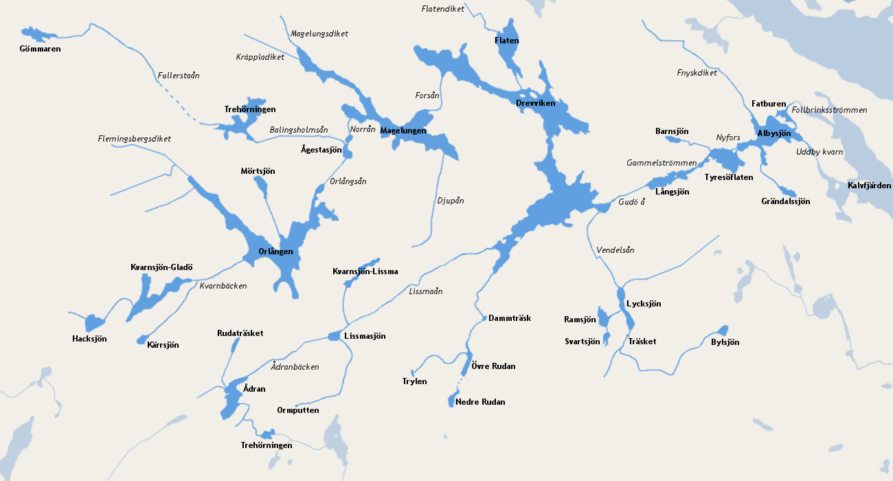
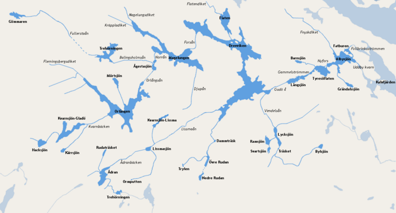
English: Map over Tyresån Lake System. Name of lakes are in bold and streams in italics. Dashed blue lines are streams under ground.
Svenska: Karta över Tyresåns sjösystem. Sjöar är i fetstil och vattendrag i kursivstil. Sträckade linjer är vattendrag under mark.
|
| ⧼wm-license-information-date⧽ | 2010 |
| ⧼wm-license-information-source⧽ | ⧼Wm-license-own-work⧽ |
| ⧼wm-license-information-author⧽ | Esquilo |
ترخيص
|
تاريخ الملف
اضغط على زمن/تاريخ لرؤية الملف كما بدا في هذا الزمن.
| زمن/تاريخ | صورة مصغرة | الأبعاد | مستخدم | تعليق | |
|---|---|---|---|---|---|
| حالي | ★ مراجعة معتمدة 05:18، 11 نوفمبر 2023 | | 1٬300 × 700 (184 كيلوبايت) | Pastakhov (نقاش | مساهمات) | Upload https://upload.wikimedia.org/wikipedia/commons/5/57/Tyresta%C3%A5ns_sj%C3%B6system.png |
لا يمكنك استبدال هذا الملف.
وصلات
لا يوجد صفحات تصل لهذه الصورة.