ملف:Turkey Western. Lesbos, Dardanelles 1.JPG

حجم هذه المعاينة: 397 × 599 بكسل. البعد الآخر: 2٬008 × 3٬032 بكسل.
الملف الأصلي (2٬008 × 3٬032 بكسل حجم الملف: 1٫72 ميجابايت، نوع MIME: image/jpeg)
وصف قصير
| ⧼wm-license-information-description⧽ |
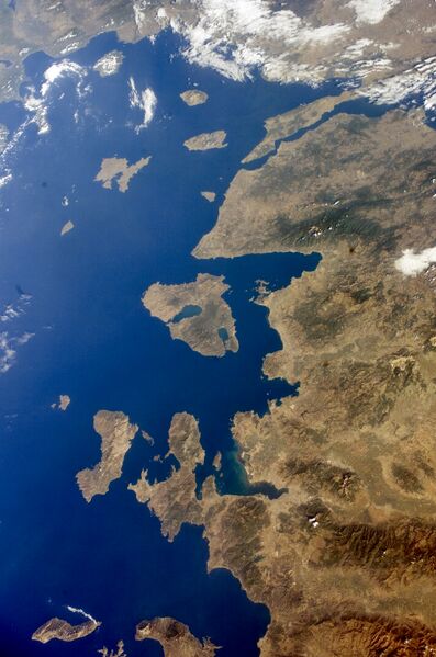
English: Turkey Western, Lesbos and Dardanelles.
Español: Noroeste de Turquía, Lesbos y Dardanelos. Mapa satelital de la Nasa (2005).
|
| ⧼wm-license-information-date⧽ | 2005 |
| ⧼wm-license-information-source⧽ | http://eol.jsc.nasa.gov/scripts/sseop/QuickView.pl?directory=ESC&ID=ISS011-E-13602 |
| ⧼wm-license-information-author⧽ | NASA |
| ⧼wm-license-information-other-versions⧽ |
ترخيص
تاريخ الملف
اضغط على زمن/تاريخ لرؤية الملف كما بدا في هذا الزمن.
| زمن/تاريخ | صورة مصغرة | الأبعاد | مستخدم | تعليق | |
|---|---|---|---|---|---|
| حالي | ★ مراجعة معتمدة 16:28، 27 أكتوبر 2023 | | 2٬008 × 3٬032 (1٫72 ميجابايت) | Pastakhov (نقاش | مساهمات) | Upload https://upload.wikimedia.org/wikipedia/commons/d/d2/Turkey_Western._Lesbos%2C_Dardanelles_1.JPG |
لا يمكنك استبدال هذا الملف.
وصلات
لا يوجد صفحات تصل لهذه الصورة.