ملف:Torna Flädie.svg

حجم معاينة PNG لذلك الملف ذي الامتداد SVG: 776 × 600 بكسل. البعد الآخر: 2٬560 × 1٬979 بكسل.
الملف الأصلي (ملف SVG، أبعاده 1٬559 × 1٬205 بكسل، حجم الملف: 2٫34 ميجابايت)
| ⧼wm-license-information-description⧽ |
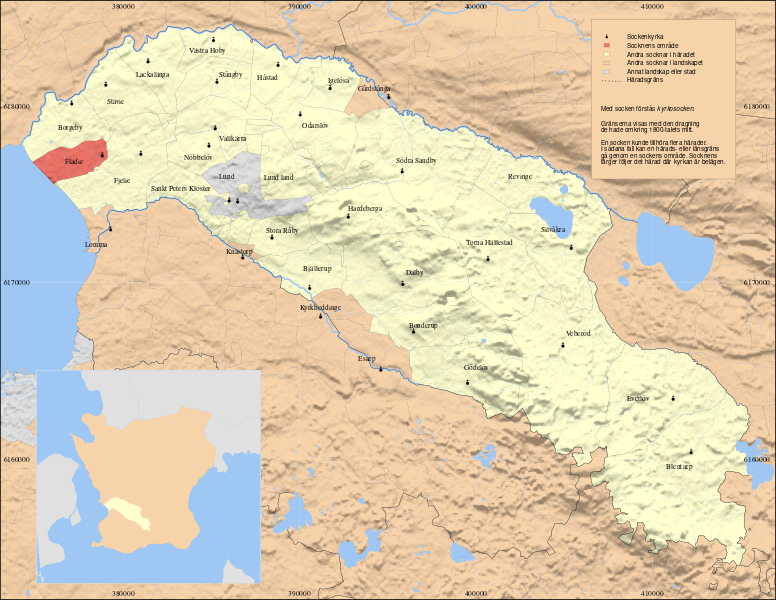
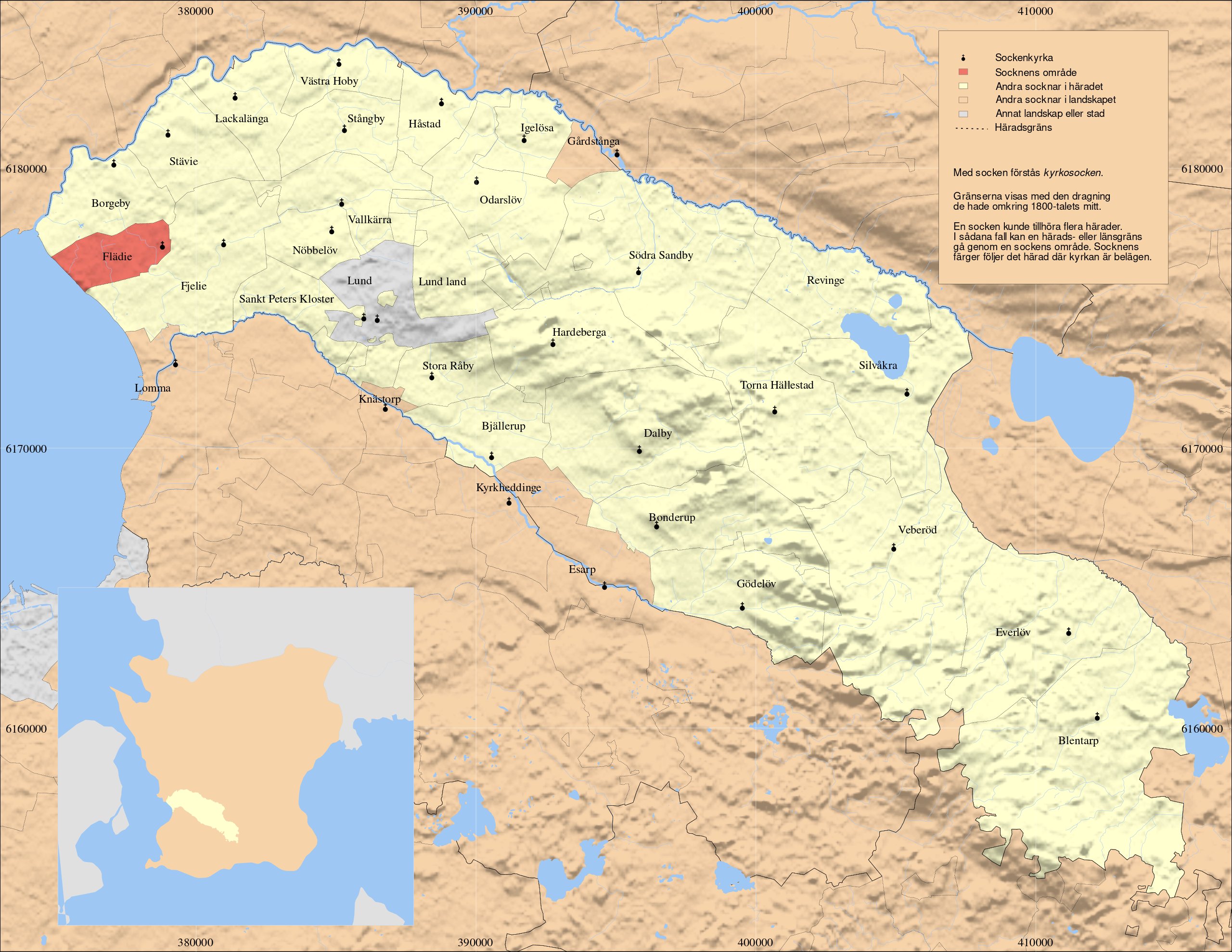
English: Map showing the parish Flädie in the hundred of Torna, Skåne, Sweden. Based on Generalstabskartan and häradsekonomiska kartan, relief from a digital elevation model of the Shuttle Radar Topography Mission. Small map made with data from Natural Earth. Terrain mostly reflecting situation in the early 1900s, borders before 1880s. SWEREF 99 TM
|
| ⧼wm-license-information-date⧽ | 2011 |
| ⧼wm-license-information-source⧽ | ⧼Wm-license-own-work⧽ |
| ⧼wm-license-information-author⧽ | Edaen |
|
تاريخ الملف
اضغط على زمن/تاريخ لرؤية الملف كما بدا في هذا الزمن.
| زمن/تاريخ | صورة مصغرة | الأبعاد | مستخدم | تعليق | |
|---|---|---|---|---|---|
| حالي | ★ مراجعة معتمدة 05:18، 2 نوفمبر 2023 | | 1٬559 × 1٬205 (2٫34 ميجابايت) | Pastakhov (نقاش | مساهمات) | Upload https://upload.wikimedia.org/wikipedia/commons/d/de/Torna_Fl%C3%A4die.svg |
لا يمكنك استبدال هذا الملف.
وصلات
لا يوجد صفحات تصل لهذه الصورة.