ملف:The swing bridge - geograph.org.uk - 860105.jpg
لا توجد دقة أعلى متوفرة.
The_swing_bridge_-_geograph.org.uk_-_860105.jpg (640 × 480 بكسل حجم الملف: 114 كيلوبايت، نوع MIME: image/jpeg)
وصف قصير
| ⧼wm-license-information-description⧽ |
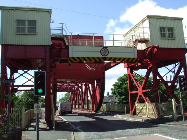
English: The swing bridge Despite its local name, the bridge does not swing - it lifts, to enable craft to pass under the A8 en-route from the Clyde to the White Cart.
See the bridge in use here http://clydesights.com/2008/04/river-cart.html
|
| ⧼wm-license-information-date⧽ | 2008 |
| ⧼wm-license-information-source⧽ | From geograph.org.uk |
| ⧼wm-license-information-author⧽ | Thomas Nugent |
| ⧼wm-license-cc-attribution⧽ (قالب:I18n/Credit line) |
Thomas Nugent / The swing bridge / |
55°52′47″N 4°24′27″W / 55.87963°N 4.4076°W قالب:Object location
_heading:315)
ترخيص
تاريخ الملف
اضغط على زمن/تاريخ لرؤية الملف كما بدا في هذا الزمن.
| زمن/تاريخ | صورة مصغرة | الأبعاد | مستخدم | تعليق | |
|---|---|---|---|---|---|
| حالي | ★ مراجعة معتمدة 14:06، 17 نوفمبر 2023 | | 640 × 480 (114 كيلوبايت) | Pastakhov (نقاش | مساهمات) | Upload https://upload.wikimedia.org/wikipedia/commons/7/76/The_swing_bridge_-_geograph.org.uk_-_860105.jpg |
لا يمكنك استبدال هذا الملف.
وصلات
لا يوجد صفحات تصل لهذه الصورة.