ملف:The pond at Tatsfield, TN16 - geograph.org.uk - 68152.jpg
لا توجد دقة أعلى متوفرة.
The_pond_at_Tatsfield,_TN16_-_geograph.org.uk_-_68152.jpg (640 × 481 بكسل حجم الملف: 128 كيلوبايت، نوع MIME: image/jpeg)
وصف قصير
| ⧼wm-license-information-description⧽ |
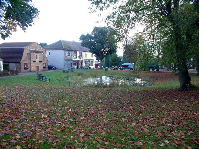
English: The pond at Tatsfield, TN16. Tatsfield sits high on the North Downs on the eastern tip of the District. At 240m above sea level it is one of the highest points in Surrey. Tatsfield lies close to the Pilgrims Way, and along its western boundary runs the route of the old London to Lewes Road built by the Romans. Tatsfield is now a thriving community with a population of almost 2000, a village shop, a pub and a village pond with resident ducks.
|
| ⧼wm-license-information-date⧽ | 2005 |
| ⧼wm-license-information-source⧽ | From geograph.org.uk |
| ⧼wm-license-information-author⧽ | Philip Talmage |
| ⧼wm-license-cc-attribution⧽ (قالب:I18n/Credit line) |
Philip Talmage / The pond at Tatsfield, TN16 / |
ترخيص
تاريخ الملف
اضغط على زمن/تاريخ لرؤية الملف كما بدا في هذا الزمن.
| زمن/تاريخ | صورة مصغرة | الأبعاد | مستخدم | تعليق | |
|---|---|---|---|---|---|
| حالي | ★ مراجعة معتمدة 06:00، 11 أكتوبر 2023 | | 640 × 481 (128 كيلوبايت) | Pastakhov (نقاش | مساهمات) | Upload https://upload.wikimedia.org/wikipedia/commons/9/95/The_pond_at_Tatsfield%2C_TN16_-_geograph.org.uk_-_68152.jpg |
لا يمكنك استبدال هذا الملف.
وصلات
لا يوجد صفحات تصل لهذه الصورة.