ملف:The bridge over the River Bain - geograph.org.uk - 284471.jpg
لا توجد دقة أعلى متوفرة.
The_bridge_over_the_River_Bain_-_geograph.org.uk_-_284471.jpg (640 × 480 بكسل حجم الملف: 109 كيلوبايت، نوع MIME: image/jpeg)
وصف قصير
| ⧼wm-license-information-description⧽ |
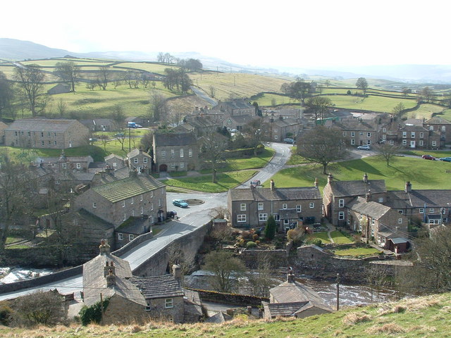
English: The bridge over the River Bain This view of the village is from the Roman Fort above the Bain to the East and shows the 18th century waterpowered mill and the Congregational Chapel dating from 1851. In the distance the Roman Road climbs West towards Lancaster.
|
| ⧼wm-license-information-date⧽ | 2004 |
| ⧼wm-license-information-source⧽ | From geograph.org.uk |
| ⧼wm-license-information-author⧽ | Geoff Keeble |
| ⧼wm-license-cc-attribution⧽ (قالب:I18n/Credit line) |
Geoff Keeble / The bridge over the River Bain / |
54°18′25″N 2°06′03″W / 54.30704°N 2.1007°W قالب:Object location
_heading:247)
ترخيص
تاريخ الملف
اضغط على زمن/تاريخ لرؤية الملف كما بدا في هذا الزمن.
| زمن/تاريخ | صورة مصغرة | الأبعاد | مستخدم | تعليق | |
|---|---|---|---|---|---|
| حالي | ★ مراجعة معتمدة 18:31، 6 أكتوبر 2023 | | 640 × 480 (109 كيلوبايت) | Pastakhov (نقاش | مساهمات) | Upload https://upload.wikimedia.org/wikipedia/commons/5/5b/The_bridge_over_the_River_Bain_-_geograph.org.uk_-_284471.jpg |
لا يمكنك استبدال هذا الملف.
وصلات
لا يوجد صفحات تصل لهذه الصورة.