ملف:The Prince-Bishoprics of Würzburg and Bamberg..jpg
حجم هذه المعاينة: 800 × 600 بكسل. البعدان الآخران: 2٬560 × 1٬920 بكسل | 2٬816 × 2٬112 بكسل.
الملف الأصلي (2٬816 × 2٬112 بكسل حجم الملف: 2٫7 ميجابايت، نوع MIME: image/jpeg)
وصف قصير
| ⧼wm-license-information-description⧽ |
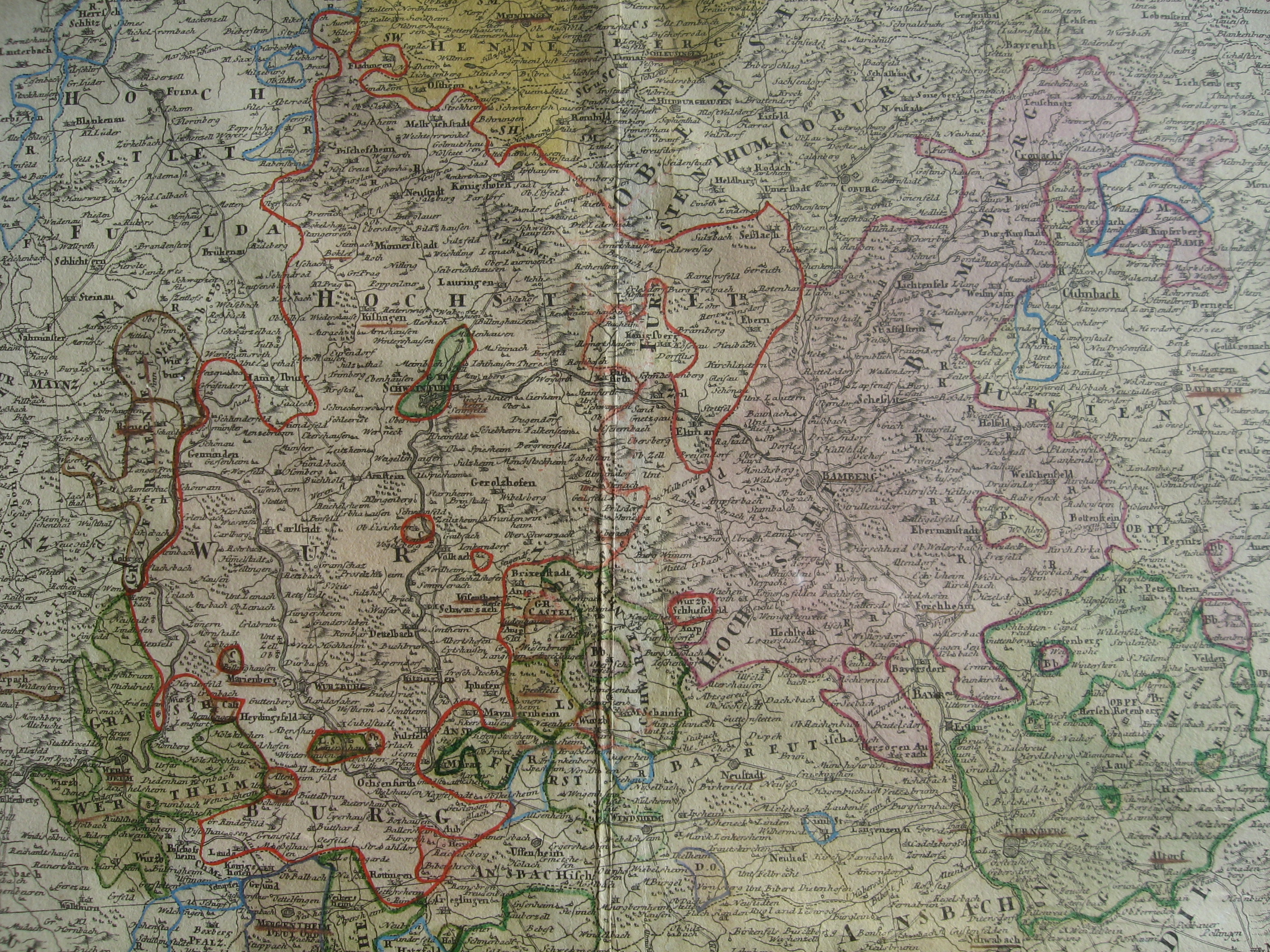
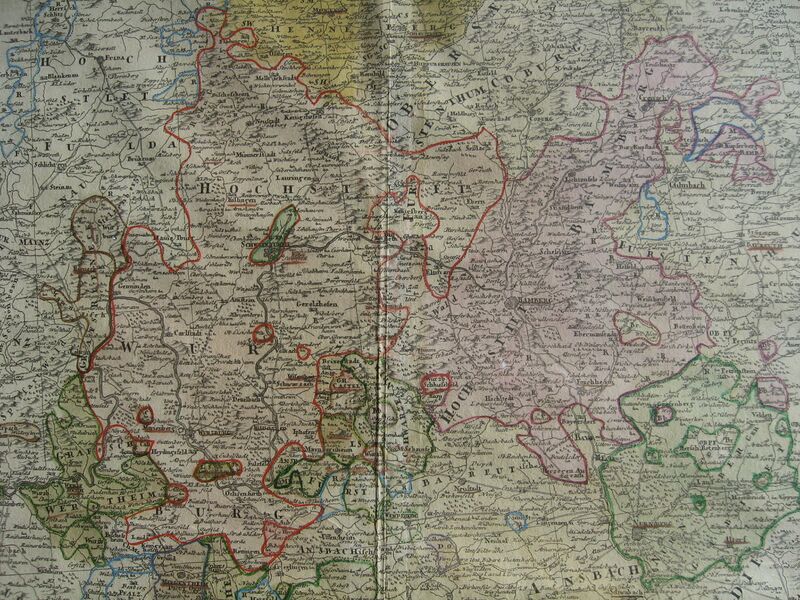
English: The area between the Mainz ant the Danube was dubbed "Priests Alley" (Pfaffengasse) because of the high concentration of ecclesiastical principalities. On this map, Fulda and Mainz are on the left and Würtzburg and Bamberg in the center. Eischtätt and Salzburg, more to the southeast, are not shown. Cropped from a 1782 map of Franconia published by Homann Heirs.
|
| ⧼wm-license-information-date⧽ | 2012 |
| ⧼wm-license-information-source⧽ | ⧼Wm-license-own-work⧽ |
| ⧼wm-license-information-author⧽ | Lubiesque |
ترخيص
|
تاريخ الملف
اضغط على زمن/تاريخ لرؤية الملف كما بدا في هذا الزمن.
| زمن/تاريخ | صورة مصغرة | الأبعاد | مستخدم | تعليق | |
|---|---|---|---|---|---|
| حالي | ★ مراجعة معتمدة 11:25، 14 ديسمبر 2023 | | 2٬816 × 2٬112 (2٫7 ميجابايت) | Pastakhov (نقاش | مساهمات) | Upload https://upload.wikimedia.org/wikipedia/commons/b/b5/The_Prince-Bishoprics_of_W%C3%BCrzburg_and_Bamberg..jpg |
لا يمكنك استبدال هذا الملف.
وصلات
لا يوجد صفحات تصل لهذه الصورة.