ملف:The Green, Marton Village - geograph.org.uk - 392733.jpg
لا توجد دقة أعلى متوفرة.
The_Green,_Marton_Village_-_geograph.org.uk_-_392733.jpg (640 × 469 بكسل حجم الملف: 157 كيلوبايت، نوع MIME: image/jpeg)
وصف قصير
| ⧼wm-license-information-description⧽ |
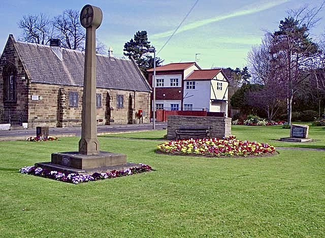
English: The Green, Marton Village Green on the corner of Stokesley Road and The Grove.
The stone on the extreme right comes from Point Hicks Hill, near Cape Everard, Victoria which was the first point of land sighted on Australia's east coast during Captain Cook's first voyage of discovery.
|
| ⧼wm-license-information-date⧽ | 2007 |
| ⧼wm-license-information-source⧽ | From geograph.org.uk |
| ⧼wm-license-information-author⧽ | Stephen McCulloch |
| ⧼wm-license-cc-attribution⧽ (قالب:I18n/Credit line) |
Stephen McCulloch / The Green, Marton Village / |
54°32′07″N 1°12′18″W / 54.5353°N 1.205°W قالب:Object location
_heading:0)
ترخيص
تاريخ الملف
اضغط على زمن/تاريخ لرؤية الملف كما بدا في هذا الزمن.
| زمن/تاريخ | صورة مصغرة | الأبعاد | مستخدم | تعليق | |
|---|---|---|---|---|---|
| حالي | ★ مراجعة معتمدة 04:13، 26 ديسمبر 2023 | | 640 × 469 (157 كيلوبايت) | Pastakhov (نقاش | مساهمات) | Upload https://upload.wikimedia.org/wikipedia/commons/4/47/The_Green%2C_Marton_Village_-_geograph.org.uk_-_392733.jpg |
لا يمكنك استبدال هذا الملف.
وصلات
لا يوجد صفحات تصل لهذه الصورة.