ملف:Texmex-map.png
حجم هذه المعاينة: 800 × 490 بكسل. البعد الآخر: 1٬732 × 1٬060 بكسل.
الملف الأصلي (1٬732 × 1٬060 بكسل حجم الملف: 3٫11 ميجابايت، نوع MIME: image/png)
وصف قصير
| ⧼wm-license-information-description⧽ |
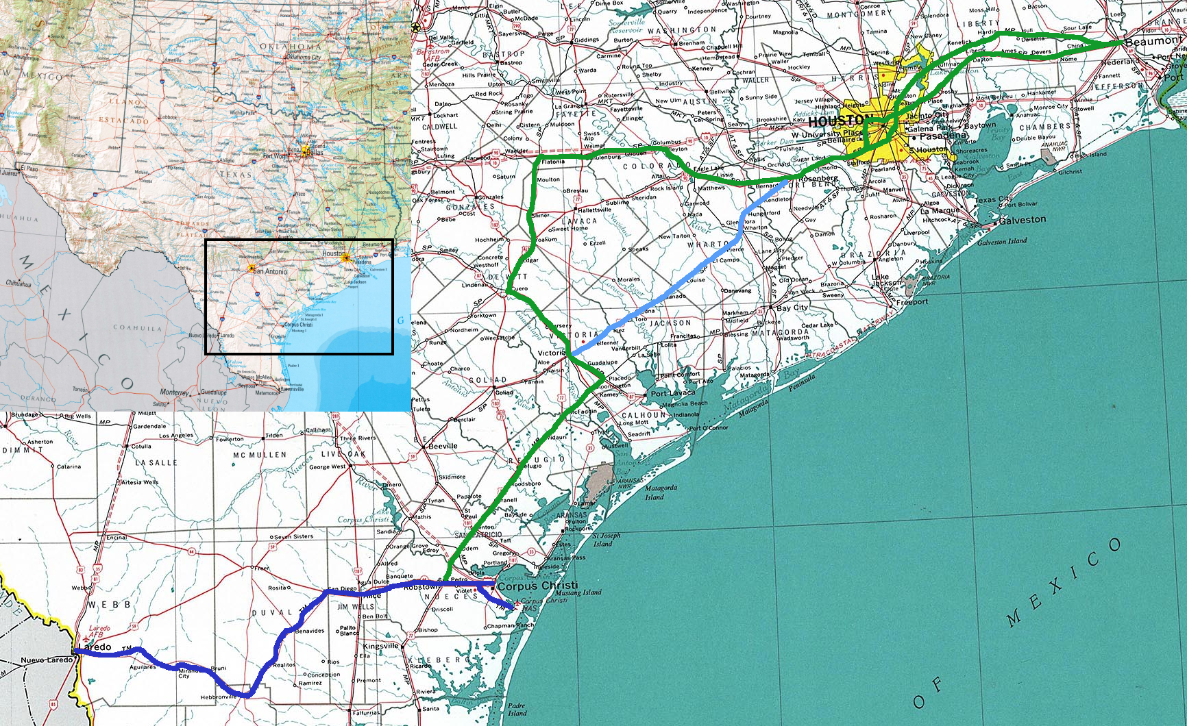
Map of The Texas Mexican Railroad. The route of the railroad is shown in dark blue, trackage rights are shown in green, and the Macaroni Line, rebuilt in 2009 and owned by the Tex-Mex's parent company, is shown in light blue. Map is based on National Atlas 1970/2002. Author:Liesel |
| ⧼wm-license-information-date⧽ | قالب:Original upload date |
| ⧼wm-license-information-source⧽ | No machine-readable source provided. Own work assumed (based on copyright claims). |
| ⧼wm-license-information-author⧽ | No machine-readable author provided. Liesel assumed (based on copyright claims). |
ترخيص
|

تاريخ الملف
اضغط على زمن/تاريخ لرؤية الملف كما بدا في هذا الزمن.
| زمن/تاريخ | صورة مصغرة | الأبعاد | مستخدم | تعليق | |
|---|---|---|---|---|---|
| حالي | ★ مراجعة معتمدة 19:26، 2 نوفمبر 2023 | | 1٬732 × 1٬060 (3٫11 ميجابايت) | Pastakhov (نقاش | مساهمات) | Upload https://upload.wikimedia.org/wikipedia/commons/7/7d/Texmex-map.png |
لا يمكنك استبدال هذا الملف.
وصلات
لا يوجد صفحات تصل لهذه الصورة.