ملف:Territorial Expansion of Russia.svg

حجم معاينة PNG لذلك الملف ذي الامتداد SVG: 771 × 599 بكسل. البعد الآخر: 2٬560 × 1٬990 بكسل.
الملف الأصلي (ملف SVG، أبعاده 1٬944 × 1٬511 بكسل، حجم الملف: 1٫09 ميجابايت)
وصف قصير
| ⧼wm-license-information-description⧽ |
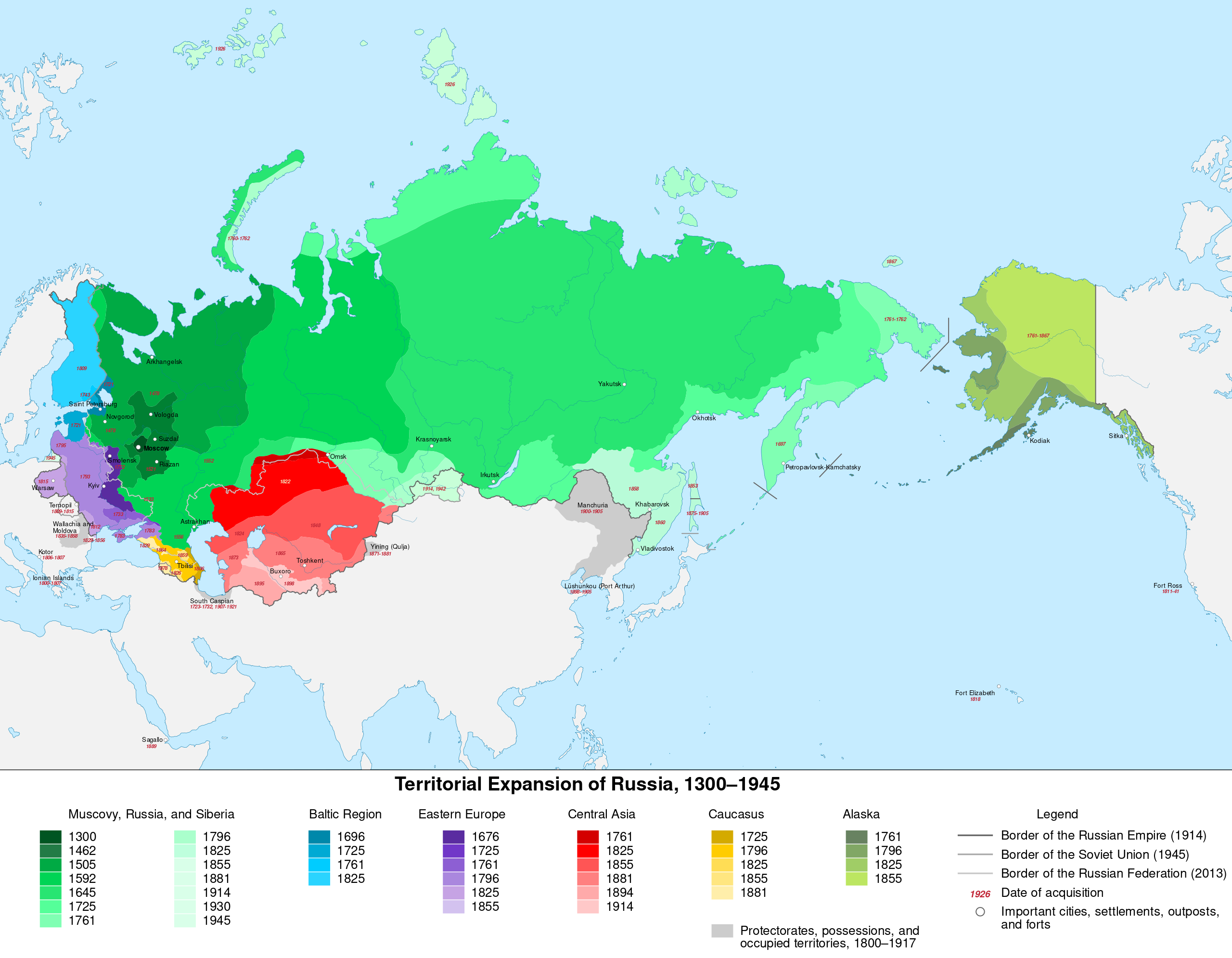
English: English translation of File:Expansión territorial de Rusia.svg. This is a multilingual SVG, with English and Spanish alternatives, and local languages as default.
|
| ⧼wm-license-information-date⧽ | 2020 |
| ⧼wm-license-information-source⧽ | ⧼Wm-license-own-work⧽ |
| ⧼wm-license-information-author⧽ | Mzajac |
ترخيص
|
تاريخ الملف
اضغط على زمن/تاريخ لرؤية الملف كما بدا في هذا الزمن.
| زمن/تاريخ | صورة مصغرة | الأبعاد | مستخدم | تعليق | |
|---|---|---|---|---|---|
| حالي | ★ مراجعة معتمدة 09:30، 30 نوفمبر 2023 | | 1٬944 × 1٬511 (1٫09 ميجابايت) | Pastakhov (نقاش | مساهمات) | Upload https://upload.wikimedia.org/wikipedia/commons/4/4a/Territorial_Expansion_of_Russia.svg |
لا يمكنك استبدال هذا الملف.
وصلات
لا يوجد صفحات تصل لهذه الصورة.
معلومات الصورة (ميتا)
تصنيفات:
- Self-published work
- Territorial growth maps of Russia
- SVG maps of the history of Russia
- Maps of the Grand Principality of Moscow
- Maps of the Tsardom of Russia
- SVG maps of the Russian Empire
- Maps with Mercator projection
- SVG maps of the Soviet Union
- English-language SVG maps showing history
- Russian imperialism