ملف:Telegrafenberg in Potsdam.jpg

حجم هذه المعاينة: 800 × 476 بكسل. البعد الآخر: 3٬174 × 1٬890 بكسل.
الملف الأصلي (3٬174 × 1٬890 بكسل حجم الملف: 2٫1 ميجابايت، نوع MIME: image/jpeg)
وصف قصير
| ⧼wm-license-information-description⧽ |
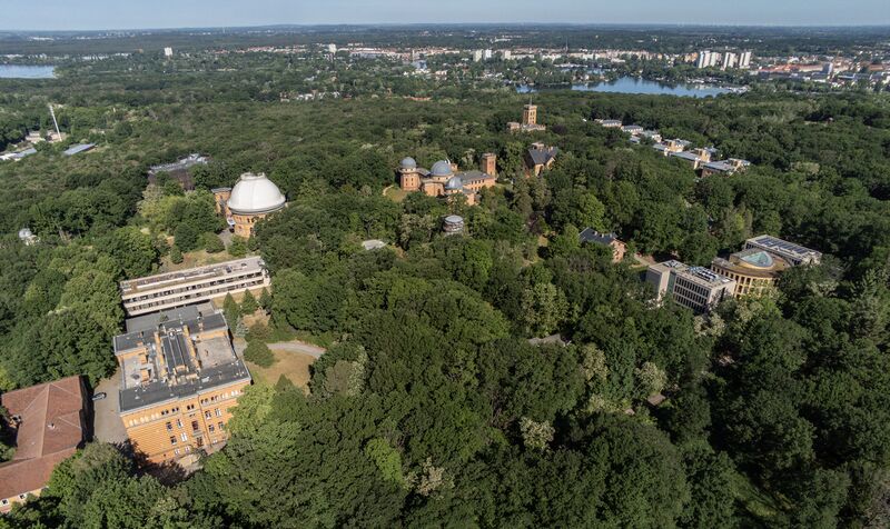
Deutsch: Der Telegrafenberg in Potsdam mit dem Gelände des Geoforschungszentrums Potsdam im Vordergrund.
English: Telegrafenberg in Potsdam with the Geoforschungszentrum Potsdam science park compound in the foreground.
|
| ⧼wm-license-information-date⧽ | 2021, {{time}} – invalid date format 02 (help) |
| ⧼wm-license-information-source⧽ | ⧼Wm-license-own-work⧽ |
| ⧼wm-license-information-author⧽ | Kemistrystorm |
52°22′53″N 13°03′52″E / 52.38141°N 13.064375°E
ترخيص
تاريخ الملف
اضغط على زمن/تاريخ لرؤية الملف كما بدا في هذا الزمن.
| زمن/تاريخ | صورة مصغرة | الأبعاد | مستخدم | تعليق | |
|---|---|---|---|---|---|
| حالي | ★ مراجعة معتمدة 07:41، 3 نوفمبر 2023 | | 3٬174 × 1٬890 (2٫1 ميجابايت) | Pastakhov (نقاش | مساهمات) | Upload https://upload.wikimedia.org/wikipedia/commons/e/ed/Telegrafenberg_in_Potsdam.jpg |
لا يمكنك استبدال هذا الملف.
وصلات
لا يوجد صفحات تصل لهذه الصورة.